This content was originally published by the Longmont Observer and is licensed under a Creative Commons license.
Forecast Discussion:
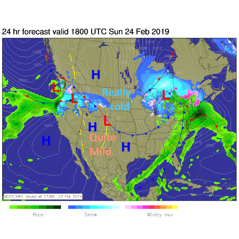
An important front sits draped across northeast Colorado for a few days. To the southwest (where we live/Longmont) temperatures will be quite mild, even with some clouds. To the northeast, it will be very cold with periods of freezing fog up near Nebraska and NW Kansas (Figure 1).
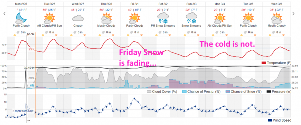
Except for a minor wiggle in this front tomorrow (Wednesday) we'll be in the mid-50's until cold air surges to the south and southwest Friday (Figure 2).
The longer range forecast:
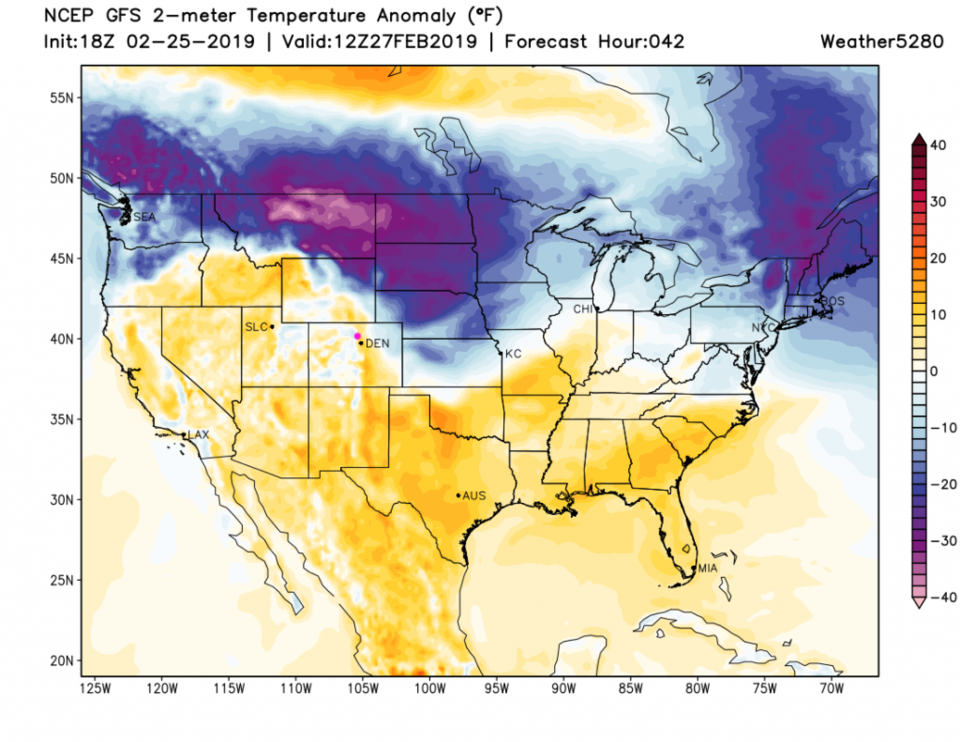
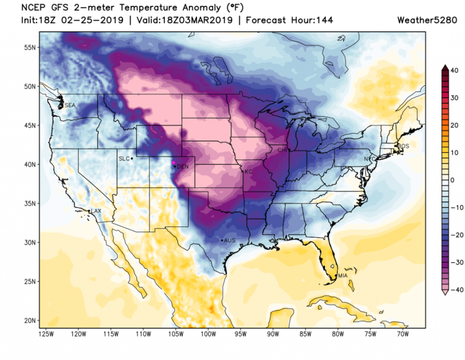
Temperatures over the next 3 days will (largely) be about 10 degrees above normal (Figure 3). Friday's cold surge is looking less snowy (Figure 2) but the cold will be memorable. Figure 4 shows temperatures dropping to 20 to 40F below normal for areas east of the Rockies by Sunday. Brrrrr! That's what we get with a semi-stagnant upper air pattern over the northern hemisphere now. More on this big change later!