This content was originally published by the Longmont Observer and is licensed under a Creative Commons license.
Forecast Discussion:
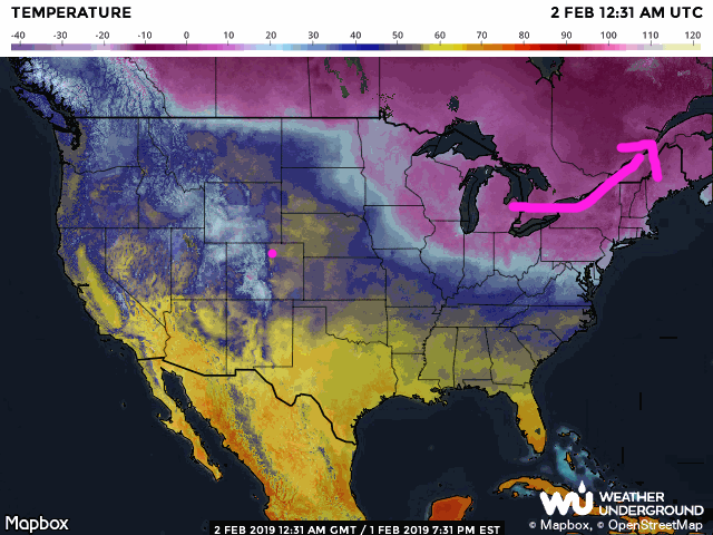
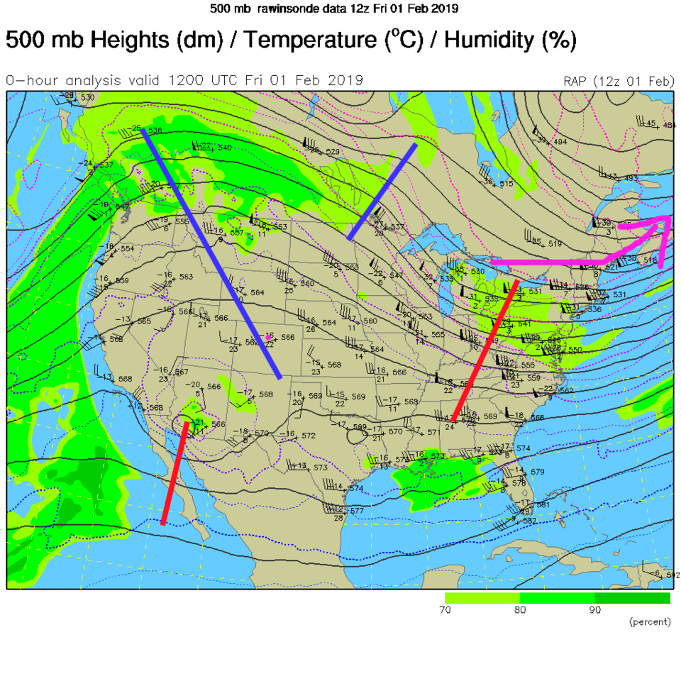
We keep warming up (even if we get windy at times) this weekend as the super-cold slides northeast out of the U.S. over the next couple of days. Easy come, easy go? (Figure 1). The big ridge overhead is the force responsible for our comfort as is the corresponding departing trough out east (Figure 2).
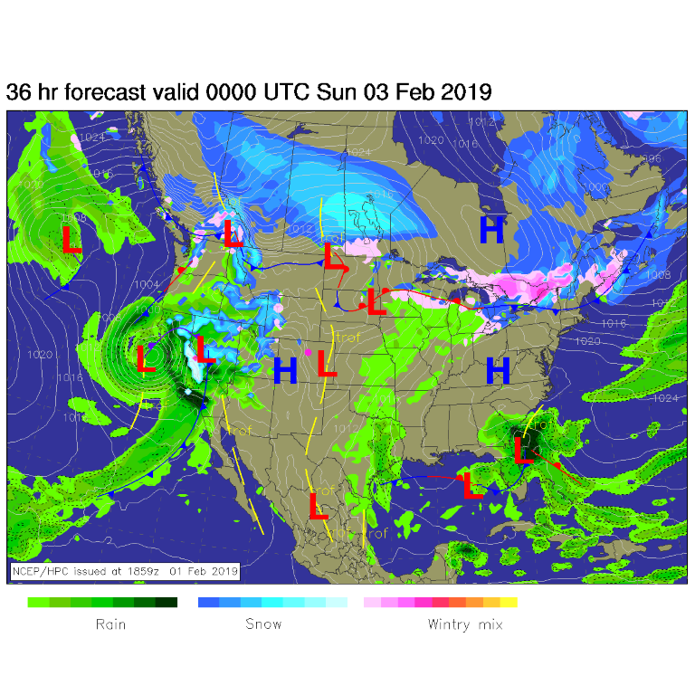
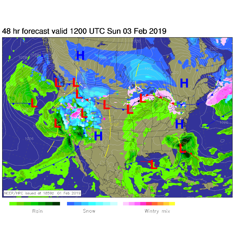
The ripple in the jet stream to our south will be associated with some storminess that will bring snow to the western slopes into the later weekend. We stay dry down on the Plains (Figure 3 and 4). Even Estes Park is expected to receive only some rain on Sunday. That is unusual February warmth!
The longer range forecast:
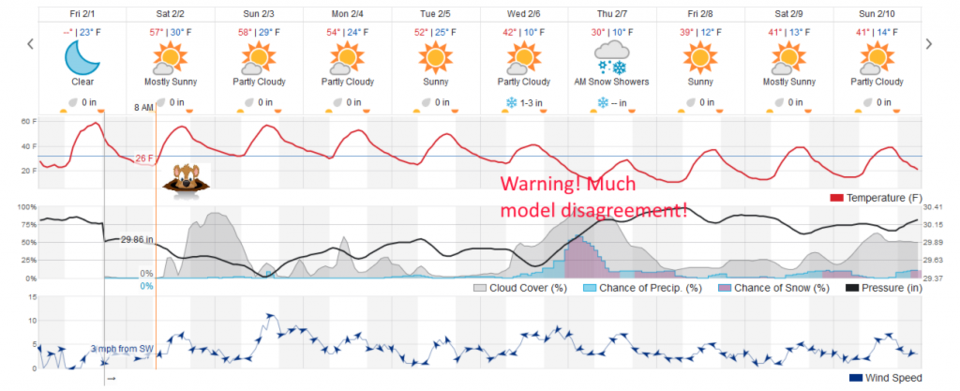
Things are still looking cool and mostly cloudy in Punxsutawney, Pa for this morning (we'll see what the guys in the top hats say) and clear locally, though clouds form as moisture in the mid levels slips over the Rockies from that approaching western storm (Figure 5). The models are all over the place concerning our midweek snow chances, so don't place any bets yet. The weather undergroundmodel gives us 1-3 inches. But, really, anything is on the table from 0 to 6 inches at this point. You'll have to come back later to find out!