This content was originally published by the Longmont Observer and is licensed under a Creative Commons license.
In Brief:
Sometimes the weather is very straight forward. A big ridge brings very warm temperatures and dry conditions for the weekend. A big trough drives a very strong cold front down the state Sunday night with very cold conditions and snow Monday into Tuesday. The rest of the week remains unsettled and chilly (so the snow will hang around--- again).
Forecast Discussion:
With our second weak front yesterday (with a passing shortwave trough aloft) - most of Longmont received 1/4th inch of snow. Boulder missed out this time. That snow will be only a only this afternoon (Friday).
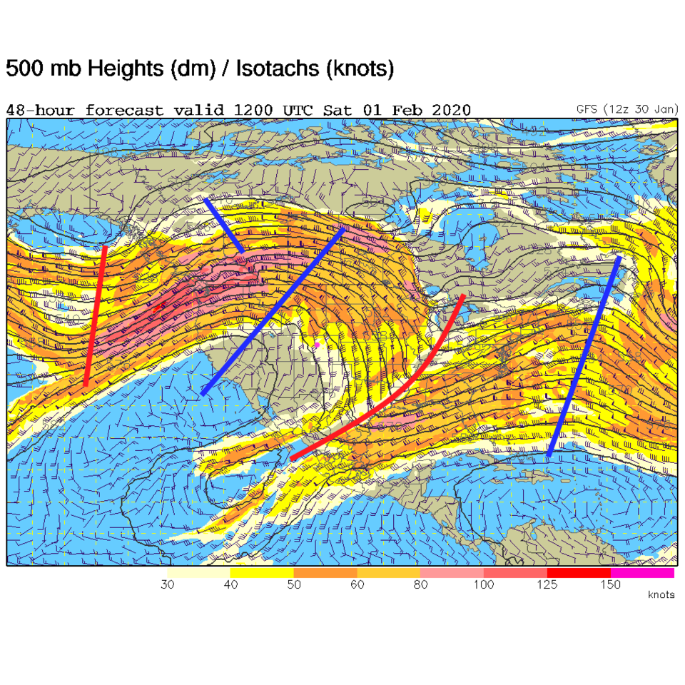
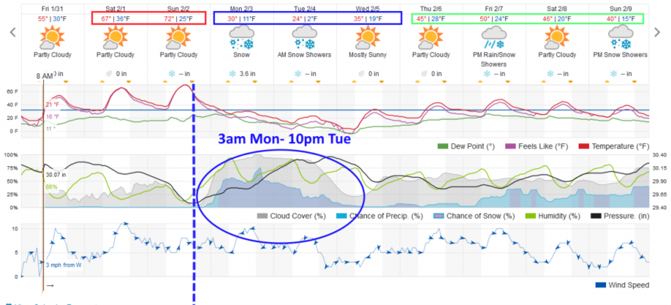
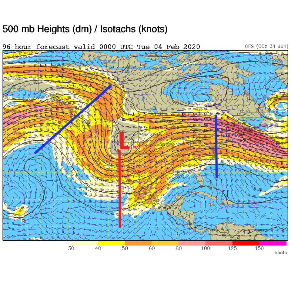
A strong surface high pressure will keep us clear and dry (Figure 1) this weekend. In the upper atmosphere, a strong ridge is migrating slowly eastward (blue line to our west in Figure 2). By Sunday afternoon, with gusty southwest winds and down slope warming, we'll see temperatures up to 25F (maybe 30F in spots) above normal - Figure 3. Get out and enjoy this because the longer range forecast is not good for short sleeves...
The Longer Range Forecast:
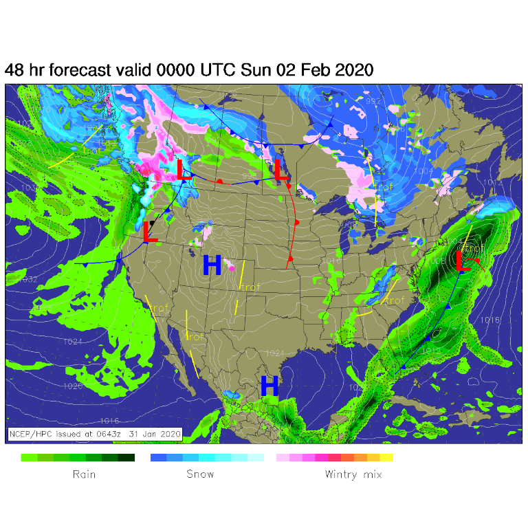
A rapid cool down begins Sunday evening with a cold front sweeping down the Plains around 8-9pm (Figure 4). The near record heat (red rectangle up top in Figure 4) becomes shocking cold (blue rectangle). We go from 72F to about 0F in 36 hours.
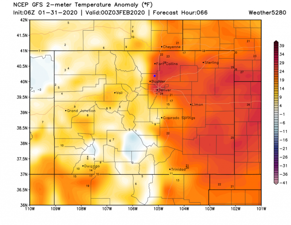
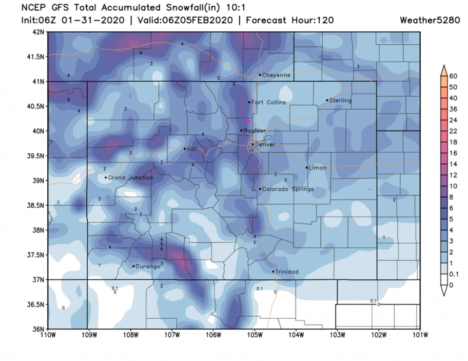
Snow should begin around 3am Monday with the heaviest snow ending Tuesday morning. There will be continued show showers into the late evening Tuesday (Figure 2). This storm is driven by a very deep trough hitting us straight-on from the west and an almost-closed off low moving overhead (Figure 5). Temperatures Tuesday will be far below normal with areas around Colorado Springs approaching 40F below normal (Figure 6).
There will be some moisture, good upper level support/lift, and some up slope flow. A strong gradient in snowfall amounts is expected across the lower foothills and out onto the adjacent plains. The GFS gives Lyons 5-6 inches and Firestone 1-2 inches. Longmontians will experience this storm differently depending on where they live.
The rest of the week remains chilly (just below to near normal temperatures) and another chance of snow later on (green box figure 4). This looks like a pattern change, away from a persistent ridge in the western U.S., is coming.
I'll not have a lot of posting time until Sunday PM. I will issue updates through the weekend with a normal post Sunday night. I need to enjoy this nice weather too!