This content was originally published by the Longmont Observer and is licensed under a Creative Commons license.
Forecast Discussion:
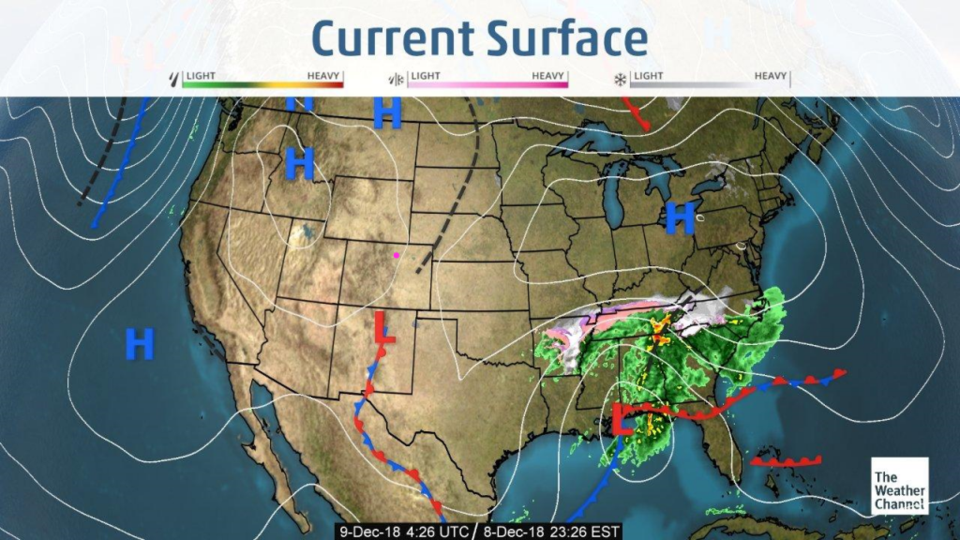
The very mild, dry, weekend continues today. There are almost no weather map features near us today (Figure 1). All the attention is with the gigantic snow and rain storm going on in the SE U.S.
The longer range forecast:
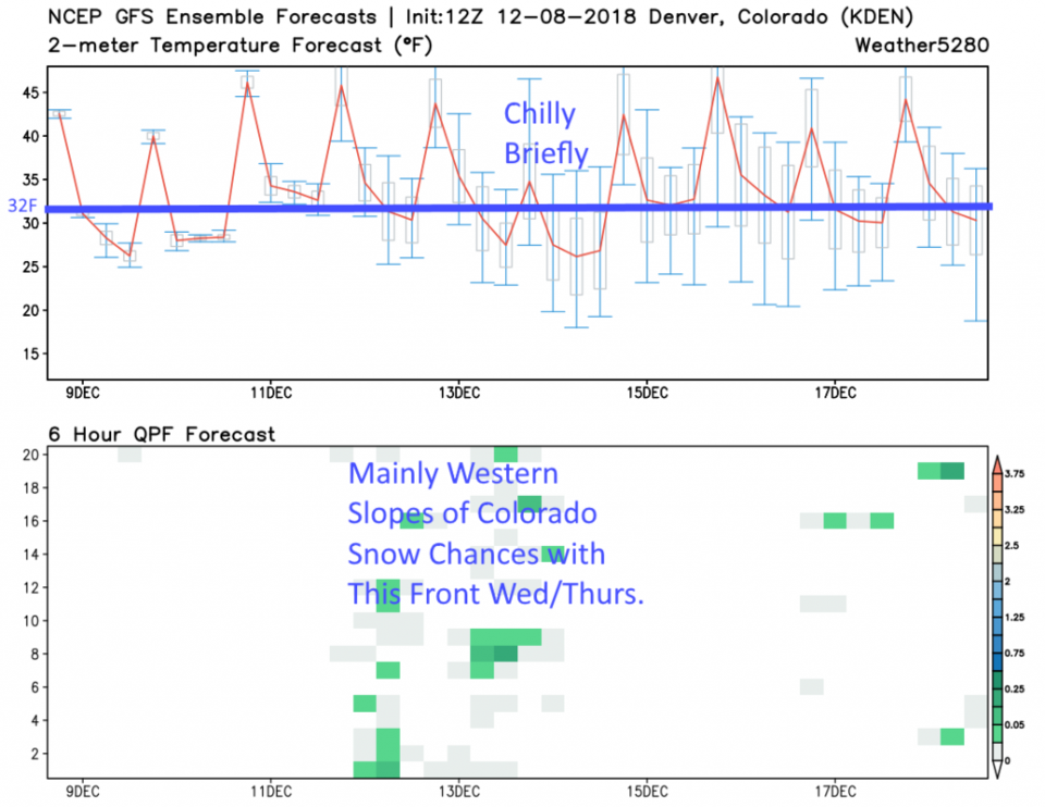
The 10 day forecast (Figure 2) from the GFS keeps us above freezing every day, and just a bit below freezing each night for a long time. These are average temperatures except for the cold front coming Wednesday/Thursday this week. But even that cool down is brief and will only last a day and a half or so.
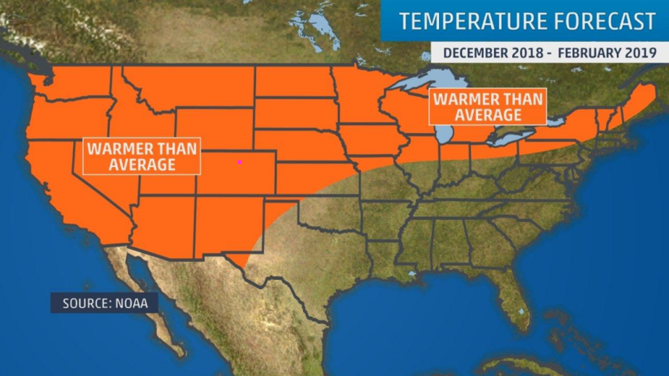
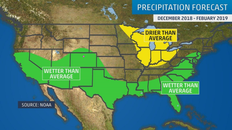
Going out to see what is going to happen over the next 3 months, NOAA is calling for continued above average temperatures (Figure 3) and above average precipitation (Figure 4) through February. It is interesting how uninteresting our local weather will be for a while (the western slopes and higher mountains WILL continue to see snow, even if we don't; that is good news).