Skip to content

Next Storm/Next Snow Forecast Discussion from the Cherrywood Observatory – December 6, 2018

This content was originally published by the Longmont Observer and is licensed under a Creative Commons license.

Forecast Discussion:

(I'll post this early since the snow will move in tonight... Wednesday).

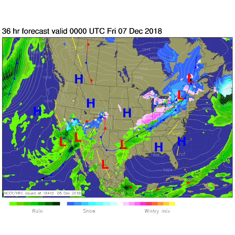
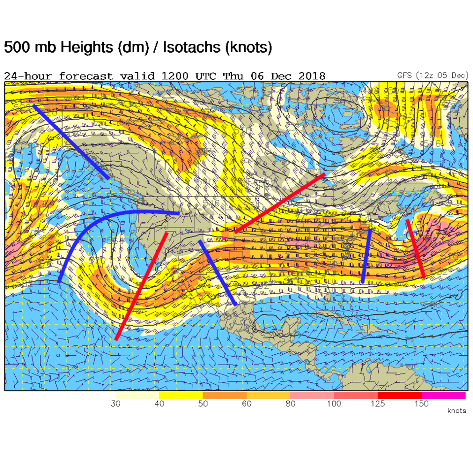
The storm in the west is digging down into Arizona and Mexico with some precipitation extending up into the Western slopes of Colorado and Longmont (Figure 1). This is being driven by this big trough (red line to the southwest of Colorado) headed past us (Figure 2).

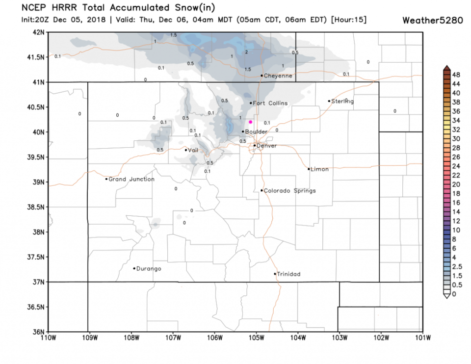
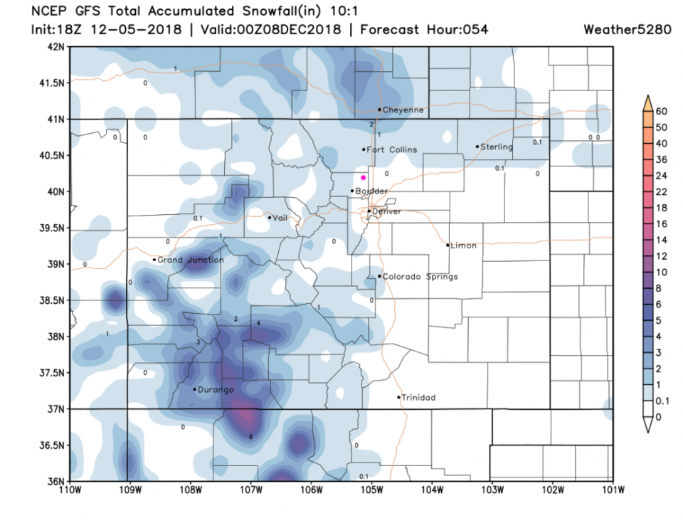
Figure 3 is the HRRR from Wednesday PM to Thursday early morning. We do seem to get a coating to 1/2 inch! Figure 4 is the GFS and it has snow very close to us.

Figure 1: The forecast surface map for Thursday night. From NCEP.

Figure 2: The 500mb forecast upper air analysis for Thursday AM. Pink dot is Longmont. Red lines are troughs, blue lines are ridges.

Figure 3: The forecast accumulated snow map from the HRRR and weather5280.com for Colorado for the next 15 hours through 4 am . Longmont is the pink dot, as always.

Figure 4: The forecast accumulated snow map from the GFS and weather5280.com for Colorado, through the next 2+ days.

The longer range forecast:

Like yesterday, we get a couple of fronts next week, but no real heat ups or cold air is on the way. And no snow. Sorry.

Current Weather

Cloudy

Cloudy

64°F

UV Index
2 Low
Pressure
29.8 Steady
Visibility
8 miles
Dewpoint
39 °F
Humidity
40%
Wind
NNW 7.1 mph
Gust
15.7 mph
Wind Chill
64 °F

Hourly Forecast

Today
3 PM
64°F
Thunderstorms
Today
4 PM
62°F
Mostly cloudy
Today
5 PM
60°F
Intermittent clouds
Today
6 PM
57°F
Mostly cloudy w/ t-storms
Today
7 PM
55°F
Intermittent clouds
Today
8 PM
53°F
Thunderstorms
Today
9 PM
51°F
Cloudy
Today
10 PM
49°F
Cloudy
Today
11 PM
47°F
Cloudy
Tomorrow
12 AM
46°F
Cloudy
Tomorrow
1 AM
45°F
Cloudy
Tomorrow
2 AM
44°F
Mostly cloudy

7 Day Forecast

Partly sunny w/ t-storms

Wednesday

68 °F

Times of sun and clouds; a shower in spots this morning followed by a couple of thunderstorms this afternoon


Thunderstorms

Wednesday Night

37 °F

A thunderstorm this evening; otherwise, mostly cloudy


Intermittent clouds

Thursday

62 °F

A blend of sun and clouds


Mostly cloudy

Thursday Night

38 °F

Mostly cloudy


Partly sunny

Friday

64 °F

Some sun; breezy in the afternoon


Partly cloudy

Friday Night

36 °F

Partly cloudy


Partly sunny

Saturday

66 °F

Partial sunshine


Mostly clear

Saturday Night

41 °F

Clear to partly cloudy


Mostly cloudy

Sunday

78 °F

Rather cloudy and warmer; breezy in the afternoon


Mostly cloudy

Sunday Night

43 °F

Rather cloudy


Sunrise and Sunset

Sunrise
5:59 AM
Sunset
7:56 PM

Based on AccuWeather data