Skip to content

Next Storm/Next Snow Forecast Discussion from the Cherrywood Observatory – December 3, 2018

This content was originally published by the Longmont Observer and is licensed under a Creative Commons license.

Forecast Discussion:

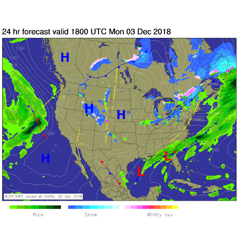
The western storm has crashed into the mountains of the West and has diminished to up-slope snows mainly over western Colorado. Some snow and rain may slip over the Rockies before dying from down-slope warming/sinking (Figure 1). Cold air (the center of which is the high pressure slipping south to our east) is most deeply entrenched east of the Rockies today. We may barely break freezing today.

Figure 1: The forecast surface map for Monday noon. From NCEP.

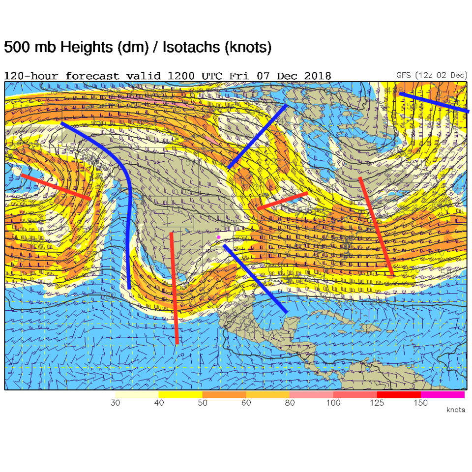
The longer range forecast:

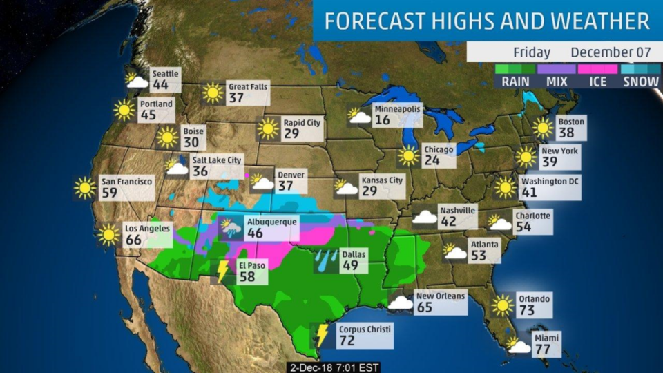
We stay dry and cool this week. Another front/low passes late in the week, but as you can see in Figure 2, the jet stream is far to the south of us. The bulk of the lift and instability will be down in Arizona and New Mexico. We just get the cold air. Figure 3 shows the expected precipitation at the end of the week and it stretches from AZ to TX and beyond.  Sorry, if you were hoping for some good snow around town.

Figure 2: The 500mb forecast upper air analysis for Friday AM. Pink dot is Longmont. Red lines are troughs, blue lines are ridges.

Figure 3: The surface precipitation type forecast map from the weather channel for Friday.

Current Weather

Clear

Clear

50°F

UV Index
0 Low
Pressure
29.9 Falling
Visibility
8 miles
Dewpoint
44 °F
Humidity
79%
Wind
NNW 3.8 mph
Gust
8.4 mph
Wind Chill
49 °F

Hourly Forecast

Today
4 AM
45°F
Clear
Today
5 AM
43°F
Mostly clear
Today
6 AM
41°F
Mostly clear
Today
7 AM
45°F
Partly sunny
Today
8 AM
52°F
Partly sunny
Today
9 AM
59°F
Partly sunny
Today
10 AM
65°F
Intermittent clouds
Today
11 AM
71°F
Intermittent clouds
Today
12 PM
75°F
Intermittent clouds
Today
1 PM
77°F
Intermittent clouds
Today
2 PM
75°F
Thunderstorms
Today
3 PM
73°F
Cloudy

7 Day Forecast

Mostly sunny

Wednesday

75 °F

Mostly sunny, pleasant and warmer


Partly cloudy

Wednesday Night

41 °F

Patchy clouds


Mostly cloudy w/ t-storms

Thursday

77 °F

Turning cloudy, warm; breezy, a stray thunderstorm this afternoon


Thunderstorms

Thursday Night

47 °F

A thunderstorm in spots this evening; otherwise, considerable cloudiness


Thunderstorms

Friday

69 °F

Mostly cloudy and not as warm with a couple of thundershowers


Thunderstorms

Friday Night

44 °F

Cloudy with a couple of thundershowers


Rain

Saturday

46 °F

Chilly with periods of rain and a thunderstorm


Rain and snow

Saturday Night

39 °F

Cloudy with rain, mixed with a little snow late


Mostly cloudy

Sunday

59 °F

Mostly cloudy and warmer; a stray afternoon thundershower


Partly cloudy

Sunday Night

36 °F

Partly cloudy


Sunrise and Sunset

Sunrise
6:08 AM
Sunset
7:49 PM

Based on AccuWeather data