This content was originally published by the Longmont Observer and is licensed under a Creative Commons license.
In Brief:
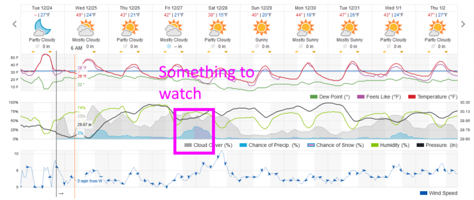
Chances of snow by Christmas morning are amazingly small, but not absolutely zero. We warm to about 50F for the afternoon. This will be great for kids riding their new bikes around the block. There is a chance of a storm worth watching Friday PM into Saturday morning. Beyond the weekend, normal temperatures and dry conditions return.
Update 12/28 11pm:
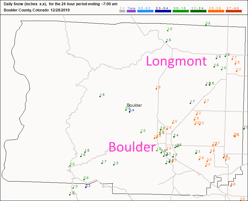
I'm just back from the snow covered regions of Crested Butte with a quick check on the pre-7am snowfall. We had 1 to 2.5 ish inches of snow by sunrise. And snow kept falling much of the day. Figure 6 update shows the 1 to 1.5 inch snowfall totals on the west side and just over 2.5 inches on the east side of town.
New Years midnight forecast:
Right now it looks mostly clear with a light breeze from the west as you stand outside counting down to midnight. Temperatures will be around 20F. Bundle up!
End 12/28 11pm Update.
Update 12/27 11am Update:
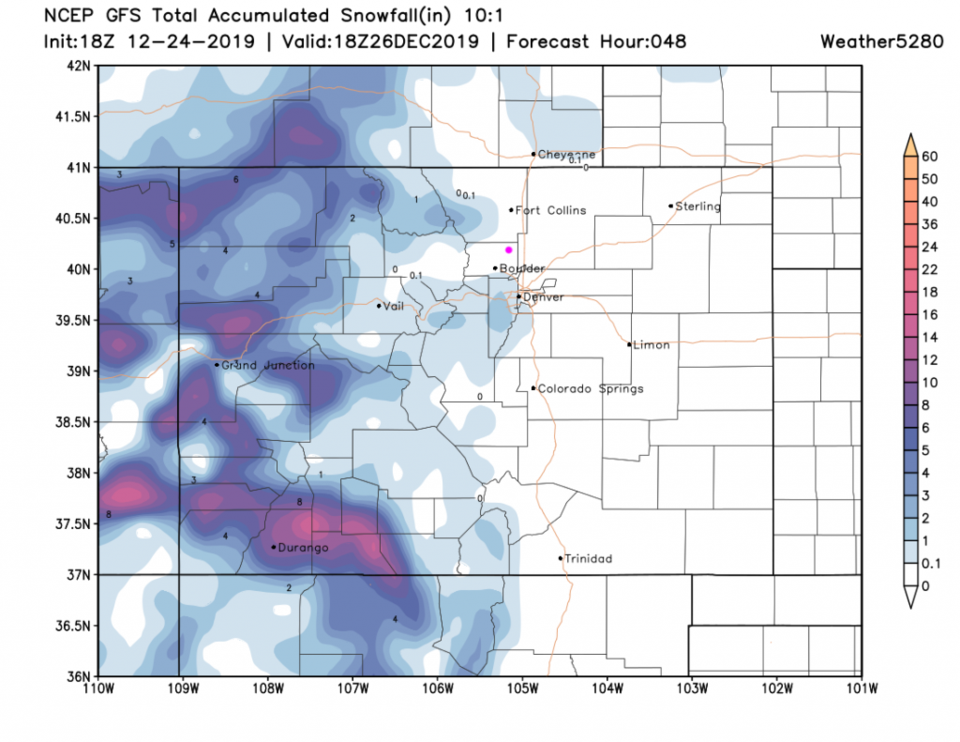
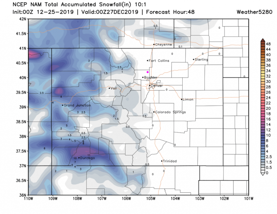
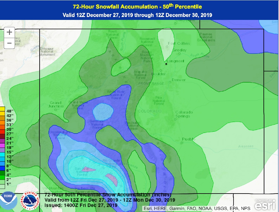
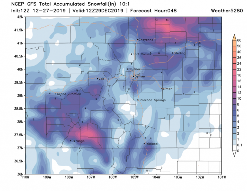
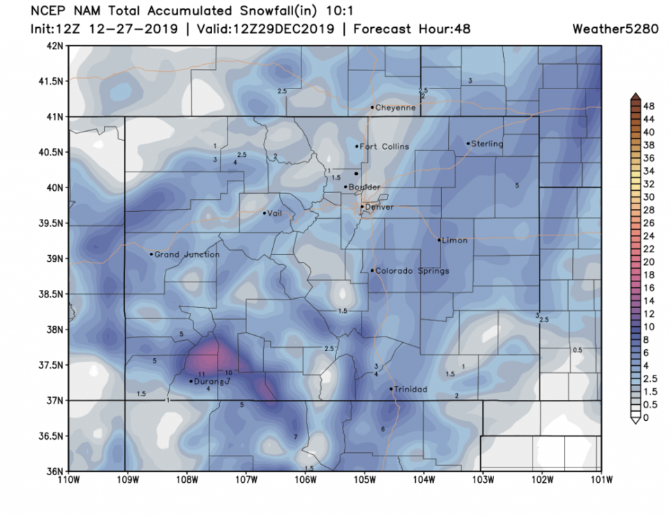
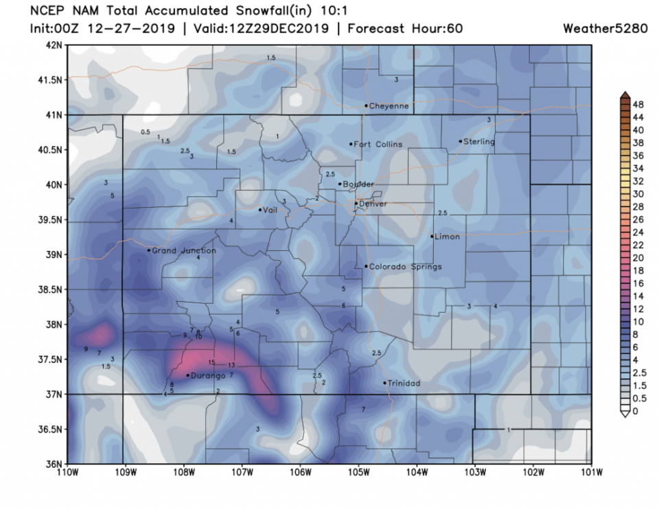
A period of snow will move in with a short wave this afternoon. The main cold front with upper level trough support will arrive early morning Saturday. Snow showers will be possible from pre-dawn into the late afternoon Saturday. For Longmont, a trace to maybe 3 inches is possible. The show will be lighter towards Ft. Collins (0-2 inches). Heavier towards Denver (2-4 inches). The big snow will be in the southwest corner of the state. (Figure 3 update). The GFS has Longmont getting 1/2-1 inch of snow (Figure 4 update). The NAM has us getting 1-2 inches of snow (Figure 5 update).
End 12/27 11am update.
Update 12/26 9pm:
Just a quick check in from my down time this week (I actually had a nap today! - Wow.) We are on target for increasing clouds and chances of rain in the day, snow at night Friday. Overnight Friday into Saturday AM will be the primary period for new snow. The GFS is the most bullish on show giving us 1/2-2 inches of snow over the next 3 days (Figure 1 update). The NAM (Figure 2 update) has us at 1-2.5 inches of snow but most other models give us much less. There is a winter storm advisory for many inches of blowing snow east of I-25 and east of Denver Friday into Saturday. If you are traveling the eastern plains, it could be rough going. Keep an eye on your weather apps for the first part of the weekend. Happy almost New Year everyone!
End 12/26 9pm update.
Forecast Discussion:
We are assembling bicycles and stuffing stockings with eggnog in hand as I write. I'll try to take the next 3 days off and just post an update on the week-end storm chances (in case you are traveling).
Pacific moisture continues to create mostly cloudy skies and places from California to Estes Park will see moisture - but we won't see much or anything over the next 24 hours (Figure 1) in Longmont or northeast Colorado.
Christmas Morning Forecast:
Figure 2 shows nearby snow, but only up in the higher foothills by Christmas morning (the HRRR).
Figure 3 has snow almost into Boulder and a dusting in Denver (lucky folks) but nothing right in Longmont (the GFS).
Figure 4 has snow only up in the mountains and higher foothills (the NAM).
At least we go down into the 20'sF overnight! You do need that for snow.
The Longer Range Forecast:
We stay very close to seasonable temperatures with highs in the lower 40'sF and lows in the upper teens for the next 10 days overall (Figure 5). I'll supply updates as the weekend approaches covering what we might get out of the Friday/Saturday system.
New Years Eve midnight forecast:
It will be about 28F with partly cloudy skies and almost no chance of snow as the 'ball drops' in Colorado 12/31 11:59pm. Winds will be light from the west at 3mph on average.