This content was originally published by the Longmont Observer and is licensed under a Creative Commons license.
Forecast Discussion:
There were a few flurries in the air in the early morning Saturday. Nothing more. Estes Park picked up only 1/2" or so. This just wasn't much of a storm. Now it is dry-sailing through Christmas morning. Sorry, snow on the ground or in the air Christmas morning is very very unlikely now.
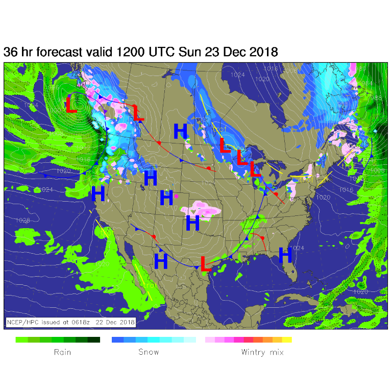
Figure 1 shows the Sunday morning map with our upper air disturbance down into Kansas/Oklahoma. The next storm is crashing on shore in the Pacific northwest.
The longer range forecast:
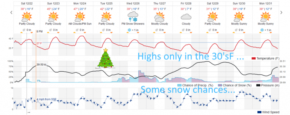
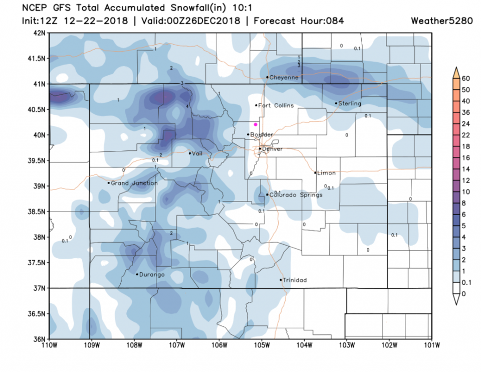
Figure 2 shows highs in the 40'sF through Christmas Day. It will be very nice travel weather for the Plains. Looking out through Christmas night across the state, the western slopes and higher mountains will get 2 to locally 6 inches of snow. Driving in from the west could be tricky in the mountain passes (Figure 3).
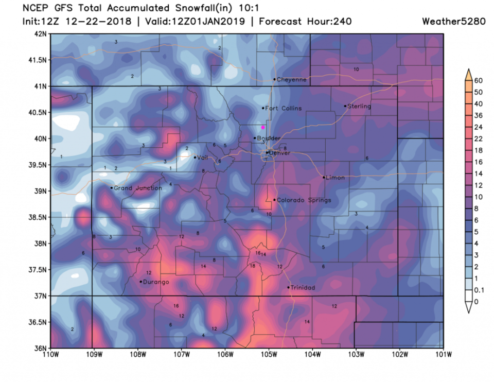
The big change after Christmas in the pattern will chill us to the 30's F daily and give us snow chances every day as well (Figure 2 again). The GFS keeps Longmont in a snow-hole (only 1-2 inches over 10 days!) while much of Colorado will see a foot of snow!! Some runs recently dropped as much as 4-6 inches of snow in town on the 26th so we need to watch the path of this system - it has the potential to lock up highways and make things rough right after Christmas Day. Merry Christmas everyone.