Skip to content

Next Storm/Next Snow Forecast Discussion from the Cherrywood Observatory – December 20, 2018

This content was originally published by the Longmont Observer and is licensed under a Creative Commons license.

Forecast Discussion:

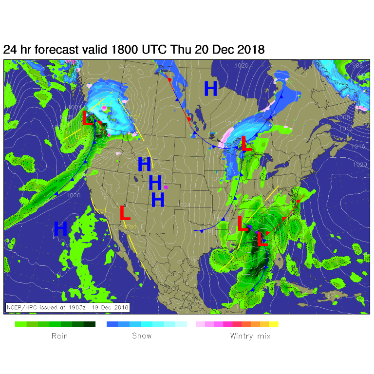
Winds roared up in the 70 mph range in the mountain passes Wednesday as clouds of dust kicked up on the Plains. It was chilly and wild. Today we turn calm again and tomorrow (Friday) we approach record high temperatures along I-25. The surface map (Figure 1) shows high pressure in place again as our 'Saturday' storm comes ashore in the Pacific northwest.

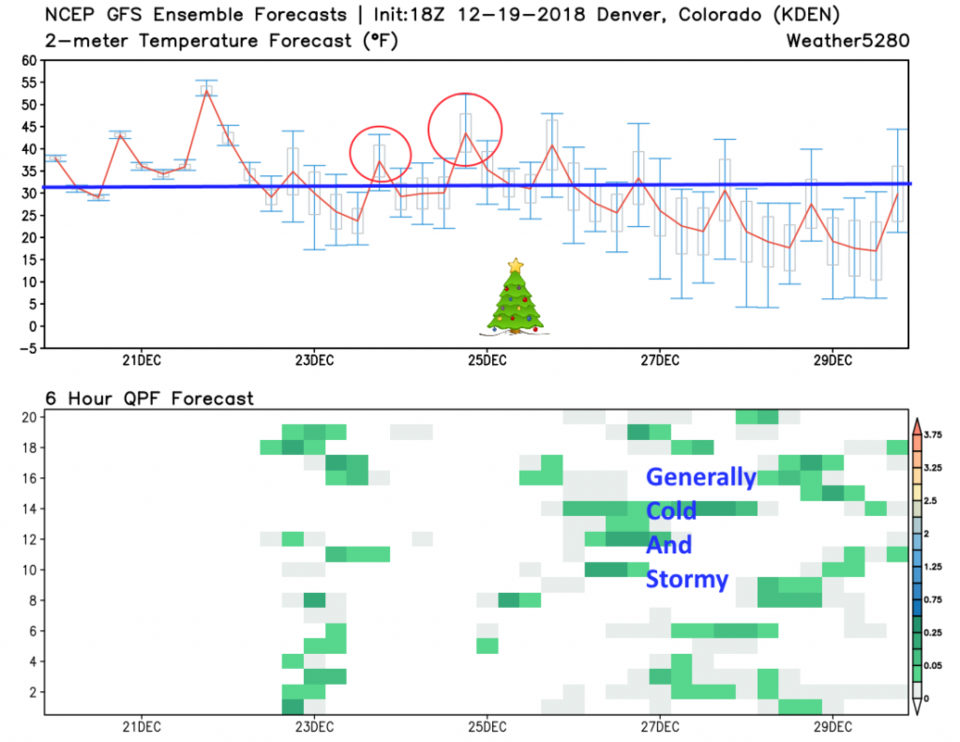
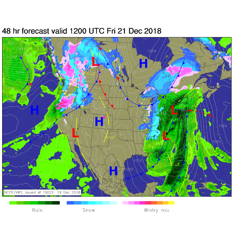
The first couple of days on Figure 2 and Figure 3 shows how utterly dry and abnormally warm we'll get (we don't even go below freezing Thursday night!). That storm arrives Saturday with most model runs giving us a chance of precipitation with temperatures at or just below freezing. We should see a coating of snow Saturday AM (the red trough in Figure 4). More below...

Figure 1: The forecast surface map for Thursday midday. From NCEP.

Figure 2: 10 day meteogram from weather5280.com for DIA.

Figure 3: The forecast surface map for Friday midday. From NCEP.

Figure 4: The 500mb forecast upper air analysis for Saturday AM. Pink dot is Longmont. Red lines are troughs, blue lines are ridges.

The longer range forecast:

Even if the official definition of a White Christmas seems to be 1" of snow on the ground Christmas morning - I grew up in Phoenix, AZ - if there is something frozen and white in the shadow of a bush on Christmas morning, I'll be happy. With Sunday and Monday highs climbing above freezing (red circles on Figure 2) - my definition may be all that works this year.

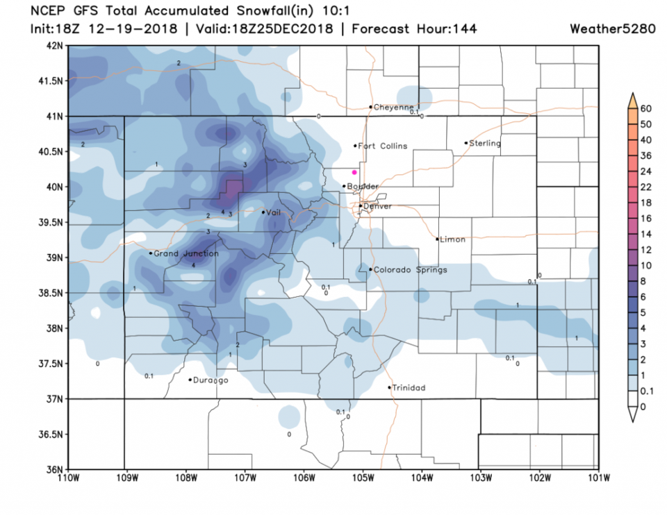
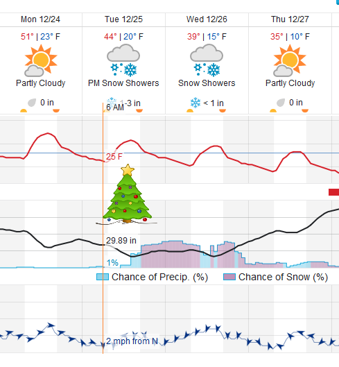
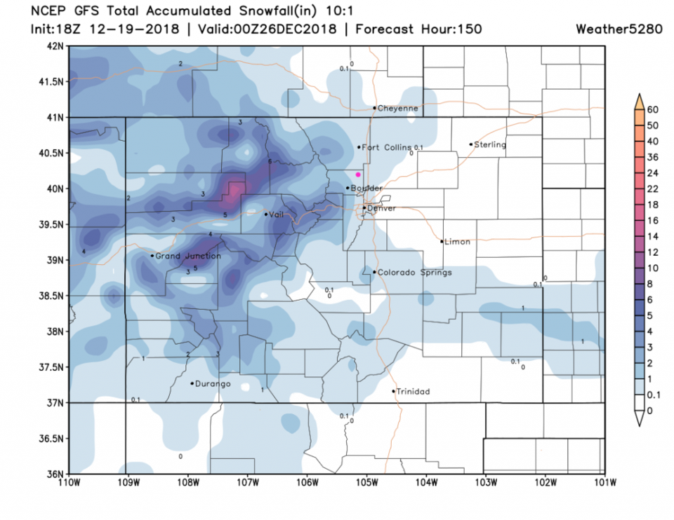
The GFS ensemble (that creates Figure 2) doesn't see much of a storm on Christmas day (but it does the day after Christmas). The operational version of the model does bring snow in. Figure 5 is for Christmas morning - the mountains have new snow right down, almost to, Boulder. The weatherunderground model (Figure 6) shows 1-3 inches of snow falling later on Christmas day. The GFS (Figure 7) gives us 1/10th to 1 inch of snow into the evening.

Does that count as a White Christmas - Christmas night snow?

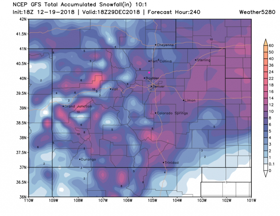
The big pattern change after Christmas (seen later in Figure 2) does spell more snow and more long-lasting snow. Figure 8 paints Longmont with 6 inches or more snow over the total of the next 10 days. Wow! More later...

Figure 5: The forecast accumulated snow map from the GFS and weather5280.com for Colorado, through Christmas Day morning.

Figure 6: a snippet of the graphical forecast for the next 10 days forecast for Longmont, CO from weatherunderground.com

Figure 7: The forecast accumulated snow map from the GFS and weather5280.com for Colorado, through Christmas Day night.

Figure 8: The forecast accumulated snow map from the GFS and weather5280.com for Colorado, through the next 10 days.

Current Weather

Light rain

Light rain

38°F

UV Index
2 Low
Pressure
30.23 Steady
Visibility
7 miles
Dewpoint
35 °F
Humidity
86%
Wind
NNE 4.5 mph
Gust
7.8 mph
Wind Chill
35 °F

Hourly Forecast

Today
1 PM
39°F
Mostly cloudy
Today
2 PM
40°F
Cloudy
Today
3 PM
41°F
Cloudy
Today
4 PM
42°F
Cloudy
Today
5 PM
40°F
Cloudy
Today
6 PM
39°F
Rain
Today
7 PM
38°F
Rain
Today
8 PM
37°F
Cloudy
Today
9 PM
35°F
Flurries
Today
10 PM
35°F
Cloudy
Today
11 PM
35°F
Rain and snow
Tomorrow
12 AM
35°F
Rain and snow

7 Day Forecast

Rain and snow

Friday

42 °F

Cloudy and chilly; a couple of showers of rain or snow this morning followed by a little rain this afternoon


Rain and snow

Friday Night

32 °F

Periods of snow; rain mixed in early, accumulating 1-3 inches; roads could be slippery


Flurries

Saturday

39 °F

A bit of morning snow with little or no accumulation; otherwise, cloudy and chilly; storm total snowfall 1-3 inches


Intermittent clouds

Saturday Night

31 °F

A shower in places in the evening; otherwise, partly cloudy


Partly sunny

Sunday

64 °F

Partly sunny, pleasant and warmer


Mostly clear

Sunday Night

41 °F

Mainly clear


Intermittent clouds

Monday

79 °F

Warmer with a blend of sun and clouds


Partly cloudy

Monday Night

36 °F

Partly cloudy


Mostly cloudy

Tuesday

64 °F

Mostly cloudy and cooler


Mostly cloudy

Tuesday Night

40 °F

Mostly cloudy


Sunrise and Sunset

Sunrise
6:15 AM
Sunset
7:44 PM

Based on AccuWeather data