This content was originally published by the Longmont Observer and is licensed under a Creative Commons license.
Forecast Discussion:
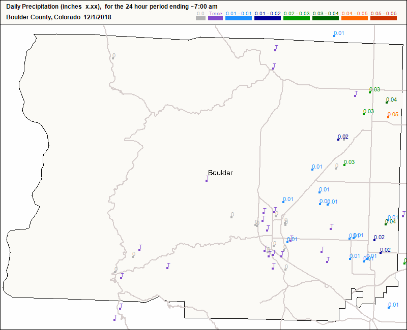
We had only a trace of snow around the county Friday into Saturday, but we did have very thick fog and freezing fog overnight. Figure 1 shows the meager, but needed, rainfall/water equivalents that fell.
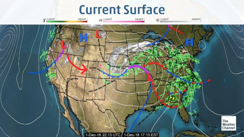
Our storm is pulling out to the east creating a blizzard in the Great Plains, Our next storm is swinging in from the northwestern coast of the U.S. (Figure 2).
The longer range forecast:
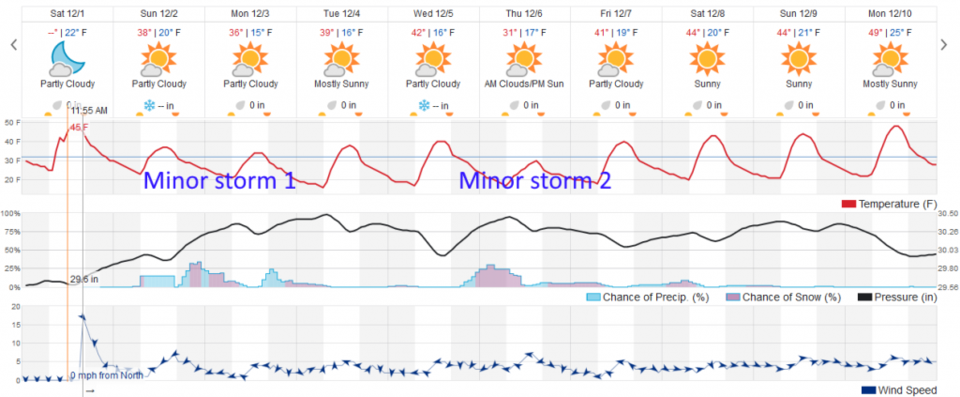
The next storm arrives today giving us light snow off and on all day, but the temperatures will be above freezing during the day (Figure 3). Temperatures bottom out on Monday (some models keep us below freezing for a day). There is a hint of another, late week, storm on the horizon. The jet stream is the south of us and these storm system will keep swinging through.