This content was originally published by the Longmont Observer and is licensed under a Creative Commons license.
Forecast Discussion:
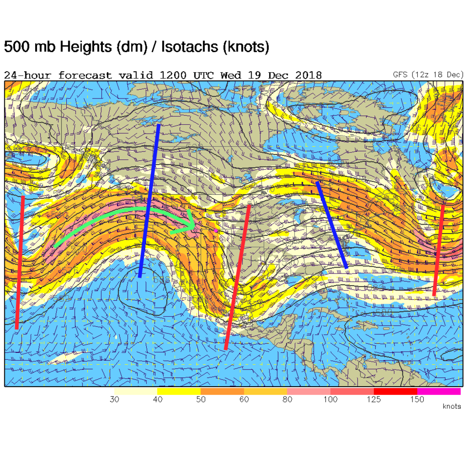
Our first trough is passing and the winds will become pretty extreme Tuesday PM in the mountains and Wednesday everywhere as the nose of the jet stream plows into the state (Figure 2). (I'll push this earlier, on Tuesday, since the NWS has issued a warning for Wednesday.)
HIGH WIND WARNING IN EFFECT FROM 8 AM TO 5 PM MST WEDNESDAY...The National Weather Service in Denver has issued a High Wind
Warning, which is in effect from 8 AM to 5 PM MST Wednesday. The
High Wind Watch is no longer in effect.
* TIMING...8 AM MST through 5 PM MST.
* WINDS...Northwest winds 30 to 40 MPH with gusts up to 60 MPH
possible.
* IMPACTS...Areas of blowing dust restricting visibility. Strong
crosswinds on highways resulting in hazardous travel for high
profile vehicles. Possible power outages caused by downed power
lines. The strong winds and dry vegetation will result in
elevated fire danger.
PRECAUTIONARY/PREPAREDNESS ACTIONS...
A High Wind Warning means a hazardous high wind event is expected
or occurring. Strong winds may lead to property damage. Hazardous
driving conditions due to powerful cross winds will pose a
serious risk for drivers, especially for light weight and
high profile vehicles. Loose outdoor items should be brought
inside or secured properly.
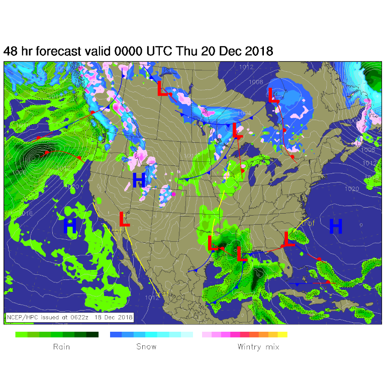
Figure 1 shows the western slope's up-slope flow and snow also created by this jet.
We remain warm through Monday with temperatures in the upper 40's F to 60° F at times. It is normally in the lower 40's F for a high this time of year.
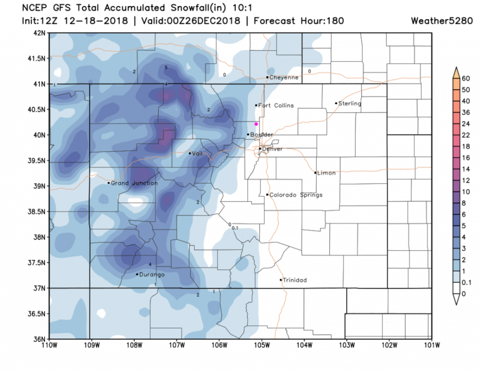
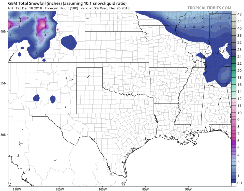
Our previously forecasted snow chance on Wednesday is largely gone (the mountains still get it). Our Saturday snow chances are pretty small as well. We do have a Christmas Day chance of precipitation (but it is small in Longmont). Figure 3 shows that the GFS thinks snow comes very close to Main St. on the west side. That is encouraging. Figure 5 (the GEM) has snow confined to Lyons and westward.
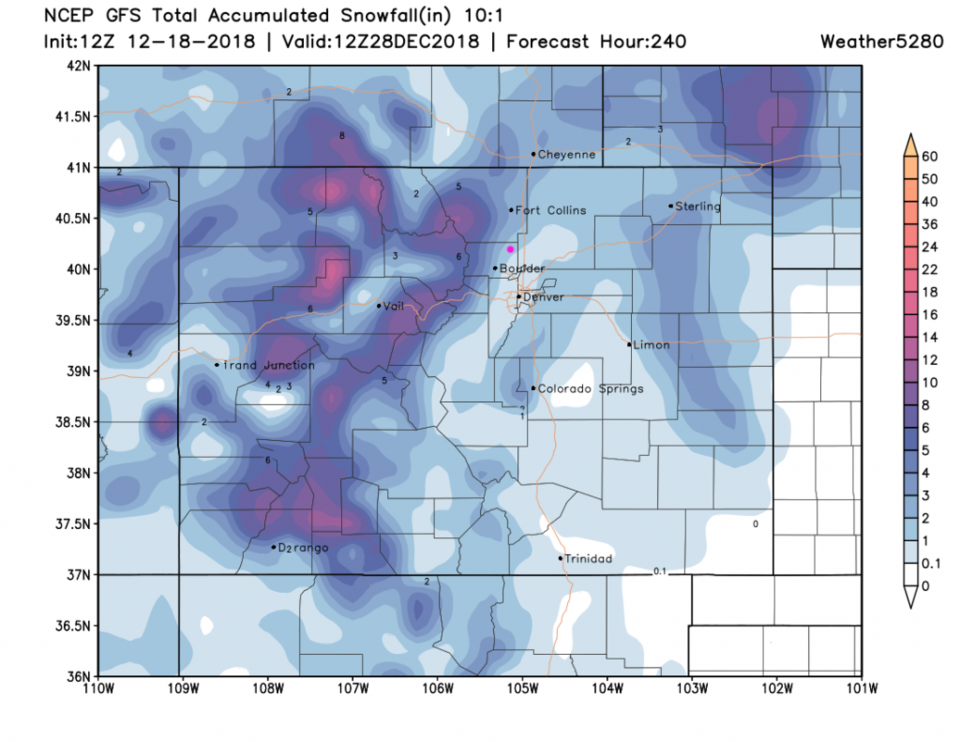
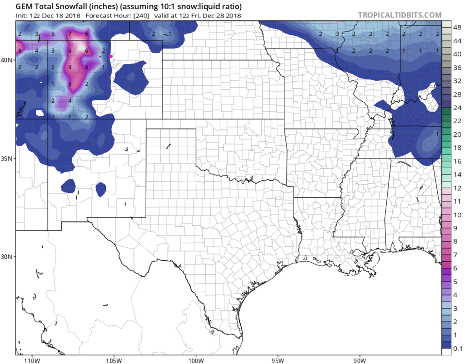
Going further out, there seems to be a real snow "storm" coming the next couple of days after Christmas - Figure 4 gives us 1-3 inches up to the 28th. Figure 6 brings snow just into Longmont by the 28th.