This content was originally published by the Longmont Observer and is licensed under a Creative Commons license.
Forecast Discussion:
Rooting for snow this Christmas is like hoping the Broncos will 'do it' this next game. One still does not know, no matter how much talk there is about it...
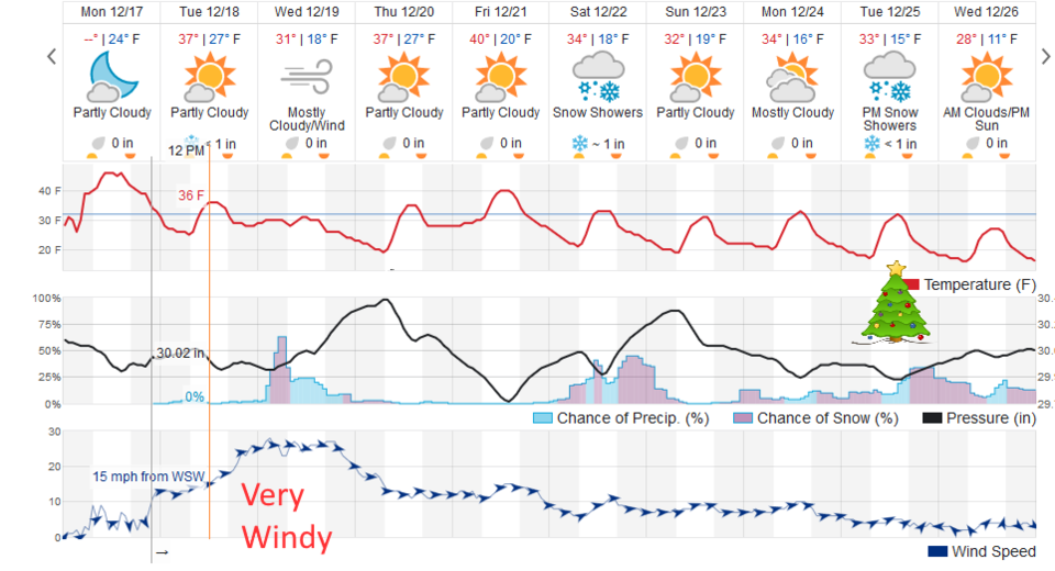
But first, an upper level trough will bring the jet stream over the Rockies and the Front Range tonight into Wednesday night. We will have strong, possibly damaging, winds at times. From the National Weather Service (and Figure 1):
..HIGH WIND WATCH IN EFFECT FROM WEDNESDAY MORNING THROUGHWEDNESDAY AFTERNOON...
The National Weather Service in Denver has issued a High Wind
Watch, which is in effect from Wednesday morning through
Wednesday afternoon.
* TIMING...8 AM MST through 5 PM MST.
* WINDS...Northwest winds 30 to 40 MPH with gusts up to 55 MPH
possible.
* IMPACTS...Areas of blowing dust restricting visibility. Strong
crosswinds on highways. Possible power outages caused by downed
power lines.
PRECAUTIONARY/PREPAREDNESS ACTIONS...
A High Wind Watch means there is the potential for a hazardous
high wind event. Strong winds may lead to property damage.
Hazardous driving conditions due to powerful cross winds will be
possible for drivers, especially for light weight and
high profile vehicles. Loose outdoor items should be brought
inside or secured properly. Continue to monitor the latest
forecasts.
The longer range forecast:
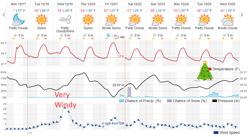
We have a pre-dawn chance of snow Saturday, but highs reach upper 40's to lower 50's F Saturday through Christmas. That is hard to hold on to any dusting of snow that might occur. There is a chance of evening precipitation Christmas night (does that count?) on to the day after. We'll keep watching it here.
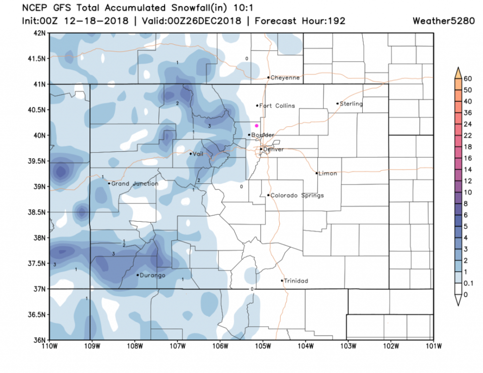
Meanwhile the mountains will see snow Wednesday morning and all day Saturday and Monday mornings as well as Christmas morning and day (Figure 2).
A large river of cold air will begin to dominate the Great Plains and places eastward, but we'll only be on the western shoreline of this shallow cold air. Longmont seems snow-free through Christmas at this time (Figure 3).
Also, from the NWS Boulder: Winter Solstice is coming up this Friday, Dec 21st at 3:23 PM MST. Our shortest day of the year will feature 9 hrs, 53 mins & 21 seconds of light. Enjoy that sunshine early and often!