Skip to content

Next Storm/Next Snow Forecast Discussion from the Cherrywood Observatory – December 13, 2018

This content was originally published by the Longmont Observer and is licensed under a Creative Commons license.

Forecast Discussion:

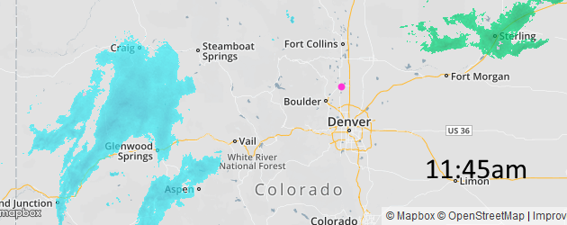
The front has swept past Longmont and skies are dark. (I'll post this early, since the storm is underway). The current radar image sows western slope snows have begun (Figure 1).

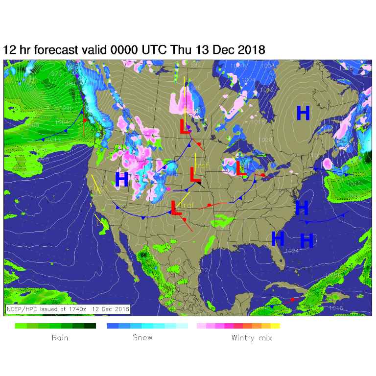
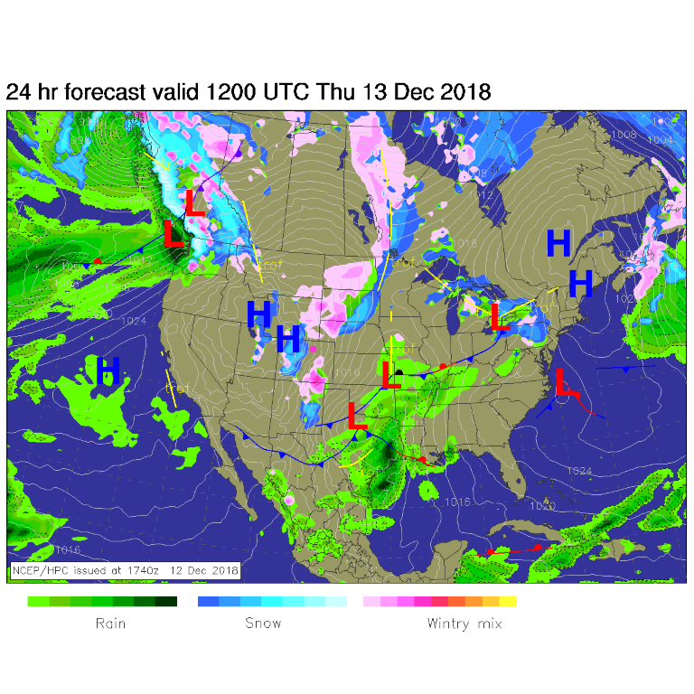
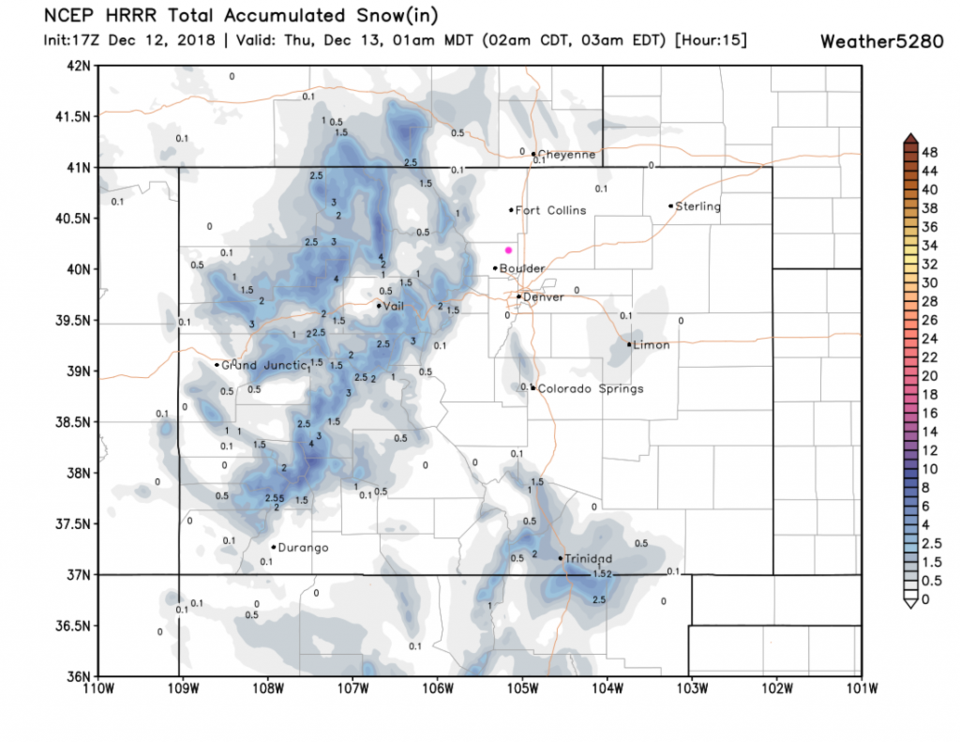
Figure 2 by Wednesday evening, the front is far to the south with western slope snows almost making it down to Lyons! By Thursday a.m. (Figure 3) the front is far far to the south, but mountain snows and 'plains' snows are falling in just about every direction but not here in town. A dusting IS possible.

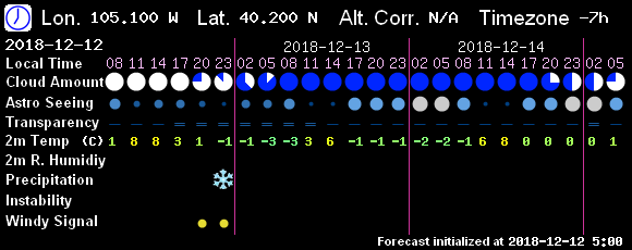
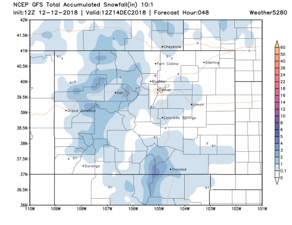
Figure 4 is a model used by astronomers that predicts snow around 11 p.m. Wednesday.   The HRRR model, before 1 a.m. Thursday, puts 1-4 inches of snow down in the mountains, with snow almost making it down to Boulder, but not quite. Figure 6, the GFS, has snow south of Denver and up in the mountains from this storm, but nothing right in our town.  My dusting to a coating of snow is still possible.

Figure 1: Radar image from just before noon on Wednesday from weatherunderground.com

Figure 2: The forecast surface map for Wednesday night. From NCEP.

Figure 3: The forecast surface map for Thursday a.m. From NCEP.

Figure 4: the next couple of days of astronomical forecasting with precipitation type (11pm snow flurries). From 7! Timer.

Figure 5: The forecast accumulated snow map from the HRRR and weather5280.com for Colorado, through the next 15 hours.

Figure 6: The forecast accumulated snow map from the GFS and weather5280.com for Colorado, through the next 48 hours.

The longer range forecast:

We warm right up to the 50's F and winds die down after Thursday. Very quiet weather will be the rule through Dec 22nd. That is VERY close to Christmas.

Current Weather

Cloudy

Cloudy

60°F

UV Index
0 Low
Pressure
29.64 Rising
Visibility
8 miles
Dewpoint
31 °F
Humidity
34%
Wind
NW 4.8 mph
Gust
13.7 mph
Wind Chill
60 °F

Hourly Forecast

Today
9 PM
59°F
Thunderstorms
Today
10 PM
57°F
Cloudy
Today
11 PM
56°F
Cloudy
Tomorrow
12 AM
54°F
Cloudy
Tomorrow
1 AM
53°F
Cloudy
Tomorrow
2 AM
52°F
Cloudy
Tomorrow
3 AM
51°F
Cloudy
Tomorrow
4 AM
50°F
Cloudy
Tomorrow
5 AM
51°F
Cloudy
Tomorrow
6 AM
51°F
Cloudy
Tomorrow
7 AM
52°F
Cloudy
Tomorrow
8 AM
56°F
Cloudy

7 Day Forecast

Mostly cloudy w/ showers

Thursday

72 °F

Turning cloudy, warm; an afternoon shower or two


Thunderstorms

Thursday Night

50 °F

A thunderstorm in spots this evening; otherwise, considerable cloudiness and mild


Thunderstorms

Friday

70 °F

Mostly cloudy with a couple of thundershowers


Thunderstorms

Friday Night

43 °F

Cloudy with a couple of thundershowers


Rain

Saturday

46 °F

Chilly with periods of rain and a thunderstorm


Rain and snow

Saturday Night

39 °F

Cloudy with rain, mixed with a little snow late


Mostly cloudy

Sunday

59 °F

Mostly cloudy and warmer; a stray afternoon thundershower


Partly cloudy

Sunday Night

36 °F

Partly cloudy


Partly sunny

Monday

71 °F

Partly sunny, pleasant and warmer


Partly cloudy

Monday Night

42 °F

Partly cloudy


Sunrise and Sunset

Sunrise
6:07 AM
Sunset
7:50 PM

Based on AccuWeather data