This content was originally published by the Longmont Observer and is licensed under a Creative Commons license.
In Brief:
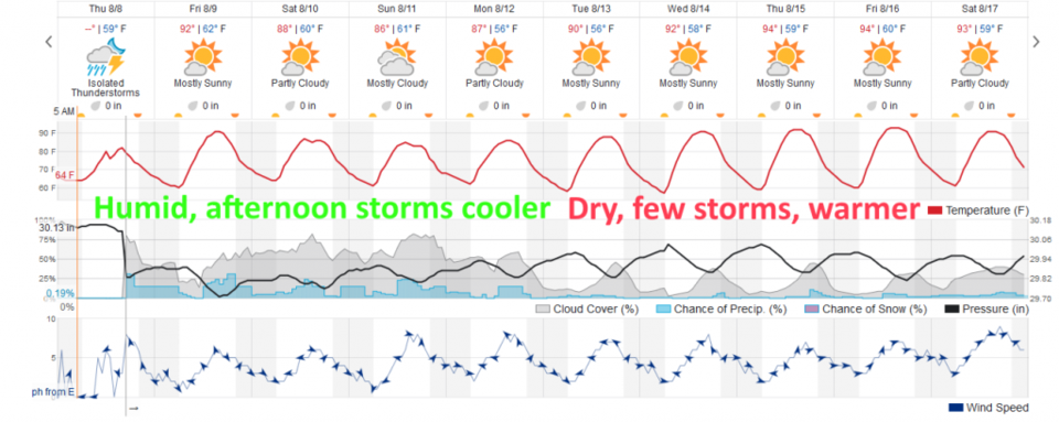
For today (Friday), things will dry out a bit over what we saw Thursday and warm up a bit. That might mean less flooding rains in spots, but a better chance of severe weather (a Marginal Risk is in place again) than resulted Thursday along I-25. Afternoon storms continue for the weekend with highs in the 80'sF. Things dry out and warm to the mid 90'sF next week starting Tuesday.
10am Update:
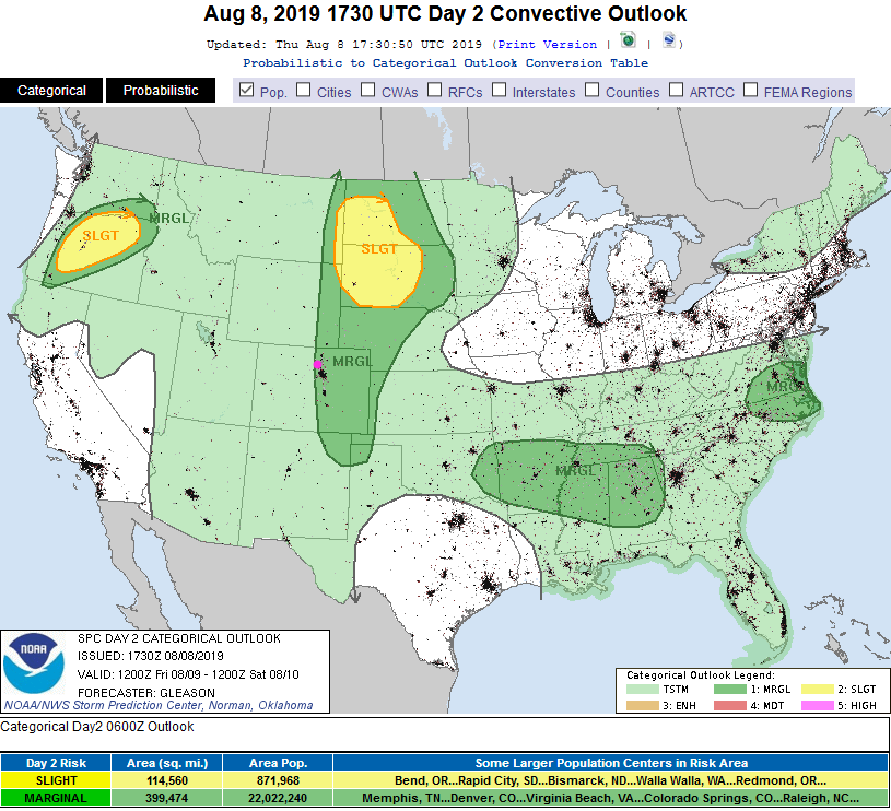
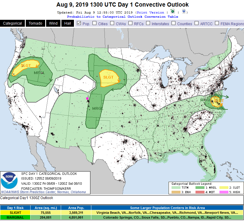
The expectation is that the drier air pushing in will inhibit severe storm development near I-25 and westward. The SPC has trimmed the western edge of yesterdays forecast Marginal Risk off and moved it eastward (Figure 1 update). Still, any storm that passes may contain small hail and frequent lightning. Lightning can kill!
The marginal risk for Saturday is almost the same - just off to our east (not shown).
End 10am Update.
Forecast Discussion:
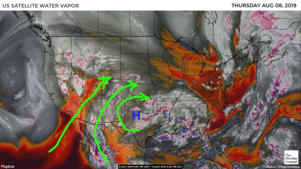
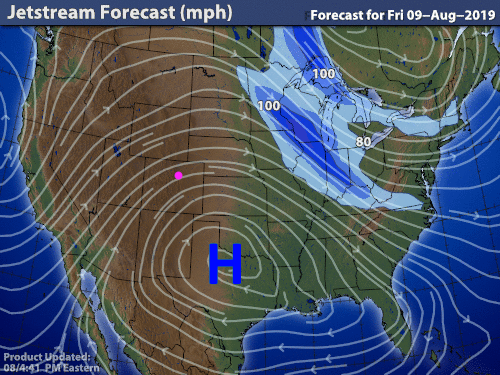
Storms on Thursday were widely scattered - but did approach severe limits out on the Plains. It looks like there was too much moisture/cloud cover in the early parts of the day back near the mountains. The moisture flow was optimal for 12-24 hours from deep to the south latitudes (Figure 1). The high was located, Thursday PM, just west of Dallas/Ft. Worth (Figure 2) creating that favorable flow pattern.
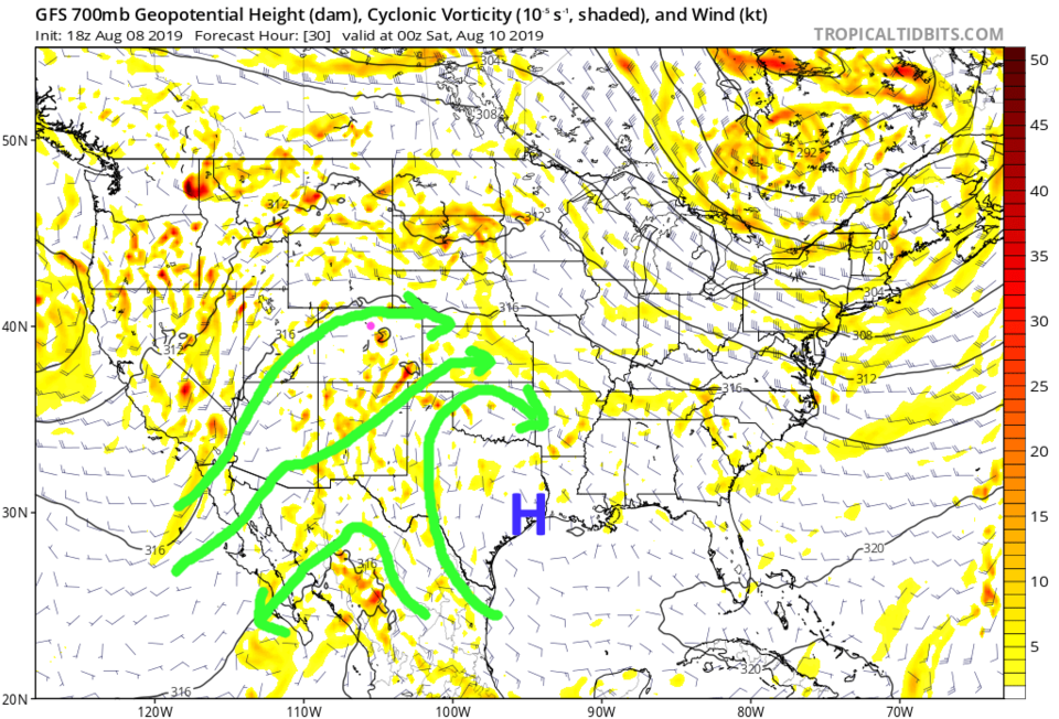
For today (Friday) the high moves to SE Texas (at 700mb, which is lower in the atmosphere than the 500mb map we usually look at - it is the airflow at roughly 10,000 feet -Figure 3). This results in a more westerly (dry) air flow in the middle atmosphere over northern Colorado. We should see fewer clouds and higher temperatures (but sill some low level moisture).
With more heating and some moisture still around - a Marginal Risk (1 on a scale of 1-5) is in place for all of eastern Colorado again (Figure 4). High winds are the primary threat, but a few cells creating large damaging hail may form as well.
The Longer Range Forecast:
Beyond Friday, there will be some pulses of moisture returning now and then and semi-warm temperatures (near or just below normal for this time of year) and daily afternoon thunderstorm chances. Beyond Monday - the high returns to our neck-of-the-woods and we dry out and warm to the mid-90'sF.