Skip to content

Next Storm/Next Snow Forecast Discussion from the Cherrywood Observatory – August 23-24, 2019

This content was originally published by the Longmont Observer and is licensed under a Creative Commons license.

In Brief:

An encroaching trough will hold off the heat wave this weekend. The moisture flow is also remaining fairly healthy - we see another chance of severe thunderstorms tonight (Friday). We dry out for the weekend but only hit the upper 90'sF on Sunday.

After that we slowly cool until a strong cold front brings in a taste of Fall at the end of next week and weekend.

Forecast Discussion:

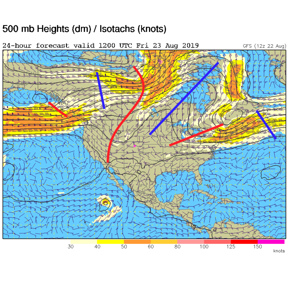
The trough to our west is holding stronger than expected - this is keeping temperatures a bit cooler through Saturday than expected earlier in the week (Figure 1). We still have tropical moisture from the south and east and Pacific moisture from the west coming in at different levels (Figure 2).

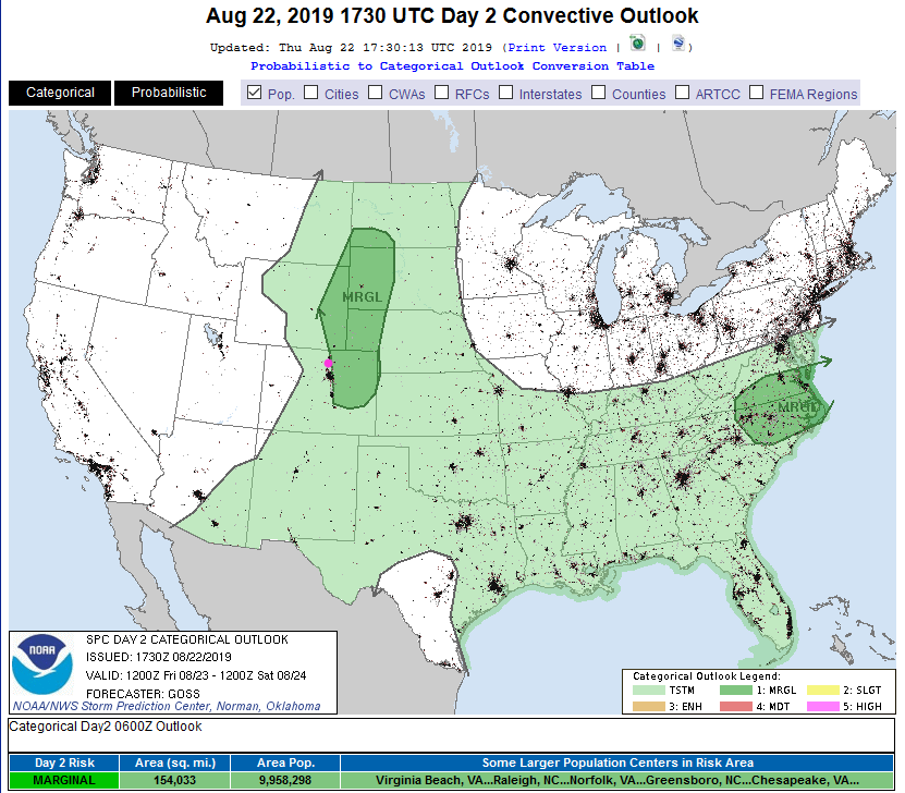
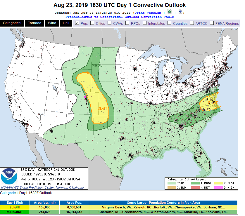
The SPC has us on the very western edge of a Marginal Risk of severe weather (1 on a scale of 1-5) for hail and high winds (as usual).

2pm Friday Update:

The forecast for today going into the weekend is on track. The Marginal Risk (1 on a scale of 1-5) for severe weather (for hail and high winds this afternoon) has been nudged westward to include most of Longmont (Figure 1 update). The Slight Risk (2 on a scale of 1-5) is just a few miles further east. There is a chance for tornadoes in the middle of the Slight Risk region.

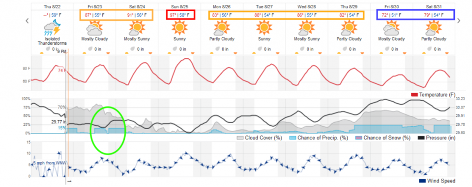
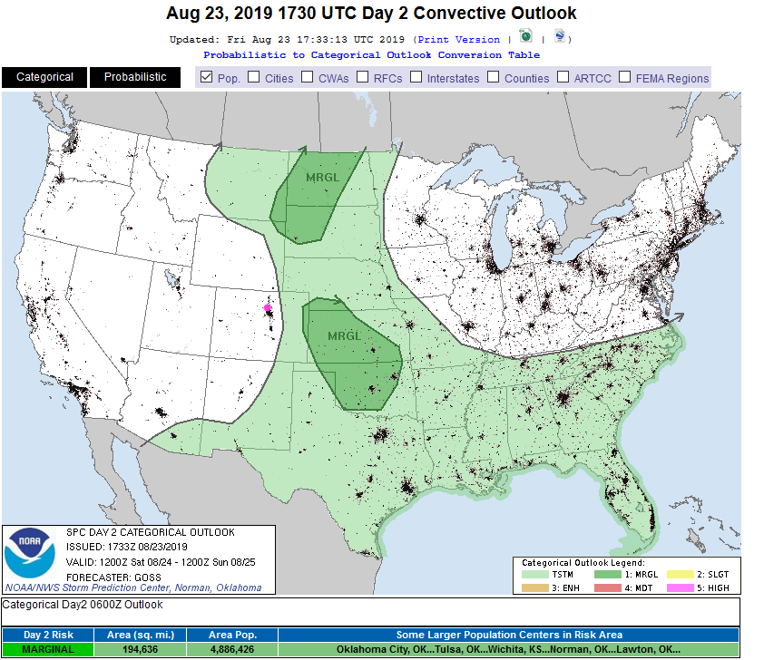
For Saturday - we warm up to around 90F and have almost no chance of a storm at all (dry air and lack of upper level support - Figure 2 update). The real heatwave (almost 100F) is still confined to Sunday only.

Figure 1 update: The severe storm weather forecast for the U.S. from the Storm Predication Center in Norman, OK. Made Friday for Friday.
Figure 2 update: The severe storm weather forecast for the U.S. from the Storm Predication Center in Norman, OK. Made Friday for Saturday.

End 2pm Friday Update.

The Longer Range Forecast:

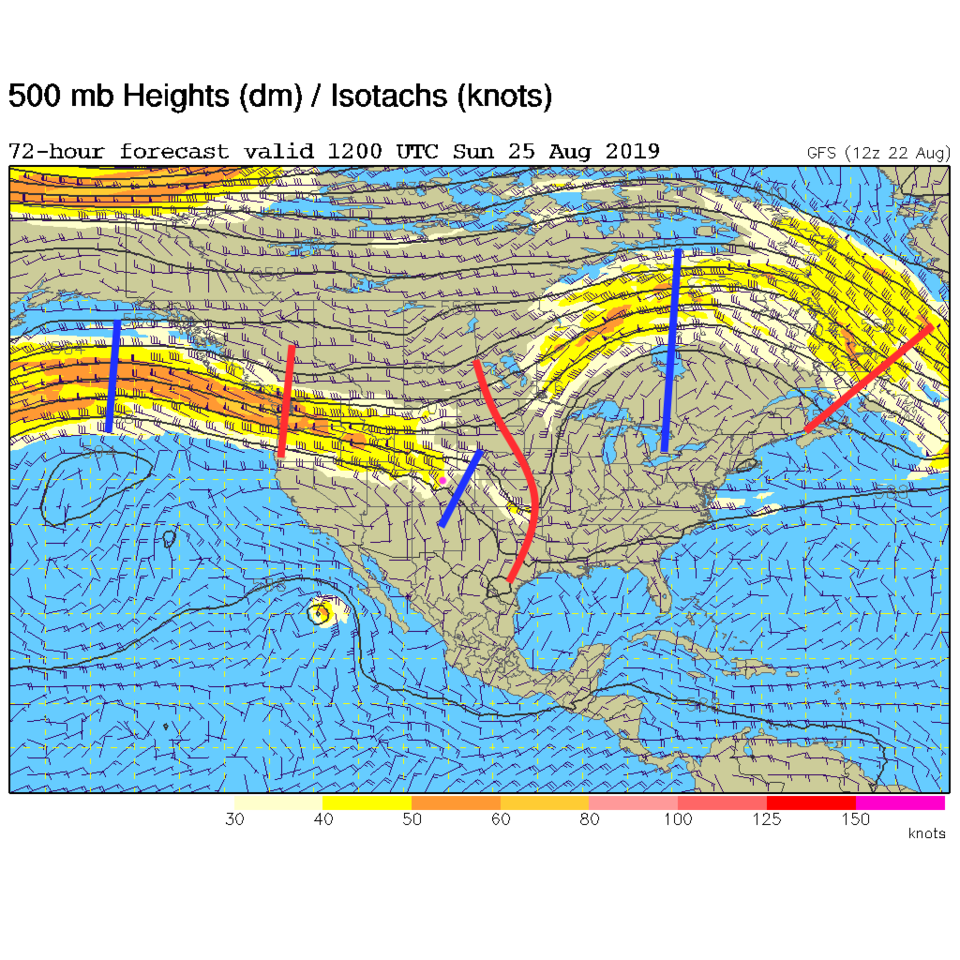
We hover just around 90'F Friday and Saturday then the ridge hits us hard for a day (see the ridge in Figure 5). We hover in the 80'sF through mid-week then a powerful cold front is still coming in Thursday PM. Highs in the lower 70'sF (or only upper 60'sF ?!) are possible on the Plains. Rain showers (not so thundery) are possible Thursday night into the weekend as well. Exciting!

Figure 1 The 500mb forecast upper air analysis for Friday AM. Pink dot is Longmont. Red lines are troughs, blue lines are ridges.
Figure 2: the water vapor satellite image (browns/reds are dry air, whites and light grey is moist air, purple/blue is ice and high cloud tops). From the the NWS from Thursday PM.
Figure 3: The severe storm weather forecast for the U.S. from the Storm Predication Center in Norman, OK. Made Thursday for Friday.
Figure 4: the graphical forecast for the next 10 days for Longmont, CO from weatherunderground.com
Figure 1 The 500mb forecast upper air analysis for Sunday AM. Pink dot is Longmont. Red lines are troughs, blue lines are ridges.

Current Weather

Clear

Clear

43°F

UV Index
0 Low
Pressure
30.16 Steady
Visibility
7 miles
Dewpoint
28 °F
Humidity
55%
Wind
SW 2.3 mph
Gust
3.9 mph
Wind Chill
43 °F

Hourly Forecast

Today
10 PM
42°F
Clear
Today
11 PM
38°F
Clear
Tomorrow
12 AM
36°F
Clear
Tomorrow
1 AM
34°F
Clear
Tomorrow
2 AM
33°F
Clear
Tomorrow
3 AM
32°F
Clear
Tomorrow
4 AM
31°F
Clear
Tomorrow
5 AM
30°F
Clear
Tomorrow
6 AM
30°F
Mostly clear
Tomorrow
7 AM
29°F
Clear
Tomorrow
8 AM
32°F
Sunny
Tomorrow
9 AM
38°F
Sunny

7 Day Forecast

Sunny

Monday

60 °F

Milder with sunshine; the start of a stretch of dry and mild weather


Clear

Monday Night

29 °F

Clear


Sunny

Tuesday

62 °F

Plenty of sunshine


Mostly clear

Tuesday Night

30 °F

Mainly clear


Mostly sunny

Wednesday

63 °F

Mostly sunny and beautiful


Mostly clear

Wednesday Night

30 °F

Mainly clear


Intermittent clouds

Thursday

66 °F

Sun and areas of high clouds and pleasant; breezy in the afternoon


Partly cloudy

Thursday Night

31 °F

Partly cloudy


Mostly cloudy

Friday

61 °F

Becoming cloudy with a thundershower in spots in the afternoon


Mostly cloudy

Friday Night

32 °F

Mostly cloudy


Sunrise and Sunset

Sunrise
7:06 AM
Sunset
7:11 PM

Based on AccuWeather data