Skip to content

Next Storm/Next Snow Forecast Discussion from the Cherrywood Observatory – August 20, 2019

This content was originally published by the Longmont Observer and is licensed under a Creative Commons license.

In Brief:

After roasting for a few days, moisture leaks back into the state and the ridge overhead weakens a bit. Thunderstorms - a few reaching severe limits - will be possible Tuesday through Friday afternoons. We return to the 80'sF with increased moisture then bounce back to the 90'sF for the weekend and seem to dry out (but we need to focus only about 2-3 days out at this time of year).

Forecast Discussion:

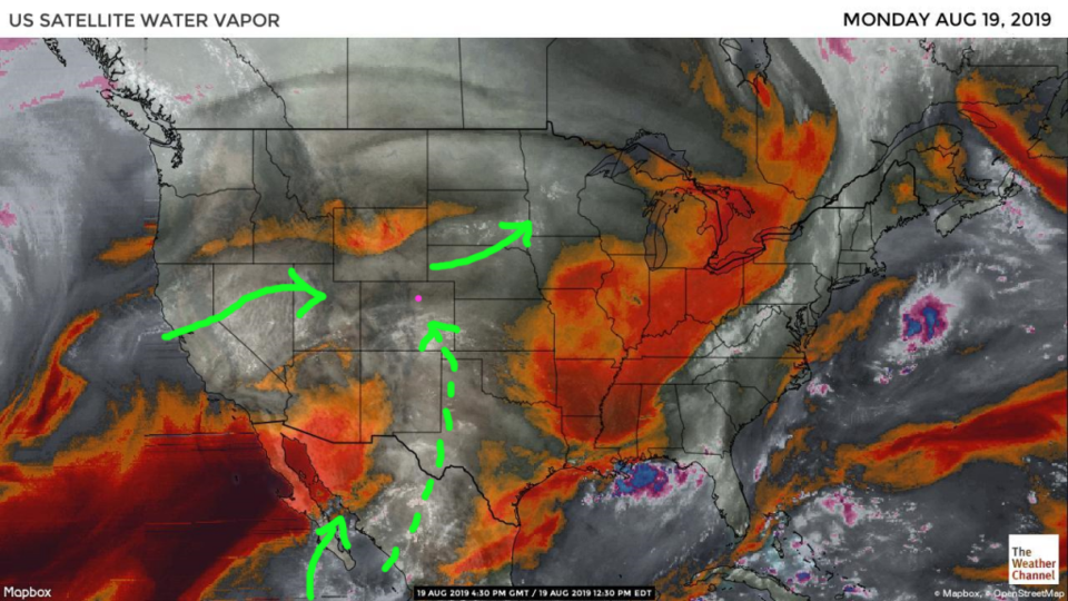
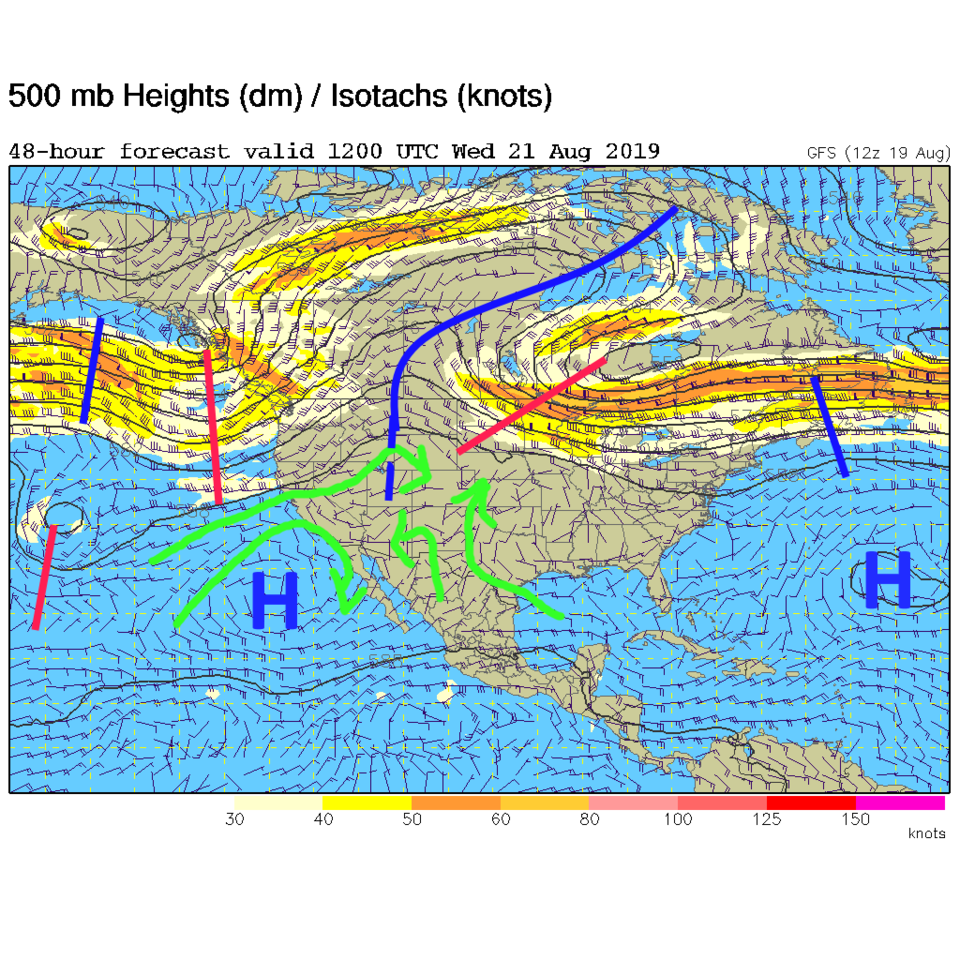
There is "a" way for moisture to get up the ridge axis into the state - but it is not a strong flow (Figure 1). We still have some Pacific moisture moving by as well. By Tuesday into Wednesday, the high pressure centers move off a bit and the weakness between them allows some moisture to return (Figure 2).

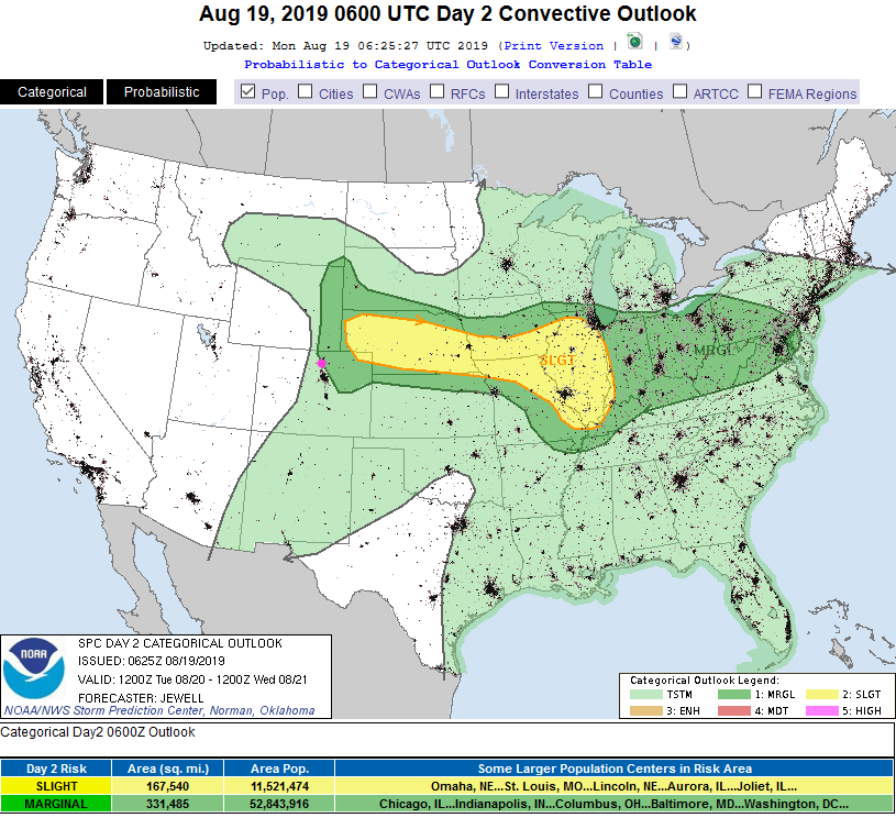
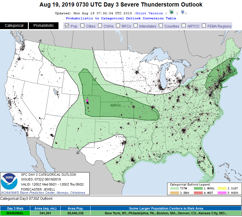
With lots of summer heat, solar energy, and atmospheric moisture - severe weather chances begin to creep back to the Front Range. For Tuesday afternoon, a Marginal Risk (1 out of 5) just touches Longmont in the current forecast (Figure 3). For Wednesday, we are deeper in the Marginal Risk zone (Figure 4).

The Longer Range Forecast:

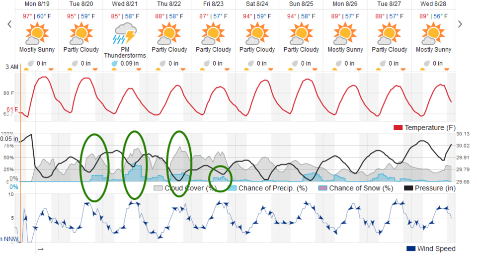
The best chances for rain are the afternoons Tuesday through Friday - with a peak on Wednesday (Figure 5). Rain chances over the next 5 days (Figure 6) are light and confined to areas east of the Rockies. It looks like high temperatures in the 90'sF and dry weather returns for the weekend. Beyond that - who knows?!

Figure 1: the water vapor satellite image (browns/reds are dry air, whites and light grey is moist air, purple/blue is ice and high cloud tops). From the the Weather Channel from Monday PM.
Figure 2: The 500mb forecast upper air analysis for Wednesday AM. Pink dot is Longmont. Red lines are troughs, blue lines are ridges.
Figure 3: The severe storm weather forecast for the U.S. from the Storm Predication Center in Norman, OK. Made Monday for Tuesday.
Figure 4: The severe storm weather forecast for the U.S. from the Storm Predication Center in Norman, OK. Made Monday for Wednesday.
Figure 5: the graphical forecast for the next 10 days for Longmont, CO from weatherunderground.com
Figure 6: the forecast accumulated precipitation map from the GFS and weather5280.com for Colorado, for the next 5 days.

Current Weather

Mostly cloudy

Mostly cloudy

60°F

UV Index
1 Low
Pressure
30.11 Rising
Visibility
7 miles
Dewpoint
35 °F
Humidity
39%
Wind
E 2.8 mph
Gust
6.7 mph
Wind Chill
60 °F

Hourly Forecast

Today
7 PM
54°F
Cloudy
Today
8 PM
55°F
Intermittent clouds
Today
9 PM
52°F
Mostly cloudy w/ t-storms
Today
10 PM
50°F
Intermittent clouds
Today
11 PM
48°F
Intermittent clouds
Tomorrow
12 AM
47°F
Intermittent clouds
Tomorrow
1 AM
45°F
Intermittent clouds
Tomorrow
2 AM
45°F
Intermittent clouds
Tomorrow
3 AM
43°F
Intermittent clouds
Tomorrow
4 AM
42°F
Intermittent clouds
Tomorrow
5 AM
41°F
Intermittent clouds
Tomorrow
6 AM
40°F
Intermittent clouds

7 Day Forecast

Mostly cloudy w/ showers

Tuesday

63 °F

Turning cloudy and cooler


Partly cloudy w/ t-storms

Tuesday Night

40 °F

An evening thundershower; otherwise, partly cloudy


Mostly sunny

Wednesday

76 °F

Pleasant and warmer with sunshine and patchy clouds


Partly cloudy

Wednesday Night

42 °F

Patchy clouds


Mostly cloudy w/ t-storms

Thursday

73 °F

Becoming cloudy; breezy in the afternoon with a thunderstorm in spots


Cloudy

Thursday Night

48 °F

Considerable cloudiness


Showers

Friday

69 °F

Mostly cloudy with a couple of showers


Thunderstorms

Friday Night

46 °F

Cloudy; thundershowers in the evening followed by periods of rain late


Showers

Saturday

53 °F

Cloudy and cooler with a couple of showers


Showers

Saturday Night

39 °F

Cloudy with occasional rain and drizzle late


Sunrise and Sunset

Sunrise
6:10 AM
Sunset
7:48 PM

Based on AccuWeather data