Skip to content

10:30am 8/16 Update: Next Storm/Next Snow Forecast Discussion from the Cherrywood Observatory – August 16-17, 2019

This content was originally published by the Longmont Observer and is licensed under a Creative Commons license.

In Brief:

Summer plows on. Some moisture countered by some morning cooling may turn into near severe thunderstorms in Longmont Friday late afternoon. Only a few storms are likely to form near the Front Range. We have another chance thunderstorms Saturday before a ridge builds over the state and we approach 100F Sunday/Monday. Beyond that, we'll look it at a day at a time.

10:30am 8/16 Update:

The MCS (mesoscale convective system - a group of self propagating and self sustaining thunderstorms that cover less area than a typical state) that slid to the southeast across the Great Plains last night pushed cool moist air up to the Foothills this morning. The evolution of the hot dry air to the west and above this cool moist layer will dictate who sees severe weather today. The Marginal Risk and Slight Risk (1 and 2 on a scale of 1-5 respectively) zones are just east of I-25. This might be changed later as we see what becomes of this boundary as the day wears on. Be alert that a single severe storm could pop up very quickly later this afternoon, even west of I-25 , no matter where the risk zones are.

End 10:30am 8/16 update.

Forecast Discussion:

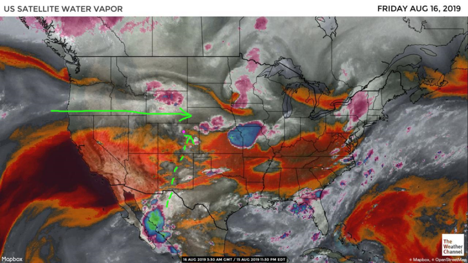
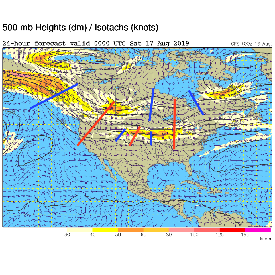
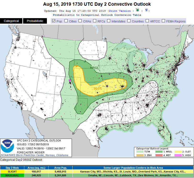
The deep tropical moisture flow is mostly cut off, but some Pacific moisture and a bit of tropical water is meandering around NE Colorado (Figure 1). Outflow from earlier storms north and east of the state will cool and stabilize the atmosphere Friday morning to midday. There are short waves traveling by the state Friday (Figure 2) and, if heating returns later in the afternoon we might see some thunderstorms (some severe) later in the day. The SPC has a Marginal Risk (1 on a scale of 1-5) near the I-25 folks (Figure 3).

The Longer Range Forecast:

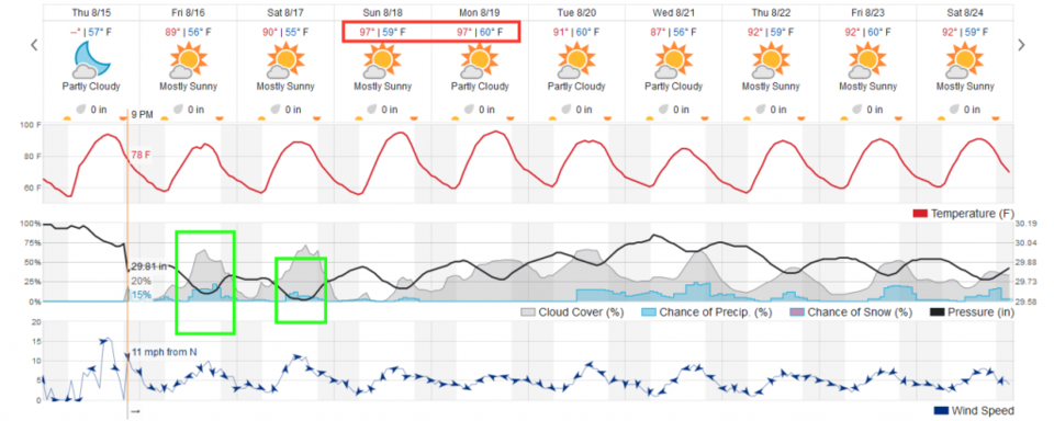
There is a lesser chance of storms Saturday afternoon (Figure 4) then the ridge builds over the state again and we bake near 100F Sunday and Monday (Figure 4) and get dry again. More later!

Figure 1 update: the water vapor satellite image (browns/reds are dry air, whites and light grey is moist air, purple/blue is ice and high cloud tops). From the the Weather Channel from Thursday PM.
Figure 2: The 500mb forecast upper air analysis for Friday PM. Pink dot is Longmont. Red lines are troughs, blue lines are ridges.
Figure 3: The severe storm weather forecast for the U.S. from the Storm Predication Center in Norman, OK. Made Thursday for Friday.
Figure 4: the graphical forecast for the next 10 days for Longmont, CO from weatherunderground.com

Current Weather

Snow

Snow

33°F

UV Index
0 Low
Pressure
30.32 Rising
Visibility
1 miles
Dewpoint
30 °F
Humidity
89%
Wind
NE 1.2 mph
Gust
2.5 mph
Wind Chill
33 °F

Hourly Forecast

Today
8 AM
30°F
Flurries
Today
9 AM
32°F
Flurries
Today
10 AM
33°F
Cloudy
Today
11 AM
34°F
Cloudy
Today
12 PM
35°F
Cloudy
Today
1 PM
37°F
Cloudy
Today
2 PM
38°F
Cloudy
Today
3 PM
40°F
Cloudy
Today
4 PM
39°F
Cloudy
Today
5 PM
39°F
Cloudy
Today
6 PM
38°F
Rain and snow
Today
7 PM
37°F
Cloudy

7 Day Forecast

Rain and snow

Saturday

40 °F

Cloudy and cold; a bit of morning snow followed by a rain or snow shower in spots this afternoon; storm total 1-3"; roads could be slippery


Rain and snow

Saturday Night

32 °F

An evening rain or snow shower in spots; otherwise, partly cloudy


Partly sunny

Sunday

63 °F

Partly sunny and warmer


Mostly clear

Sunday Night

40 °F

Mainly clear


Intermittent clouds

Monday

79 °F

Warmer with intervals of clouds and sun


Partly cloudy

Monday Night

40 °F

Partly cloudy


Mostly cloudy

Tuesday

66 °F

Mostly cloudy and not as warm


Intermittent clouds

Tuesday Night

40 °F

Partly cloudy


Intermittent clouds

Wednesday

79 °F

Warmer with intervals of clouds and sunshine


Intermittent clouds

Wednesday Night

44 °F

Partly cloudy


Sunrise and Sunset

Sunrise
6:14 AM
Sunset
7:45 PM

Based on AccuWeather data