Skip to content

Next Storm/Next Snow Forecast Discussion from the Cherrywood Observatory – April 6-7, 2019

This content was originally published by the Longmont Observer and is licensed under a Creative Commons license.

Forecast Discussion:

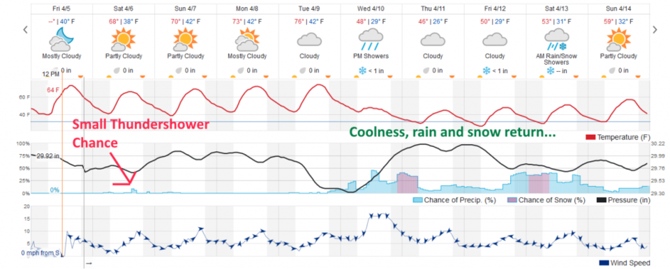
We saw some high-based showers move by Friday PM. I don't think Longmont even saw a sprinkle (Berthoud may have been splashed briefly). Today (Saturday) will be very much the same. [Correction, we got a bit of real rain around 9pm, after I wrote this!] You can see showers on the western slopes in the late afternoon today (Figure 1) with very small chances of precipitation in the late afternoon (Figure 2). Some thunder is possible given the cold air aloft. Overall, we are dry and getting warmer and warmer.

Because readers of this column are probably outside playing this weekend, and things are so quiet, I'll pick it up again Monday when we can set our sights on the next storm better.

The longer range forecast:

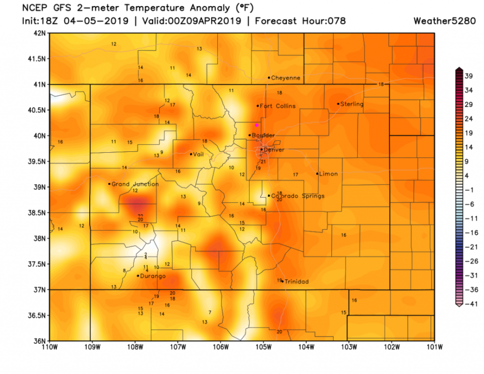
By Monday PM we are some 20F above average (Figure 3). Wonderful temperatures.

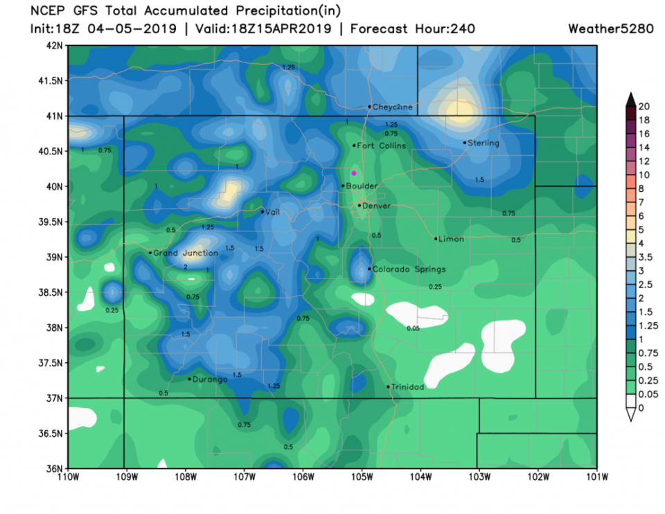
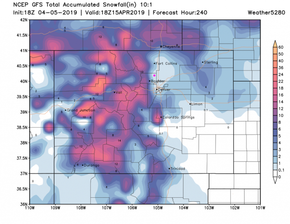
We've been seeing thata big change coming mid-week for a few days now (Figure 2). The GFS (that has often over predicted precipitation this far out) gives us about 1/4th an inch of water over the next 10 days (but 1 inch amounts are in the nearby foothills -Figure 4). The GFS DOES give us a coating to 1 inch of snow over the next 10 days - so we are probably not done with winter-like weather yet. More on Monday!

Figure 1: The forecast surface map for Saturday PM from NCEP.
Figure 2: the graphical forecast for the next 10 days for Longmont, CO from weatherunderground.com
Figure 3: The forecast temperature departure from normal map from the GFS and weather5280.com for Colorado, Monday PM.
Figure 4: the forecast accumulated precipitation map from the GFS and weather5280.com for Colorado, over the next 10 days.
Figure 5: the forecast accumulated snowfall map from the GFS and weather5280.com for Colorado, over the next 10 days.

Current Weather

Mostly sunny

Mostly sunny

68°F

UV Index
8 Very High
Pressure
29.6 Steady
Visibility
8 miles
Dewpoint
33 °F
Humidity
27%
Wind
WNW 6 mph
Gust
13 mph
Wind Chill
68 °F

Hourly Forecast

Today
12 PM
67°F
Intermittent clouds
Today
1 PM
68°F
Intermittent clouds
Today
2 PM
69°F
Intermittent clouds
Today
3 PM
70°F
Intermittent clouds
Today
4 PM
68°F
Intermittent clouds
Today
5 PM
66°F
Mostly cloudy
Today
6 PM
61°F
Thunderstorms
Today
7 PM
58°F
Thunderstorms
Today
8 PM
56°F
Cloudy
Today
9 PM
53°F
Cloudy
Today
10 PM
51°F
Thunderstorms
Today
11 PM
49°F
Thunderstorms

7 Day Forecast

Mostly cloudy w/ t-storms

Friday

70 °F

Variable cloudiness; a morning shower in spots followed by a couple of thundershowers this afternoon; gusty winds and small hail can accompany any downpour


Thunderstorms

Friday Night

44 °F

Cloudy; a couple of showers and a thunderstorm this evening followed by periods of rain late; gusty winds and small hail can accompany any downpour


Rain

Saturday

47 °F

Chilly with periods of rain and a thunderstorm; travel in the foothills and mountains will be slippery due to snow


Rain and snow

Saturday Night

36 °F

Cloudy with rain, mixed with a little snow late; travel in the foothills and mountains will be slippery due to snow


Mostly cloudy

Sunday

61 °F

Mostly cloudy and warmer


Intermittent clouds

Sunday Night

36 °F

A thunderstorm in spots in the evening; otherwise, partly cloudy


Partly sunny

Monday

71 °F

Partly sunny, pleasant and warmer


Partly cloudy

Monday Night

45 °F

Partly cloudy


Mostly sunny

Tuesday

73 °F

Pleasant with sunshine and patchy clouds


Partly cloudy

Tuesday Night

43 °F

Partly cloudy


Sunrise and Sunset

Sunrise
6:06 AM
Sunset
7:51 PM

Based on AccuWeather data