Skip to content

Next Storm/Next Snow Forecast Discussion from the Cherrywood Observatory – April 5, 2019

This content was originally published by the Longmont Observer and is licensed under a Creative Commons license.

The forecast discussion:

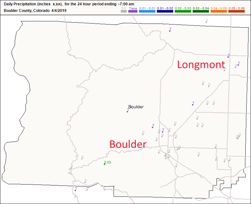
We have entered a very warm and quiet period, so I'll save words here. The showers that came through Longmont just slightly wetted the ground. Figure 1 shows a few trace amounts reported. Oh well.

With moisture around and some little upper-level ripples passing over the state, we have a slight chance of a thunderstorm or two (quite weak) Friday afternoon/evening and Saturday afternoon/evening (a bit of a better chance).

The longer range forecast:

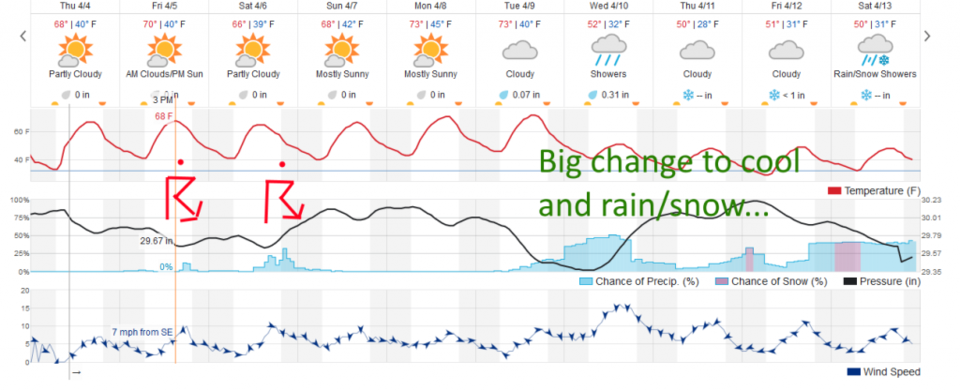
We climb into the 70's F for the weekend and start of the week before our next big change in the weather. Tuesday night, showers return and it cools enough that snow may return some evenings into next weekend. More on that later!

Figure 1: total new rainfall totals for Wednesday/Thursday up to 7am for Boulder county from CoCoRaHS.
Figure 2: the graphical forecast for the next 10 days for Longmont, CO from weatherunderground.com
Figure 3: the forecast accumulated precipitation map from the GFS and weather5280.com for Colorado, through Monday noon.
Figure 4: the forecast accumulated snowfall map from the GFS and weather5280.com for Colorado, through Monday noon.


Current Weather

Light rain

Light rain

37°F

UV Index
2 Low
Pressure
30.23 Rising
Visibility
8 miles
Dewpoint
34 °F
Humidity
88%
Wind
NNE 3.9 mph
Gust
7.3 mph
Wind Chill
34 °F

Hourly Forecast

Today
12 PM
38°F
Showers
Today
1 PM
39°F
Mostly cloudy
Today
2 PM
40°F
Cloudy
Today
3 PM
41°F
Cloudy
Today
4 PM
42°F
Cloudy
Today
5 PM
40°F
Cloudy
Today
6 PM
39°F
Rain
Today
7 PM
38°F
Rain
Today
8 PM
37°F
Cloudy
Today
9 PM
35°F
Flurries
Today
10 PM
35°F
Cloudy
Today
11 PM
35°F
Rain and snow

7 Day Forecast

Rain and snow

Friday

42 °F

Cloudy and chilly; a couple of showers of rain or snow this morning followed by a little rain this afternoon


Rain and snow

Friday Night

32 °F

Periods of snow; rain mixed in early, accumulating 1-3 inches; roads could be slippery


Flurries

Saturday

39 °F

A bit of morning snow with little or no accumulation; otherwise, cloudy and chilly; storm total snowfall 1-3 inches


Intermittent clouds

Saturday Night

31 °F

A shower in places in the evening; otherwise, partly cloudy


Partly sunny

Sunday

64 °F

Partly sunny, pleasant and warmer


Mostly clear

Sunday Night

41 °F

Mainly clear


Intermittent clouds

Monday

79 °F

Warmer with a blend of sun and clouds


Partly cloudy

Monday Night

36 °F

Partly cloudy


Mostly cloudy

Tuesday

64 °F

Mostly cloudy and cooler


Mostly cloudy

Tuesday Night

40 °F

Mostly cloudy


Sunrise and Sunset

Sunrise
6:15 AM
Sunset
7:44 PM

Based on AccuWeather data