This content was originally published by the Longmont Observer and is licensed under a Creative Commons license.
11:00am Update:
Temperatures across town are around 34-38F. A heaver blob of precipitation is passing over Longmont and snow flurries (not rain) have begun to fall.
End 11:00am Update.
8:30am Update:
(Note, the special weather statement posted at the top yesterday has been removed since the high wind portion of the storm has ended.]
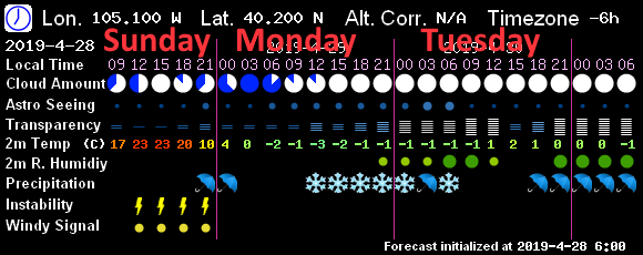
Things are better in focus this morning (since the storm is on the doorstep). The system has slowed compared to expectations yesterday with precipitation not likely until around or after noon. (Figure 1 update). Temperatures will also approach or reach 40F today - expect this to begin with rain or a rain snow mix. This evening we drop to just close to freezing. This is cold compared to the upper 70'sF of many days over the last week, but not cold when one wants a big winter storm. We return to the 50'sF tomorrow. With ongoing moisture - precipitation will switch back to rain in the morning Tuesday.
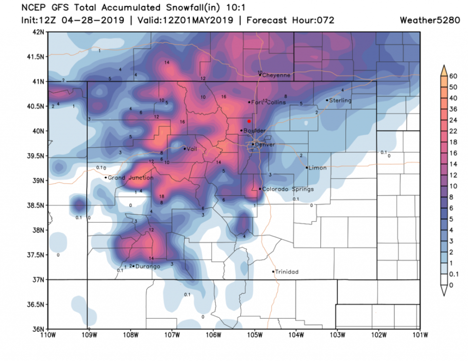
The GFS snowfall forecast (Figure 2 update) is more realistic given the warmth around. Longmont is in the 3-4 inch region but I-25 through Longmont may only see 2-3 inches. Lyons may be in the 5-6" zone. This is a sharp gradient with elevation. Ft. Collins is in the 5-6" area while Estes Park sees 12-14" over the next 2.5 days. The peak time for snowfall, in Longmont, appears to be 6pm to 6am. Much of Denver may miss the snow entirely.
End 8:30am Update.
In Brief:
There is a lot of model disagreement (shown below) but a strong cold front arriving Sunday later afternoon will bring in thunderstorm chances, rain chances, and snow in the morning Monday. Rain is possible midday (due to the warm sun this time of year) then snow returns overnight into Tuesday. That is followed by rain Tuesday PM into Wednesday. Because of banding that will set up somewhere in the state, some folks will see a lot of water and good snow build ups, while others will only get a trace to a few inches (including Longmont).
Forecast Discussion:
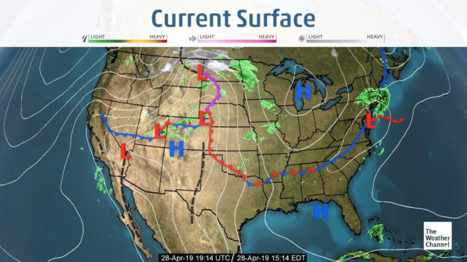
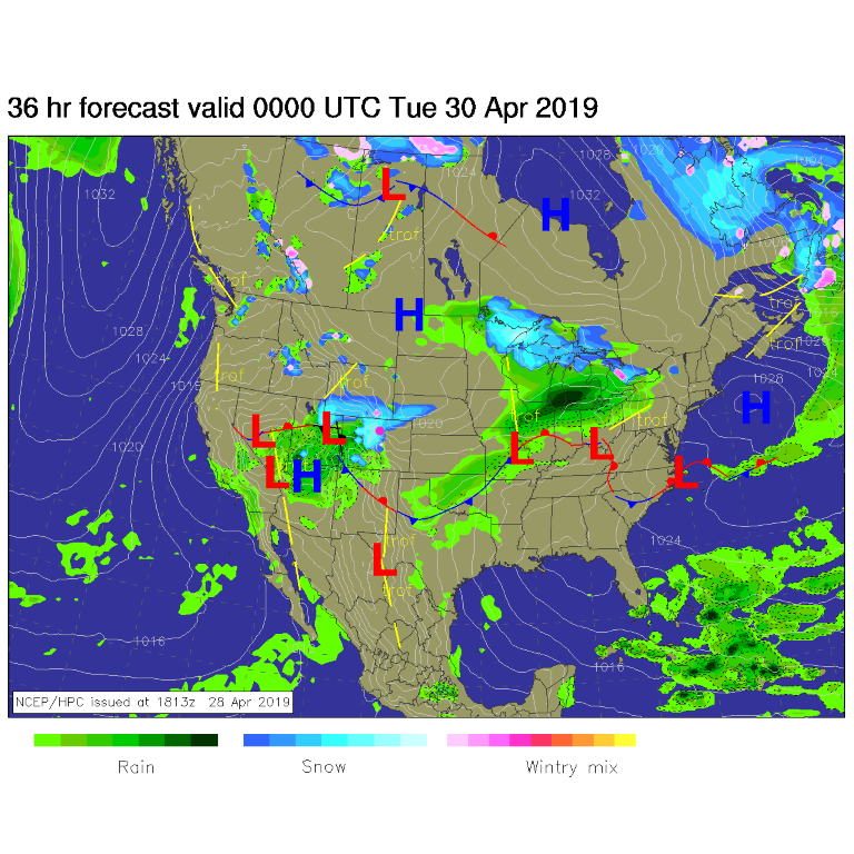
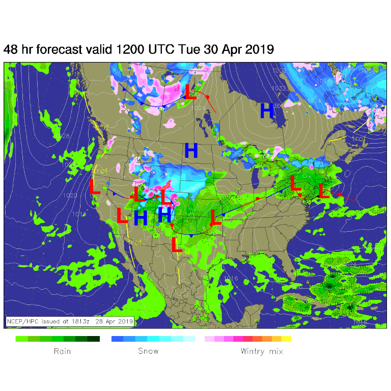
The cold front is arriving mid-afternoon Sunday (so this post is going up live - Figure 1). Things don't get continuously active (rain or snow occurring) until Monday morning. A few thundershowers are possible through the evening - along with gusty, strong winds. Snow is spreading across NE Colorado including Longmont by Monday morning and afternoon (Figure 2). Snow/ice mix (with rain nearby) is continuing Tuesday morning (Figure 3).
The Snowfall Round up:
The sun is high and warm and ground temperatures are warm. The snowfall amounts below may be more likely seen on the north side of buildings in grass covered surfaces.
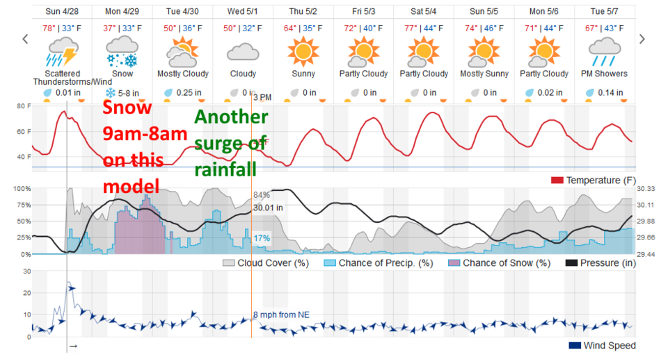
There is a different story from every data source - weatherunderground.com (which is usually somewhat conservative) has snow falling from 9am Monday to 8am Tuesday and gives us 5-8"of snow. Things warm up and rainfall takes over Tuesday PM into Wednesday.
The GFS based 7! Timer model (Figure 5) has some rain later Sunday PM then snow noon Monday to about 6am Tuesday.
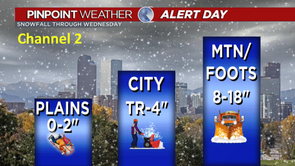
Channel 2 has us at a Trace to 4" (roughly Figure 6).
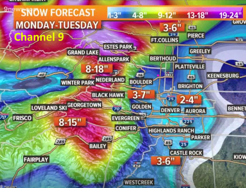
Channel 9 gives us about 3-7" (Figure 7).
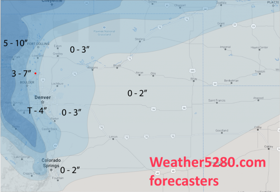
Weather5280 forecasters give us a Trace - 4" (Figure 8).
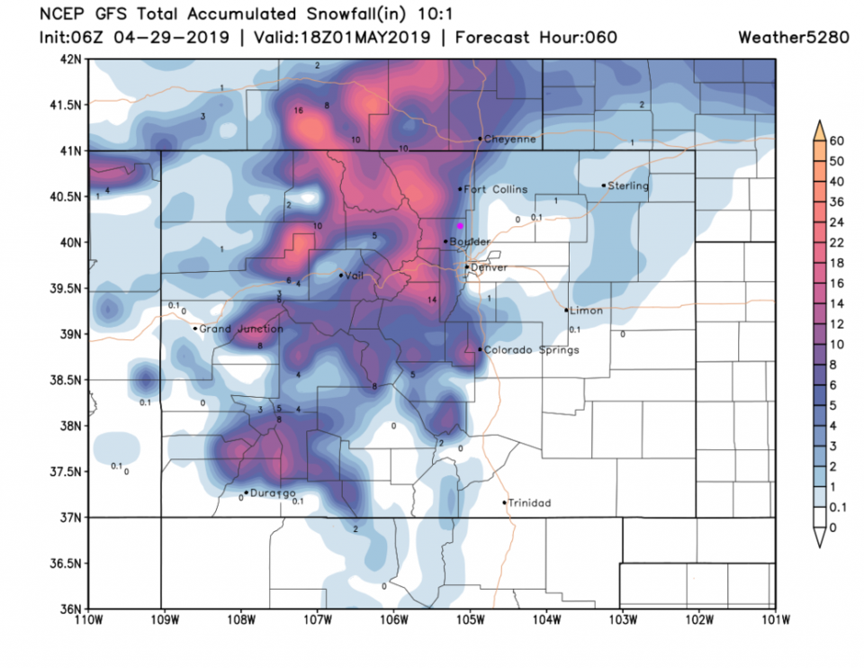
The GFS is bullish with 8" (Figure 9).
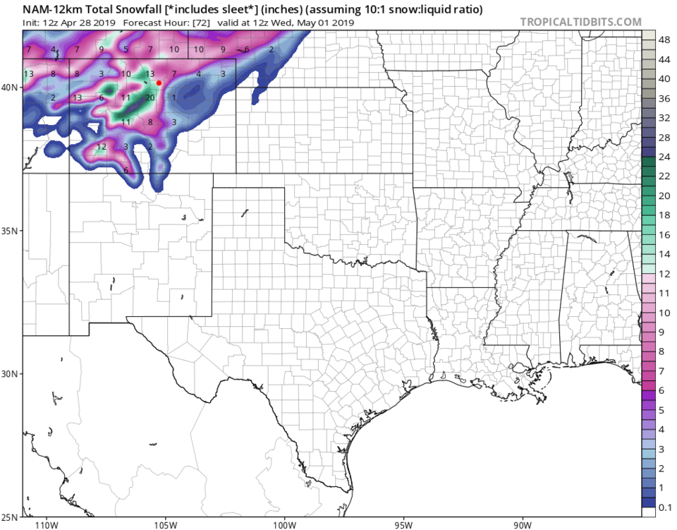
The NAM is crazy too with 11-12" (Figure 10).
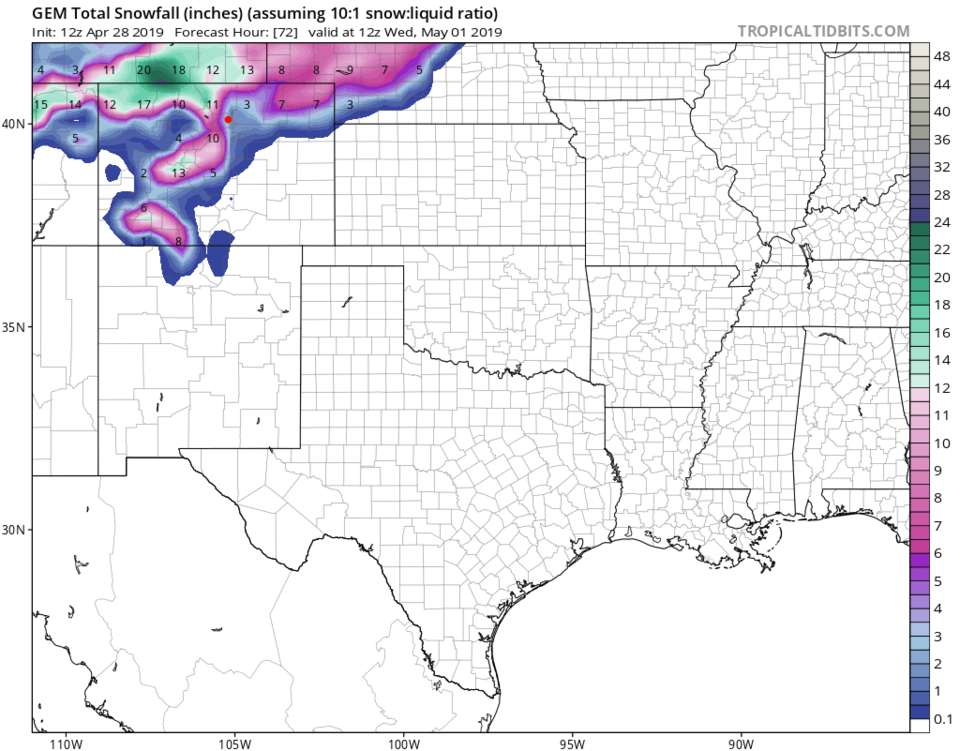
The GEM is more reasonable with 2-3" (Figure 11).
My call for Longmont is 2-5" - acknowledging that warm pavement will not see as much build up - and not for long.
Rainfall Round up:
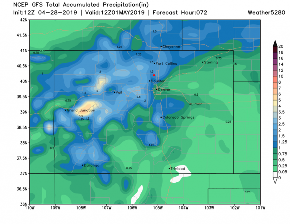
The GFS gives us 1.25-1.5 inches of water (Figure 12) over the next 3 days.
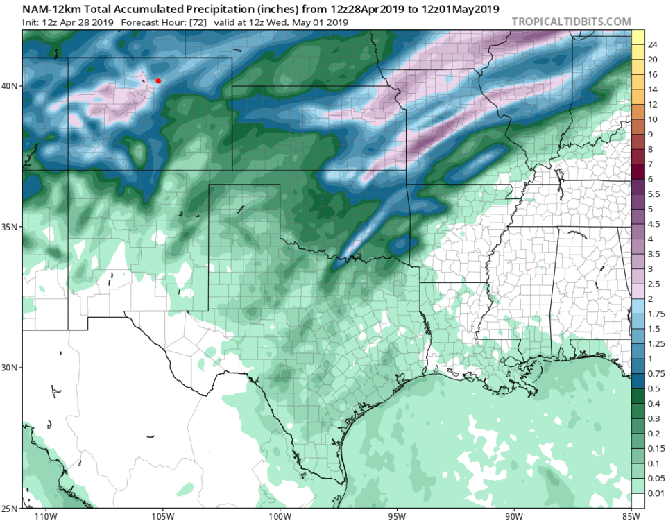
The NAM drops 1.75 to 2 inches of water (Figure 13) over the next 3 days.
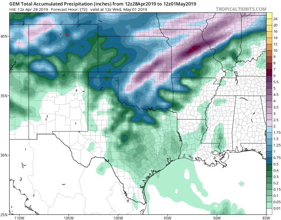
The GEM is very different with the bullseye up in the NW corner of the state and we only see 0.5-0.75 inch of water over the next 3 days.
The Longer Range Forecast:
Another part of the system moves through Tuesday into Wednesday but temperatures warm up... we should see mostly rain (part of the rainfall total above). Things dry out and warm up starting Thursday. Find your umbrella!