This content was originally published by the Longmont Observer and is licensed under a Creative Commons license.
In Brief:
A warm weekend is here - afternoon showers are a possible Friday (early post), Saturday and Sunday. Sunday also sees the arrival of a strong cold front making next week much colder, wetter, and with a better chance of Monday AM and Tuesday AM snow.
6pm 4/27 Update:
Not much has changed - the weatherunderground.com model has us getting 5-8 inches of snow Monday-Tuesday. The GFS has 6-8 inches of snow with almost 1 inch of water equivalent. I'll get into the details of this Sunday afternoon. Wow, here's to living in Colorado.
End 6pm 4/27 Update.
Forecast Discussion:
I'll be back in a tent for a couple of days enjoying this nice weather, so this is a two-day post. I'll have a Sunday afternoon update so we can see how much the models and situation changes over 48 hours.
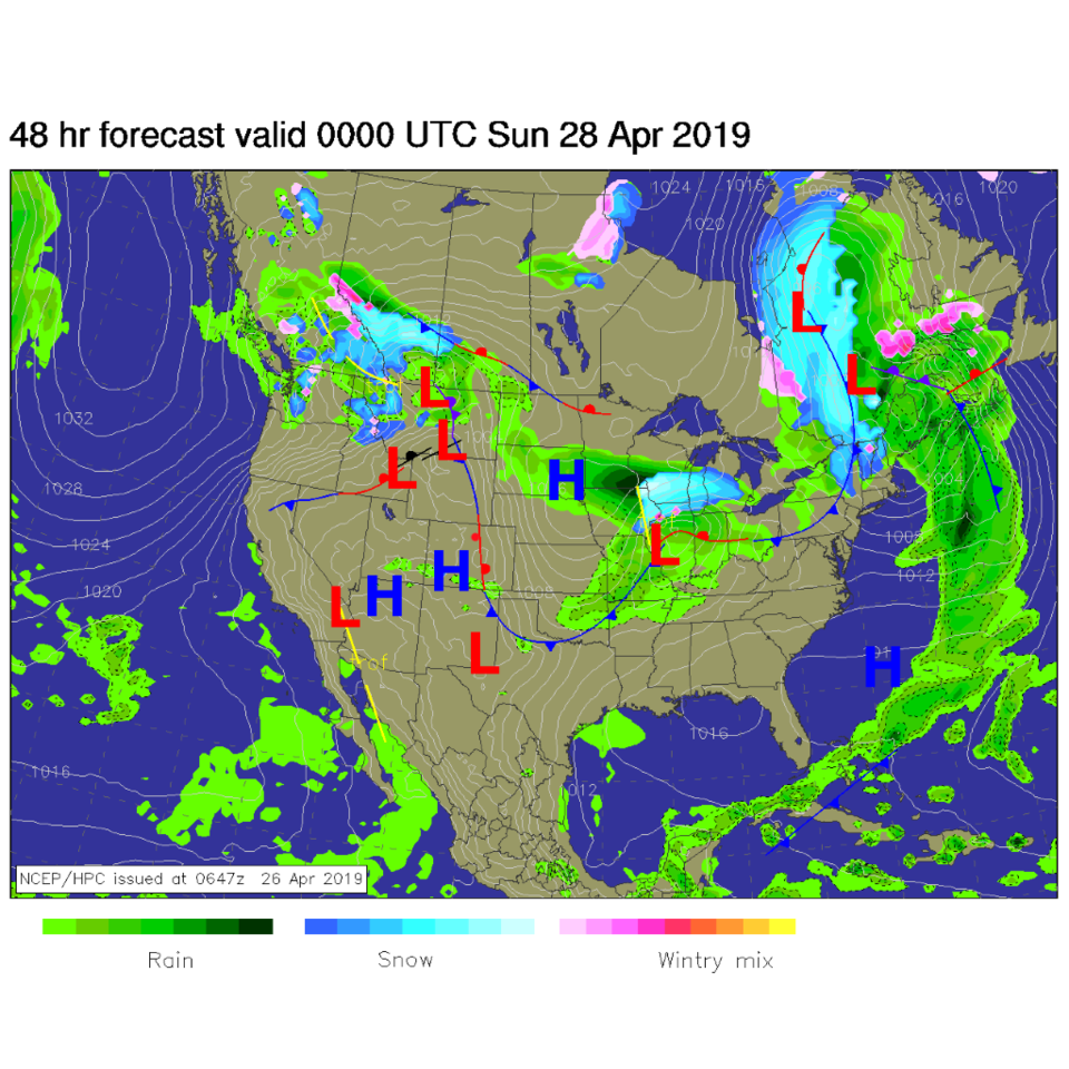
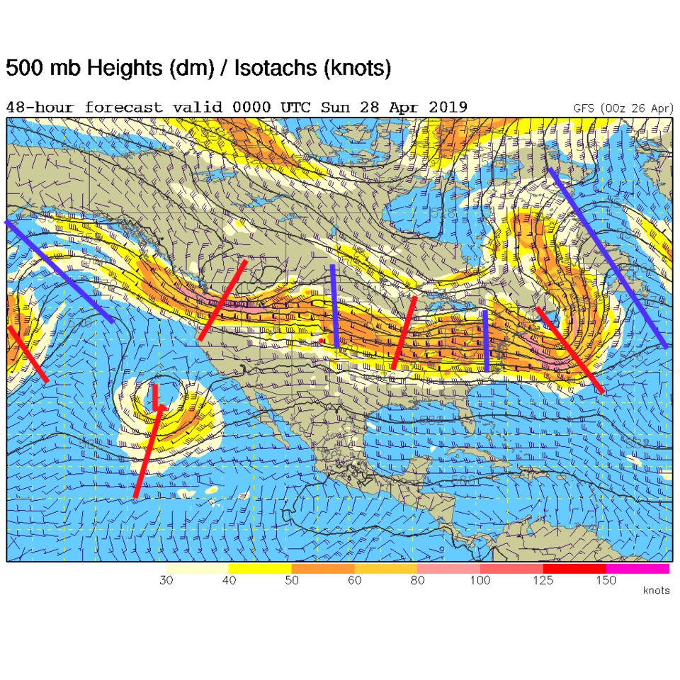
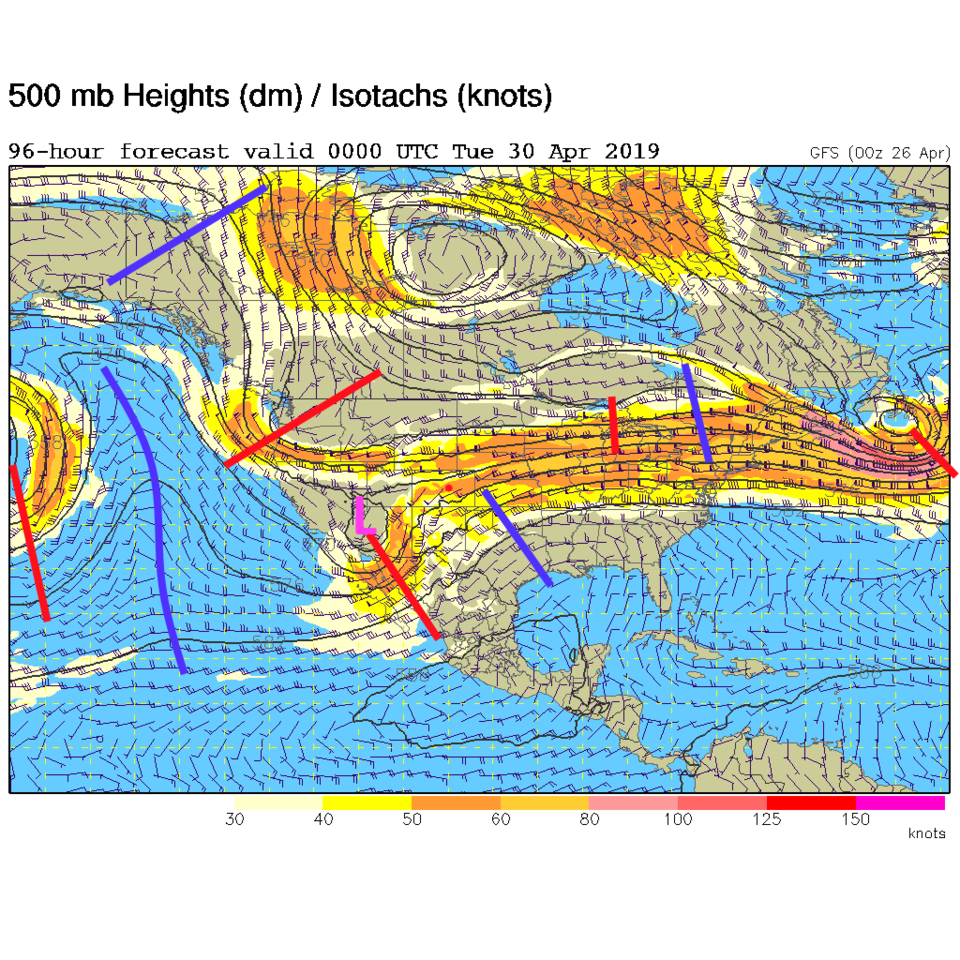
Friday afternoon through Saturday the first system/upper level trough is passing to the north. This will stage the cold air for next week (Figure 1). That system is the trough up in the Pacific northwest (Figure 2). The next system, for Sunday, is coming up out of the Pacific (the L and trough - Figure 2). We'll get to that in the Longer Range forecast
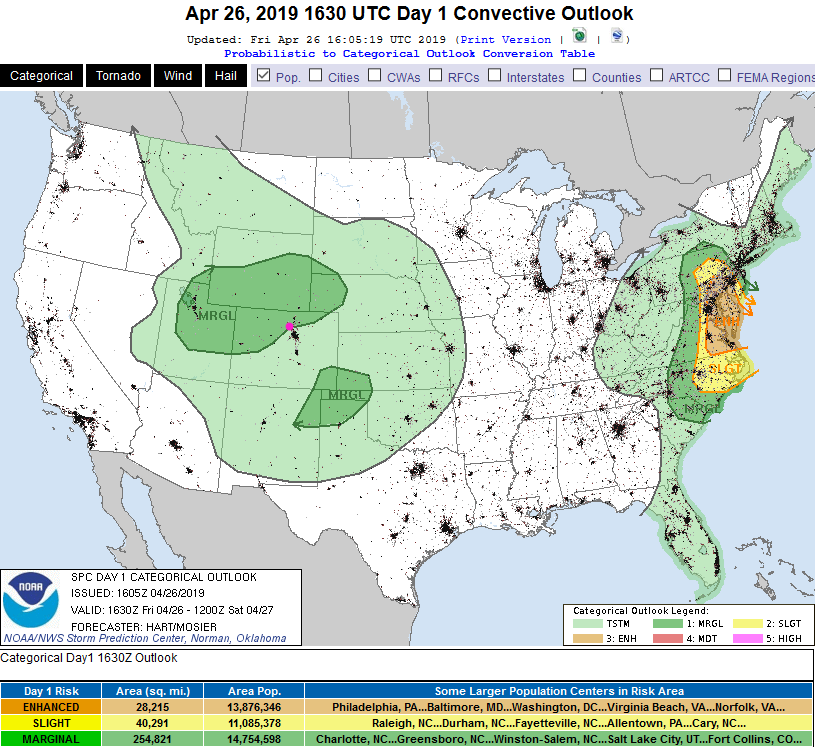
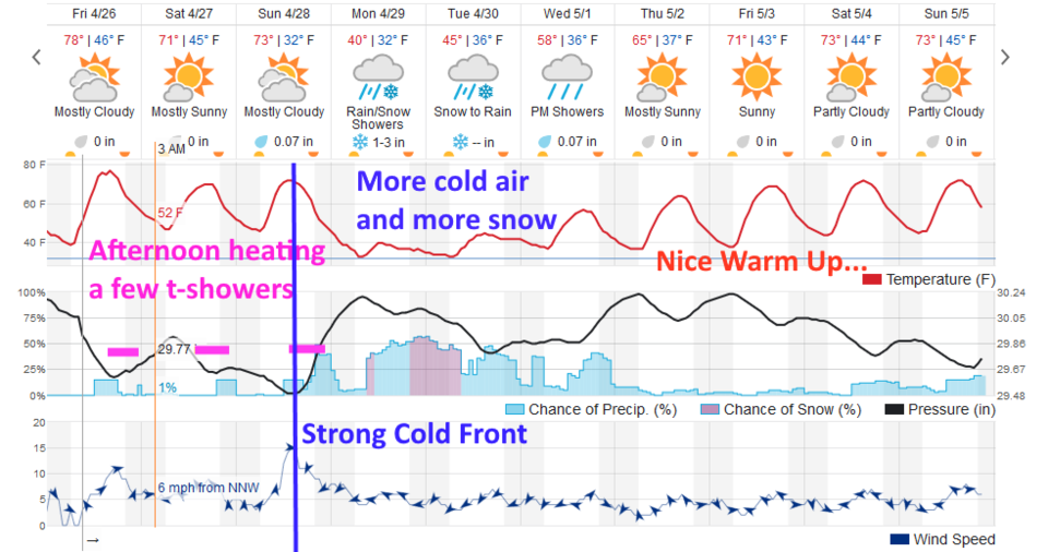
With some moisture around, some easterly flow (from the front to our east), and daytime heating (pink dash times in Figure 3) - you'll see storms pop up in the mountains. A few will stray out onto the plains. Update at post time: just as I was completing this discussion, the Storm Prediction Center got indication that the lift will be strong enough with this first storm that some cells may become severe with damaging high winds as the primary risk (though some hail may occur with the stronger cells as well). Figure 0 shows the extent of the Marginal Risk zone (1 on a scale of 1-5).
The Longer Range Forecast:
The headline is the cold front Sunday afternoon (big blue line Figure 3). The Low (that changed from red to pink for some reason - Figure 4) is sliding towards with a negative tilt. It will bring in good moisture and pretty good lift of the atmosphere.
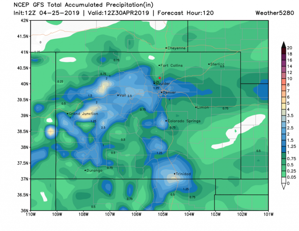
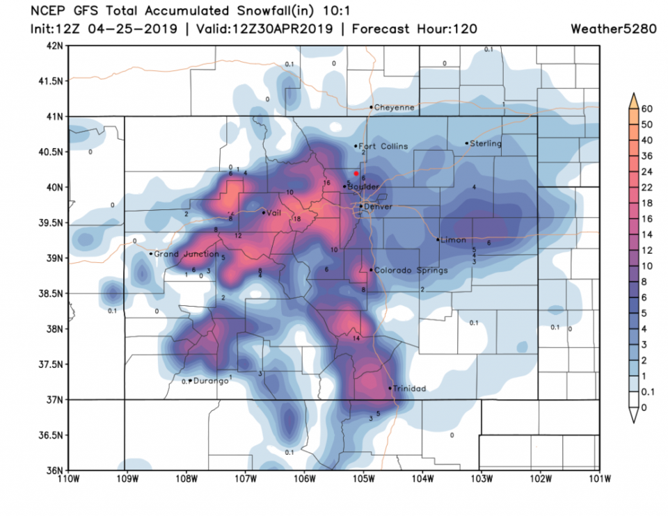
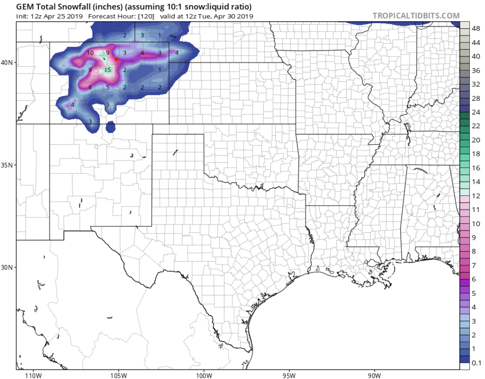
Over the next 5 days - the GFS brings a good swath of 1-4 inches of water to the western slopes, mountains, and over to Denver (Figure 5). Spots of western, southern, and eastern Denver may get 6+ inches of snow with almost 2 feet in the higher mountains (Figure 6). Note the notch of lower amounts down I-25 including Longmont. The GFS currently gives Longmont 0.5-0.75 inches of water and 3-4 inches of snow. Just as a backup, the GEM gives Longmont 5-7 inches of snow (Figure 7).
Weatherunderground.com (Figure 3) has some snow in the early hours of Monday, then a longer period of snow Monday evening through Tuesday midday.
I don't think many trees have started putting lots of leaves out yet, so tree damage won't be as widespread as it could be. Be prepared to protect young plants and new growth!
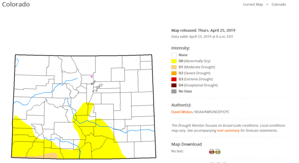
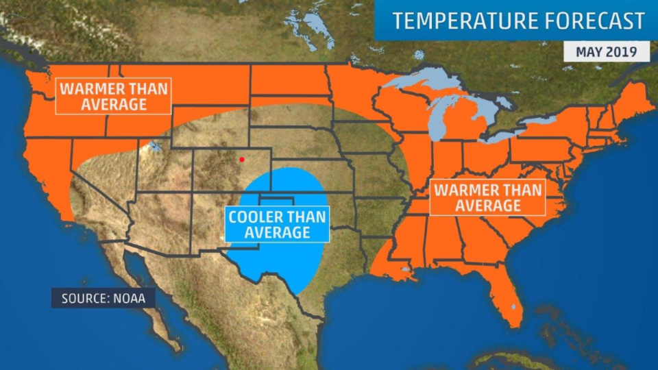
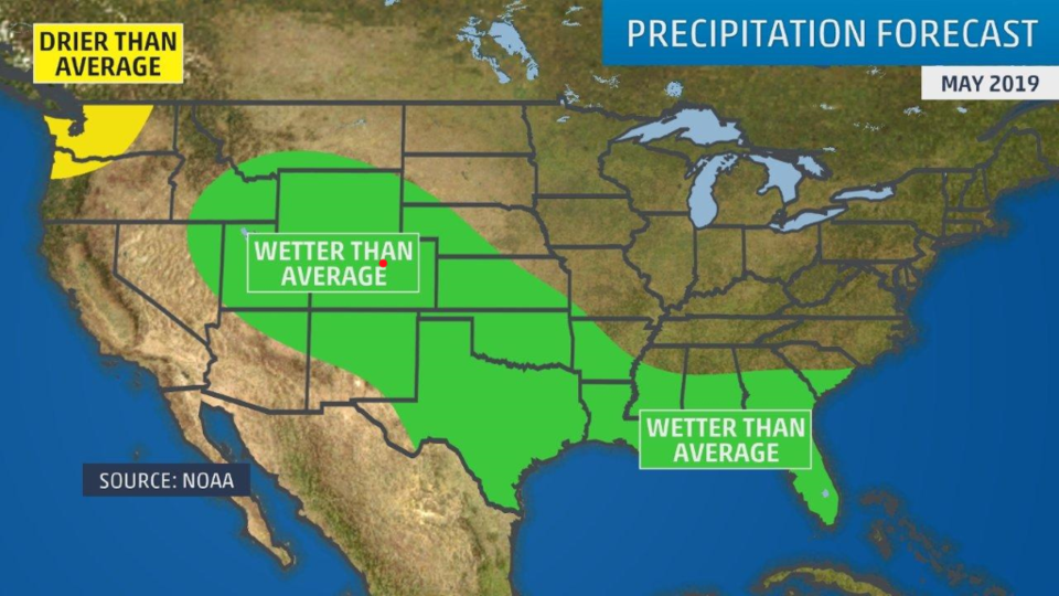
On the water supply front, Figure 8 is the end of month drought index. There is even less drought than mid-month. The outlook for May (from the Weather Channel) is for normal temperatures in May (Figure 9) and above normal precipitation (Figure 10).
If I need to update Saturday, I'll add to this post, otherwise, I'll be back Sunday evening.