Skip to content

9:30am Update: Next Storm/Next Snow Forecast Discussion from the Cherrywood Observatory – April 16, 2019

This content was originally published by the Longmont Observer and is licensed under a Creative Commons license.

9:30am Update:

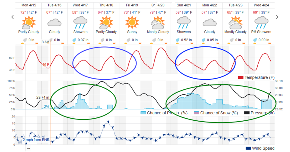
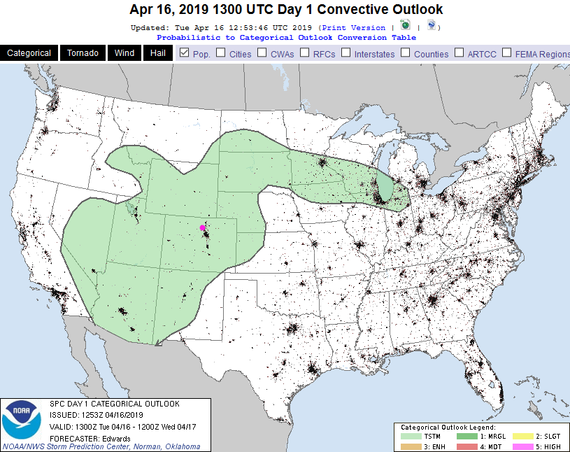
The cool front should pass Longmont around 5pm today. There is a general chance of thunderstorms (non-severe) for almost all of Colorado today (Figure 1 update). Small hail and gusty winds are possible today and tonight. A few cells may approach minimal severe levels. Aside from a thunderstorm cell or two, there are fairly low chances of rain or snow over the next 48 hours. It will be cool and moist.

Figure 1 Update: The SPC (Storm Prediction Center) Day 1 convective forecast made Tuesday for Tuesday.

End 9:30am update.

Forecast Discussion:

We're still pulling into Spring and are alternating between fairly warm and somewhat chilly (Figure 1). I circled the two minor cool downs over the next 10 days in blue and the two rain periods (with overnight/AM snow?) in green. We hover around 70° F Monday and Tuesday (earlier in the day). Later Tuesday, a front pushed down that may trigger a few garden-variety thundershowers before rain chances most of the day Wednesday.

The Longer Range Forecast:

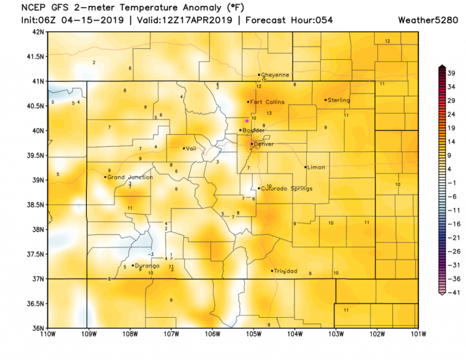
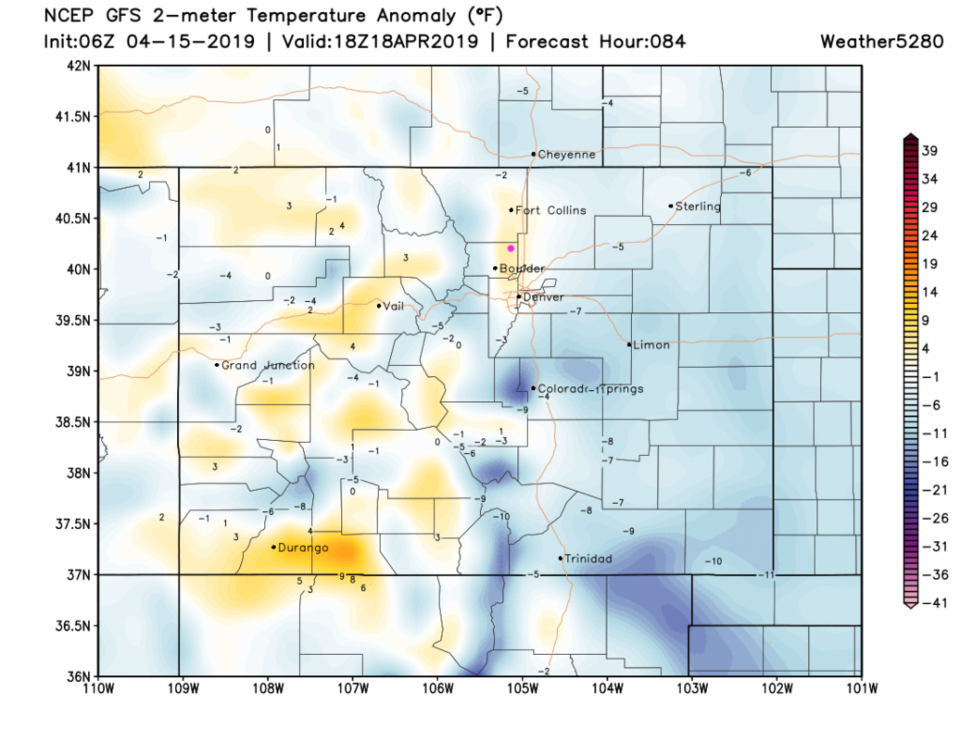
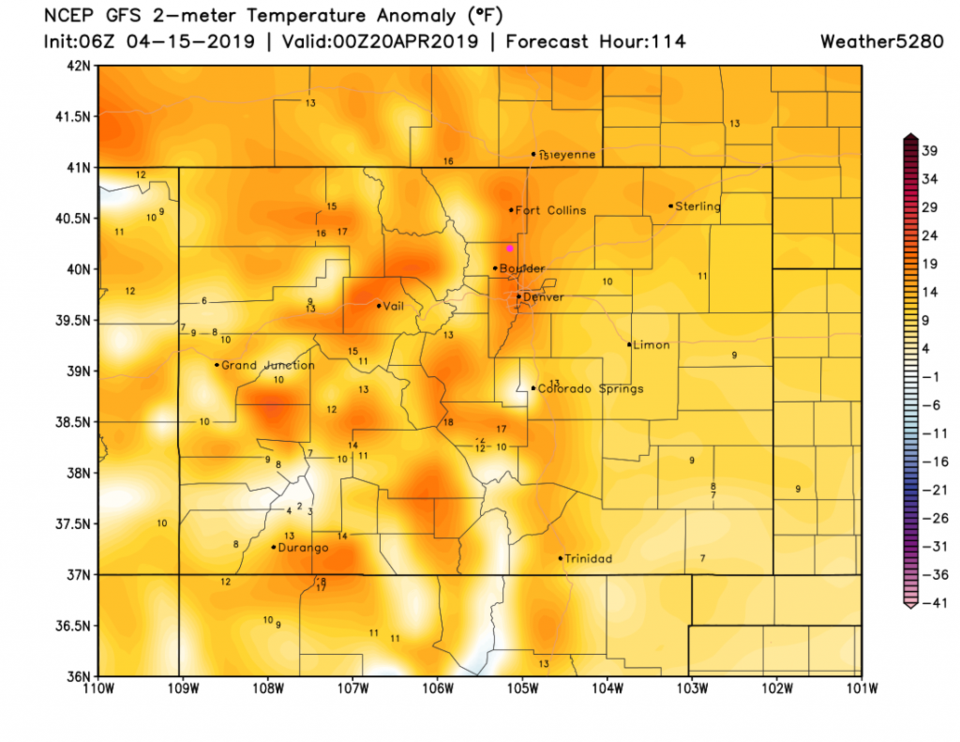
Temperatures Wednesday AM are still a bit above normal (Figure 2) then we drop to about normal Thursday midday (Figure 3). By Friday PM, we are back to about 15° F above normal (Figure 4).

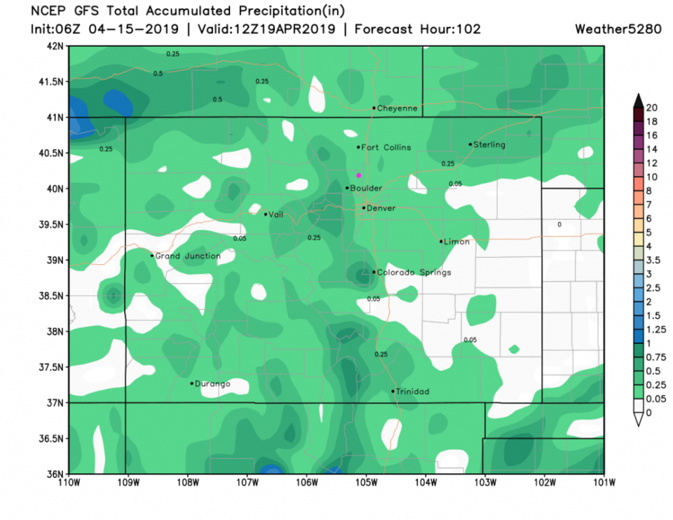
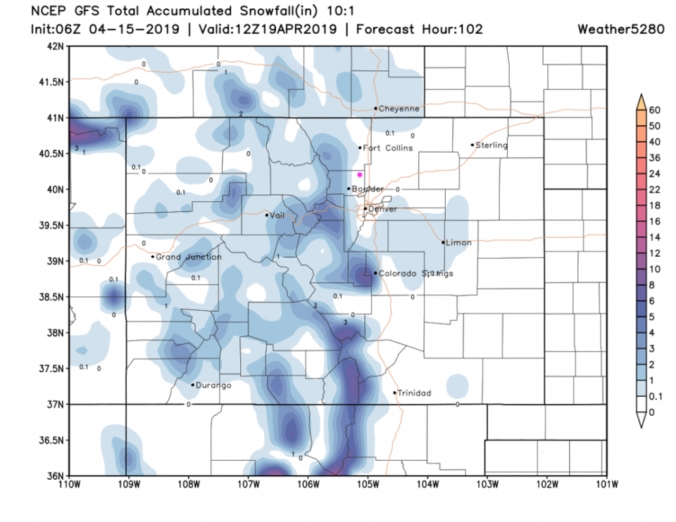
Over the next 4 days, Longmont may received about 1/10th to 1/4th inch of water (Figure 5) with snow at least down to Boulder, western Denver, the Palmer Divide (Figure 6). We might see a coating of night time snow, of course. Details later, but there isn't too much excitement in store this week.

Figure 1: the graphical forecast for the next 10 days for Longmont, CO from weatherunderground.com
Figure 2: The forecast temperature departure from normal map from the GFS and weather5280.com for Colorado, Wednesday AM.
Figure 3: The forecast temperature departure from normal map from the GFS and weather5280.com for Colorado, Thursday AM.
Figure 4: The forecast temperature departure from normal map from the GFS and weather5280.com for Colorado, Friday PM.
Figure 5: the forecast accumulated precipitation map from the GFS and weather5280.com for Colorado, over the next almost 4 days.
Figure 6: the forecast accumulated snowfall map from the GFS and weather5280.com for Colorado, over the next almost 4 days.

Current Weather

Sunny

Sunny

63°F

UV Index
8 Very High
Pressure
29.82 Steady
Visibility
7 miles
Dewpoint
47 °F
Humidity
56%
Wind
NE 2.2 mph
Gust
4.9 mph
Wind Chill
63 °F

Hourly Forecast

Today
12 PM
73°F
Intermittent clouds
Today
1 PM
77°F
Intermittent clouds
Today
2 PM
76°F
Cloudy
Today
3 PM
75°F
Cloudy
Today
4 PM
73°F
Cloudy
Today
5 PM
70°F
Cloudy
Today
6 PM
68°F
Cloudy
Today
7 PM
65°F
Cloudy
Today
8 PM
62°F
Thunderstorms
Today
9 PM
59°F
Cloudy
Today
10 PM
56°F
Cloudy
Today
11 PM
55°F
Cloudy

7 Day Forecast

Mostly cloudy

Thursday

77 °F

Turning cloudy; warm


Thunderstorms

Thursday Night

47 °F

A thunderstorm in spots this evening; otherwise, considerable cloudiness


Thunderstorms

Friday

70 °F

Mostly cloudy and not as warm with a couple of thundershowers


Thunderstorms

Friday Night

43 °F

Cloudy with a couple of thundershowers


Rain

Saturday

46 °F

Chilly with periods of rain and a thunderstorm


Rain and snow

Saturday Night

39 °F

Cloudy with rain, mixed with a little snow late


Mostly cloudy

Sunday

59 °F

Mostly cloudy and warmer; a stray afternoon thundershower


Partly cloudy

Sunday Night

36 °F

Partly cloudy


Partly sunny

Monday

71 °F

Partly sunny and warmer


Partly cloudy

Monday Night

39 °F

Partly cloudy


Sunrise and Sunset

Sunrise
6:07 AM
Sunset
7:50 PM

Based on AccuWeather data