Skip to content

The Next Storm/Next Snow Forecast Discussion from the Cherrywood Observatory – November 20, 2017

This content was originally published by the Longmont Observer and is licensed under a Creative Commons license.

Forecast discussion:

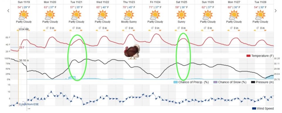
The quiet (and sometimes cloudy) weather continues. We climb to lower 60's today with the northwest flow/jet stream still fairly close to the north.  In the 10 day graphical forecast in Figure 1 - there are two weak fronts that are on tap. One comes through tomorrow/Tuesday knocking temperatures down just a touch and kicking off some snow and rain showers up in the mountains (giving us a tiny chance of a sprinkle).

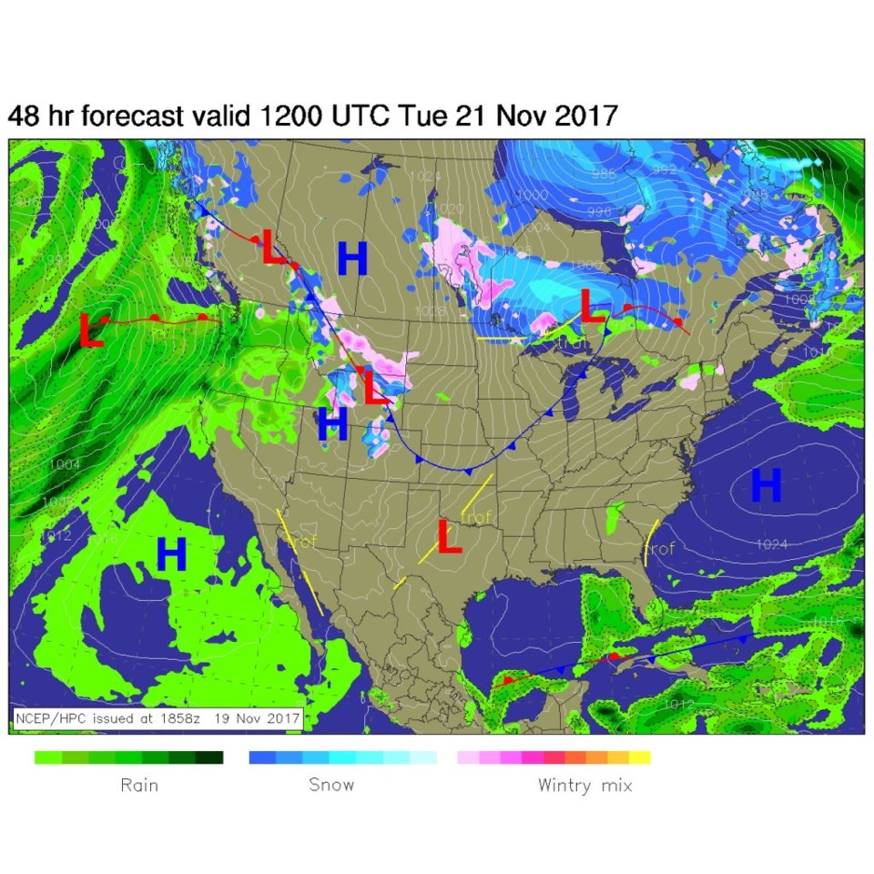
Figure 2 shows that front pushing in from the northeast with those mountain showers. Nothing really notable.

Figure 1: The 10 day graphical forecast from weatherunderground.com.

Figure 2: The NCEP surface analysis map forecast for Tuesday AM.

The longer range forecast:

Thanksgiving is still high and dry with a High of 70F, a Low of 45F with partly cloudy skies and light west winds.

Our next weak front comes in Saturday, but is really too far off and (at this point) minor to worry about (Figure 1 again).

Current Weather

Mostly cloudy

Mostly cloudy

45°F

UV Index
0 Low
Pressure
30.12 Rising
Visibility
8 miles
Dewpoint
35 °F
Humidity
67%
Wind
NE 5.4 mph
Gust
10.2 mph
Wind Chill
42 °F

Hourly Forecast

Today
11 PM
44°F
Showers
Tomorrow
12 AM
43°F
Cloudy
Tomorrow
1 AM
42°F
Showers
Tomorrow
2 AM
41°F
Rain and snow
Tomorrow
3 AM
40°F
Cloudy
Tomorrow
4 AM
39°F
Cloudy
Tomorrow
5 AM
38°F
Cloudy
Tomorrow
6 AM
38°F
Cloudy
Tomorrow
7 AM
37°F
Cloudy
Tomorrow
8 AM
37°F
Cloudy
Tomorrow
9 AM
38°F
Flurries
Tomorrow
10 AM
39°F
Flurries

7 Day Forecast

Intermittent clouds

Wednesday

74 °F

Times of clouds and sun


Rain and snow

Wednesday Night

37 °F

Cloudy; an evening shower in spots followed by a rain or snow shower in spots late


Rain and snow

Thursday

47 °F

Cloudy and chilly with a couple of showers of rain or snow


Mostly cloudy

Thursday Night

34 °F

Mostly cloudy


Mostly cloudy w/ showers

Friday

52 °F

Breezy in the morning; otherwise, cool with some sun, then turning cloudy with a little rain in the afternoon


Rain and snow

Friday Night

32 °F

Snow at times, accumulating an inch or two; rain mixed in early


Flurries

Saturday

49 °F

A bit of morning snow with little or no accumulation; otherwise, cloudy and chilly; storm total snowfall an inch or two


Intermittent clouds

Saturday Night

31 °F

Partly cloudy


Mostly cloudy

Sunday

72 °F

Mostly cloudy and warmer


Partly cloudy

Sunday Night

44 °F

Partly cloudy


Sunrise and Sunset

Sunrise
6:18 AM
Sunset
7:42 PM

Based on AccuWeather data