Skip to content

The Next Storm/Next Snow Forecast Discussion from the Cherrywood Observatory – January 3, 2018

This content was originally published by the Longmont Observer and is licensed under a Creative Commons license.

Forecast Discussion:

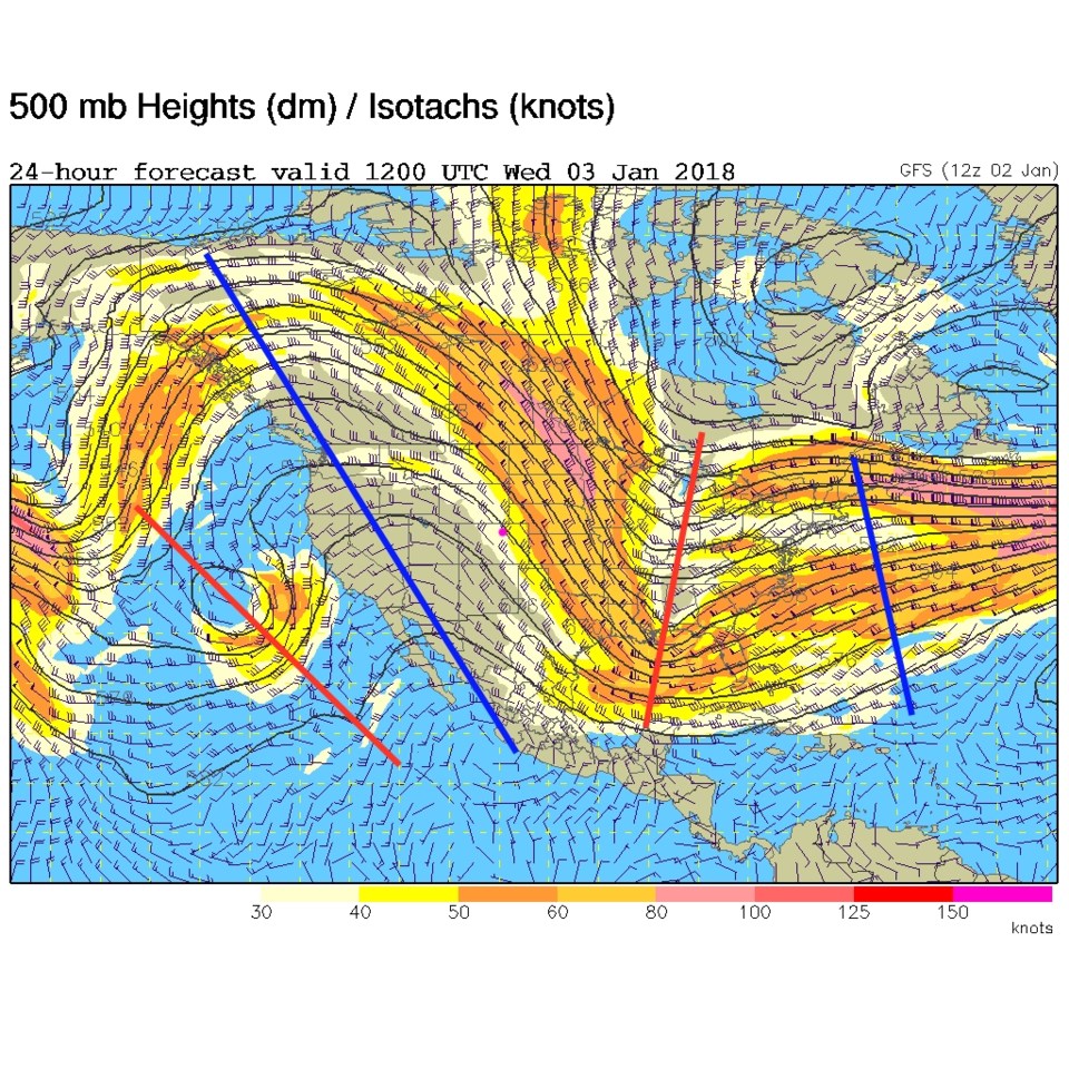
The ridge of the West is sitting to our west giving us sharp northwest flow aloft.  A weak cold front has been pushed into the state and a few mountain snow flurries flew... but it wasn't much to see (Figure 1).

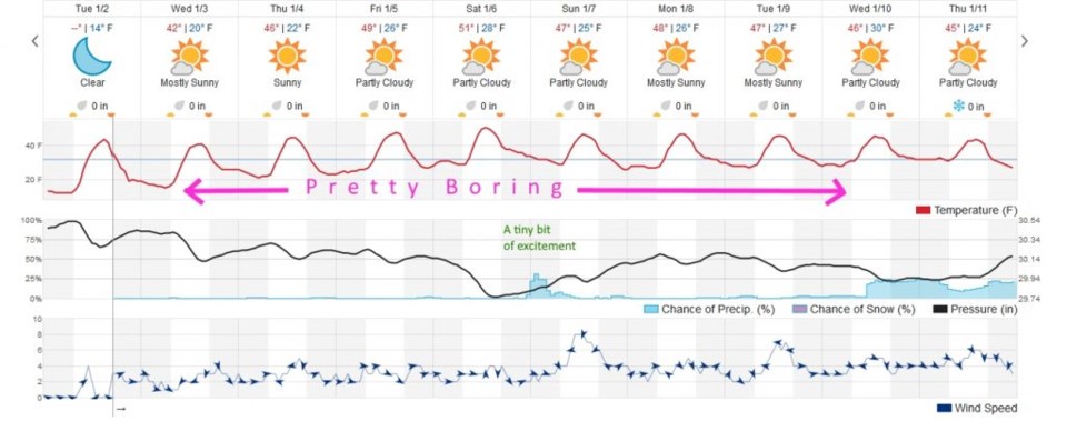
The 10 day graphical forecast (Figure 2) shows that temperatures drift around in the upper 40's and lower 50'sF for the next 10 days with a hint of a change next Thursday (see yesterday's post for that hope). On Saturday, the ridge is overhead giving us our highest temperatures.

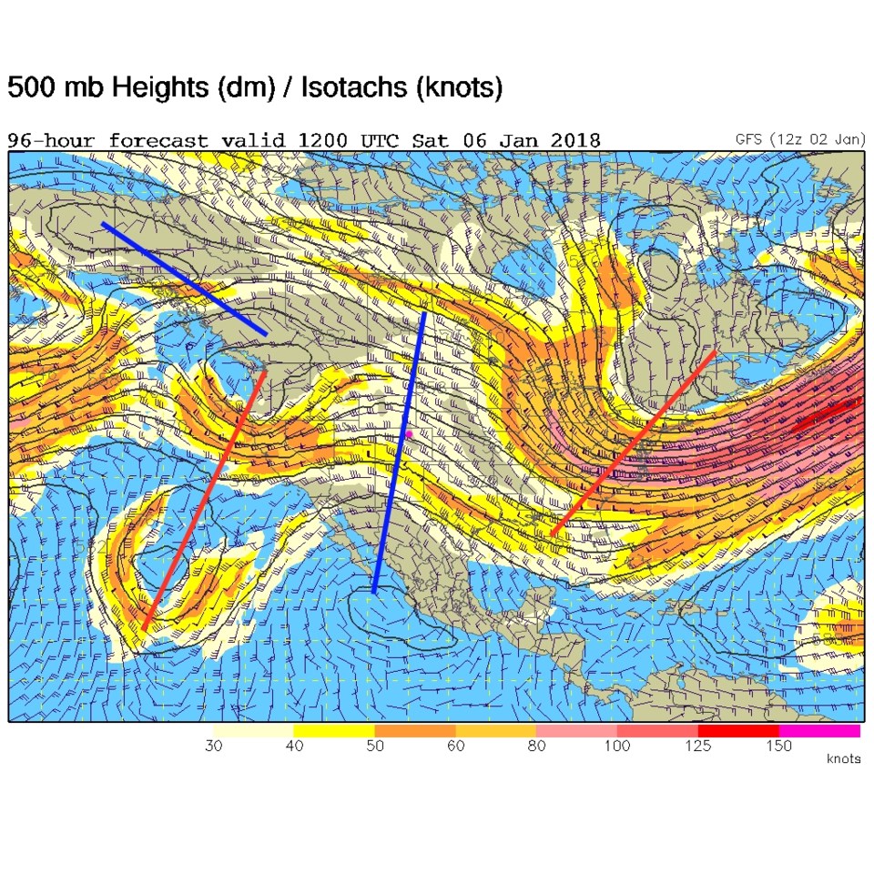
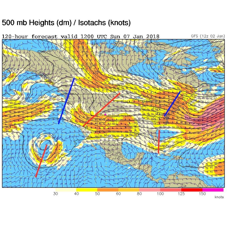
There is a tiny chance of precipitation Sunday in Figure 2 that can be seen as a result of the trough on the West coast coming in (visible in Figure 3) and sweeps overhead on Sunday (Figure 4).

It is taking some effort to keep it exciting here! <grin>

Figure 1: 500mb upper air forecast map for Wednesday morning from the GFS.

Figure 2: The 10 day graphical forecast from weatherunderground.com

Figure 3: 500mb upper air forecast map for Saturday morning from the GFS.

Figure 4: 500mb upper air forecast map for Sunday morning from the GFS.

The longer range forecast:

We'll keep an eye on next Thursday as a possible big storm and big change to a trough in the West for the last half of the month.  More later!

Current Weather

Mostly cloudy

Mostly cloudy

55°F

UV Index
0 Low
Pressure
29.91 Rising
Visibility
8 miles
Dewpoint
39 °F
Humidity
54%
Wind
N 7.3 mph
Gust
15.9 mph
Wind Chill
55 °F

Hourly Forecast

Today
8 PM
64°F
Mostly cloudy
Today
9 PM
58°F
Cloudy
Today
10 PM
52°F
Cloudy
Today
11 PM
47°F
Cloudy
Tomorrow
12 AM
45°F
Cloudy
Tomorrow
1 AM
42°F
Showers
Tomorrow
2 AM
40°F
Rain and snow
Tomorrow
3 AM
39°F
Cloudy
Tomorrow
4 AM
38°F
Cloudy
Tomorrow
5 AM
37°F
Cloudy
Tomorrow
6 AM
37°F
Cloudy
Tomorrow
7 AM
37°F
Cloudy

7 Day Forecast

Intermittent clouds

Wednesday

74 °F

Times of clouds and sun


Rain and snow

Wednesday Night

35 °F

Breezy this evening with a shower in spots followed by a rain or snow shower in spots late


Rain and snow

Thursday

47 °F

Cloudy and chilly with a couple of showers of rain or snow


Mostly cloudy

Thursday Night

34 °F

Mostly cloudy


Mostly cloudy w/ showers

Friday

52 °F

Breezy in the morning; otherwise, cool with some sun, then turning cloudy with a little rain in the afternoon


Rain and snow

Friday Night

32 °F

Snow at times, accumulating an inch or two; rain mixed in early


Flurries

Saturday

49 °F

A bit of morning snow with little or no accumulation; otherwise, cloudy and chilly; storm total snowfall an inch or two


Intermittent clouds

Saturday Night

31 °F

Partly cloudy


Mostly cloudy

Sunday

72 °F

Mostly cloudy and warmer


Partly cloudy

Sunday Night

44 °F

Partly cloudy


Sunrise and Sunset

Sunrise
6:18 AM
Sunset
7:42 PM

Based on AccuWeather data