This content was originally published by the Longmont Observer and is licensed under a Creative Commons license.
Forecast Discussion:
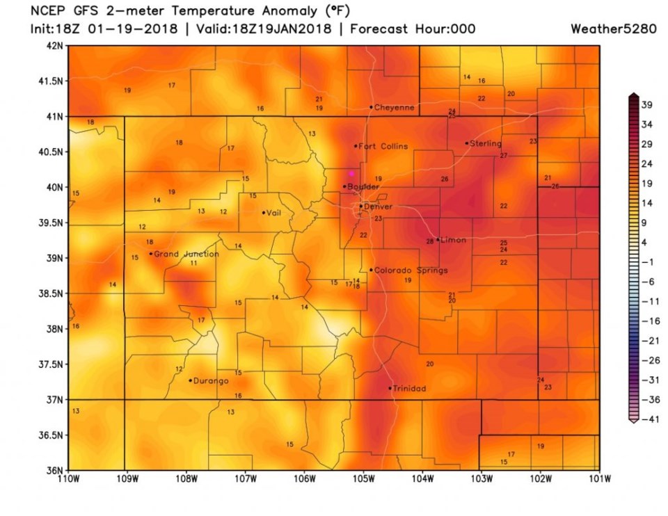
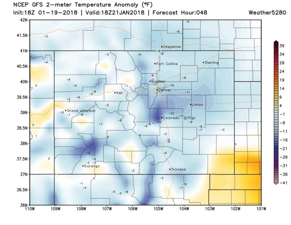
It was shorts and t-shirt weather on Friday. Figure 1 shows temperatures 19-23F warmer than normal. Pretty incredible. 48 hours later, Sunday afternoon, we are around 10 degrees below normal or more (Figure 2).
The big news is our weekend snow storm. This is slowing down compared to earlier forecasts and will deliver more snow. It won't be a big storm by Colorado standards, but it may give us the largest amount of snow in one storm so far this Fall and Winter.
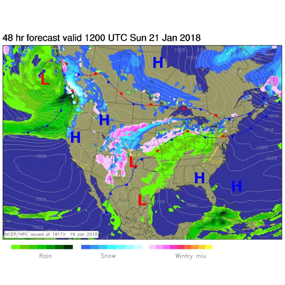
Figure 3 shows the Low south of the southeast corner of our State which is a pretty good location for a moist up slope flow around here.
The wind shift from the north will still happen around 10am Saturday. Rain changes increase after 5-6pm with a change to snow around 8-9pm, dropping temperatures, and an increasing northeast wind. At least light snow should continue until 5-7pm Sunday, as it looks now.
How about snow? It is UP from prior forecasts - which is encouraging just 48 hours from the event.
Without further ado - here is the model run downs:
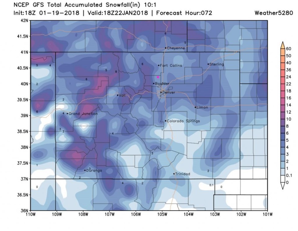
Figure 4: The GFS has 2-3 inches of snow with 5-6 inches and higher at Boulder, Lyons and west.
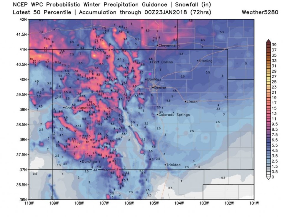
Figure 5: The WPC 50% confidence is more bullish with about 5-6" of snow.
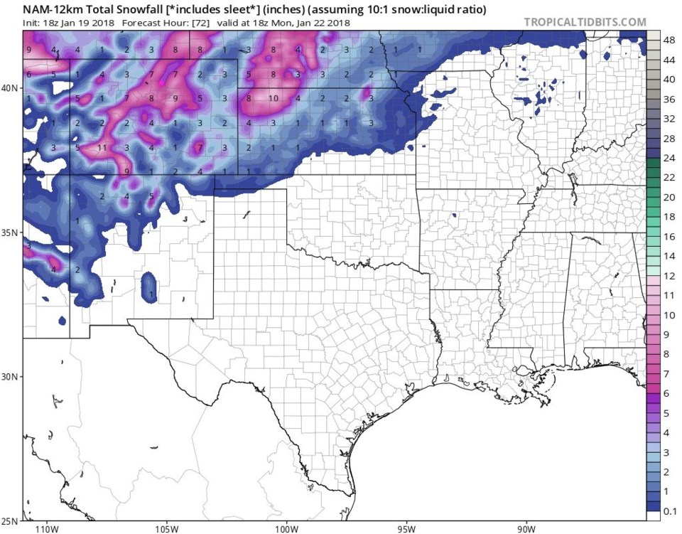
Figure 6: The NAM that has a bit of down slope up I-25 from Longmont north and east, but still an impressive 4.5-5.5 inches.
You will need your snow plow on this one.
The longer range forecast:
Temperatures return to normal (lower 40's) for the rest of the week with a hint of some storminess at the end of the week. More after this storm clears!


