This content was originally published by the Longmont Observer and is licensed under a Creative Commons license.
Forecast Discussion:
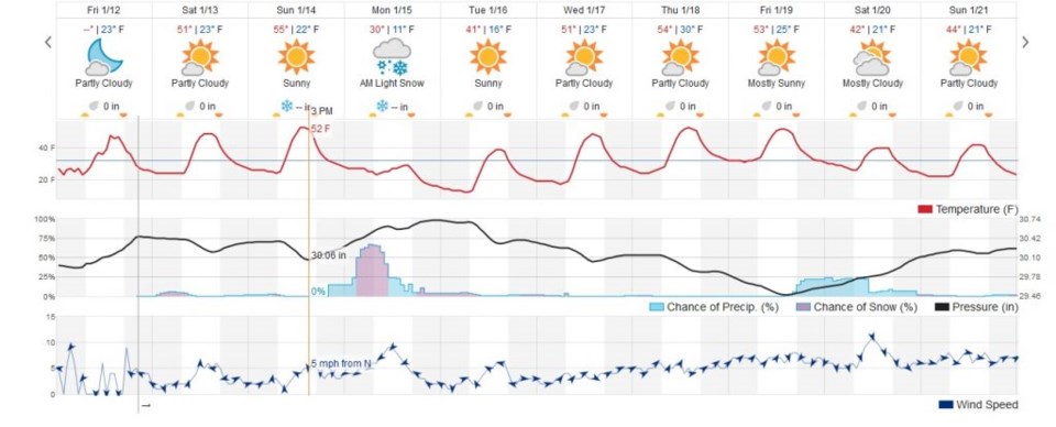
The next storm for late Sunday night through Monday is looking a little stronger now. Figure 1 shows the front arriving Sunday afternoon then a stronger push coming in Monday morning. We will be right on the edge of very cold air. Some model runs have Denver in the low 20's F for Monday while other runs have us in the mid to upper 30's F. Crazy.
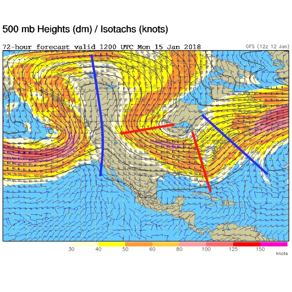
The upper air pattern shows how gigantic the ridge to the west of us is (long blue line) and the position of the short wave trough sweeping down from due north overhead on Monday (Figure 2).
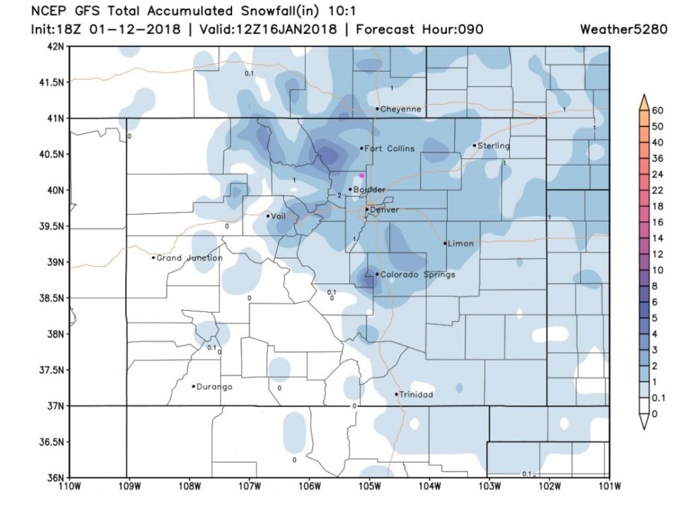
To start watching for snow estimates, the GFS puts 1-2" of snow on Longmont by Tuesday. Note that little tongue of 0.1" to 1" just to our southwest toward Boulder. Darn down slope.
The longer range forecast:
Figure 1 shows temperatures slowly climbing again to above normal by Wed/Thur. There is another weak system coming for the end of next week. Tune in again tomorrow!


