Skip to content

The Next Storm/Next Snow Forecast Discussion from the Cherrywood Observatory – January 12, 2018

This content was originally published by the Longmont Observer and is licensed under a Creative Commons license.

Forecast Discussion:

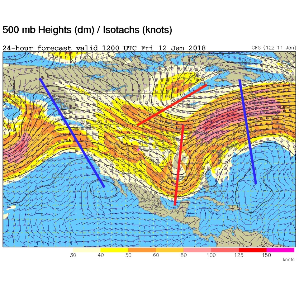
Chilly air was in place for a day, post-cold front on Thursday. Our cold front is being pushed across the Midwest U.S. by the upper air trough (the lower red line in Figure 1). The signs of things to come are visible as the blue line ridge off the West Coast (we are very familiar with that ridge this year).

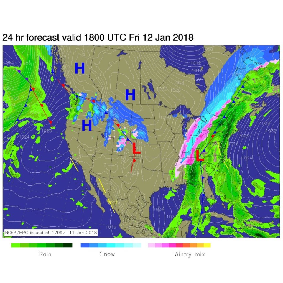
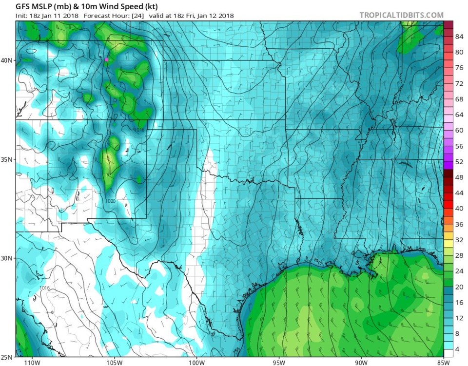
That upper trough (the higher red line) will kick off mountain snow today and lower elevation winds as it races through today.  Figure 2 shows those, mostly western slopes and higher mountain, snows.  Figure 3 shows the strong winds up and down the Front Range for today.

Figure 1: The upper air 500mb forecast map for Friday morning (today) from the GFS.

Figure 2: The forecast surface analysis map for Friday midday from NCEP.

Figure 3: The GFS forecast surface pressure and winds for midday Friday. Longmont is the pink dot in all these maps.

The longer range forecast:

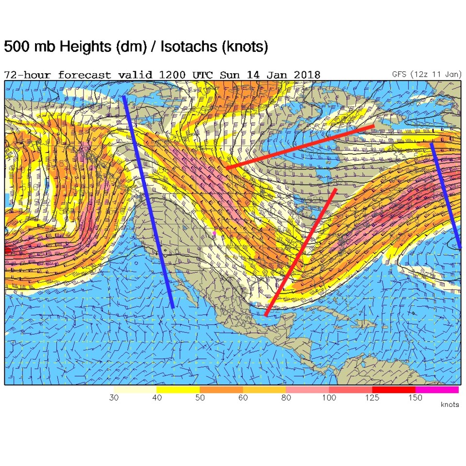
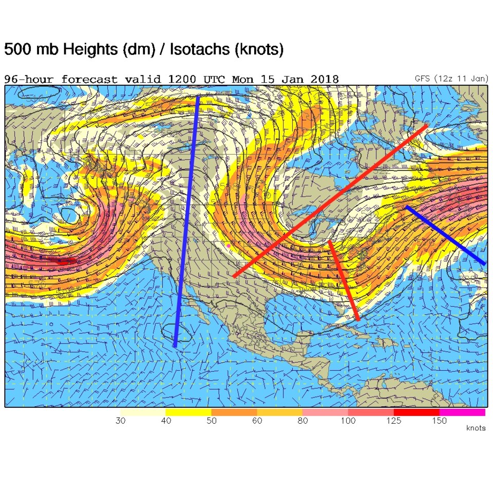
On Sunday, the western ridge is closer (Figure 4) and another northern trough is coming down to give us a brief chance of rain/snow on Monday. Figure 5 is the upper air pattern for Monday and that trough is sweeping by already.  As with most of the storms this winter... I don't expect much from it due to lack of moisture and quick passage. But we'll keep an eye on it here!

Figure 4: The upper air 500mb forecast map for Sunday morning from the GFS.

Figure 5: The upper air 500mb forecast map for Monday morning from the GFS.

Current Weather

Light rain

Light rain

54°F

UV Index
0 Low
Pressure
29.68 Steady
Visibility
8 miles
Dewpoint
43 °F
Humidity
66%
Wind
E 2.6 mph
Gust
6.8 mph
Wind Chill
54 °F

Hourly Forecast

Today
1 AM
52°F
Cloudy
Today
2 AM
51°F
Cloudy
Today
3 AM
51°F
Cloudy
Today
4 AM
50°F
Cloudy
Today
5 AM
51°F
Cloudy
Today
6 AM
51°F
Cloudy
Today
7 AM
52°F
Cloudy
Today
8 AM
56°F
Cloudy
Today
9 AM
59°F
Cloudy
Today
10 AM
63°F
Mostly cloudy
Today
11 AM
64°F
Mostly cloudy
Today
12 PM
66°F
Mostly cloudy w/ t-storms

7 Day Forecast

Mostly cloudy w/ showers

Thursday

72 °F

Turning cloudy, warm; an afternoon shower or two


Thunderstorms

Thursday Night

50 °F

Considerable cloudiness and mild


Thunderstorms

Friday

70 °F

Mostly cloudy with a couple of thundershowers


Thunderstorms

Friday Night

43 °F

Cloudy with a couple of thundershowers


Rain

Saturday

46 °F

Chilly with periods of rain and a thunderstorm


Rain and snow

Saturday Night

39 °F

Cloudy with rain, mixed with a little snow late


Mostly cloudy

Sunday

59 °F

Mostly cloudy and warmer


Partly cloudy

Sunday Night

36 °F

Partly cloudy


Partly sunny

Monday

71 °F

Partly sunny, pleasant and warmer


Partly cloudy

Monday Night

42 °F

Partly cloudy


Sunrise and Sunset

Sunrise
6:07 AM
Sunset
7:50 PM

Based on AccuWeather data