This content was originally published by the Longmont Observer and is licensed under a Creative Commons license.
Forecast Discussion:
A mild day on Saturday changed to a blustery evening as a cold front pushed through. We've looked at the northwest flow that will dominate the first 1/2 of February (at least). Now let's take a look at the fronts and storm systems that this flow is expected to bring down. Remember, long range forecasts beyond 2-3 days are highly suspect, especially with a pattern like the one we have in place now.
There are snow chances up in the mountains every day for the next week and beyond. That is great news for our future water supply and the ski resorts now.
The longer range forecast:
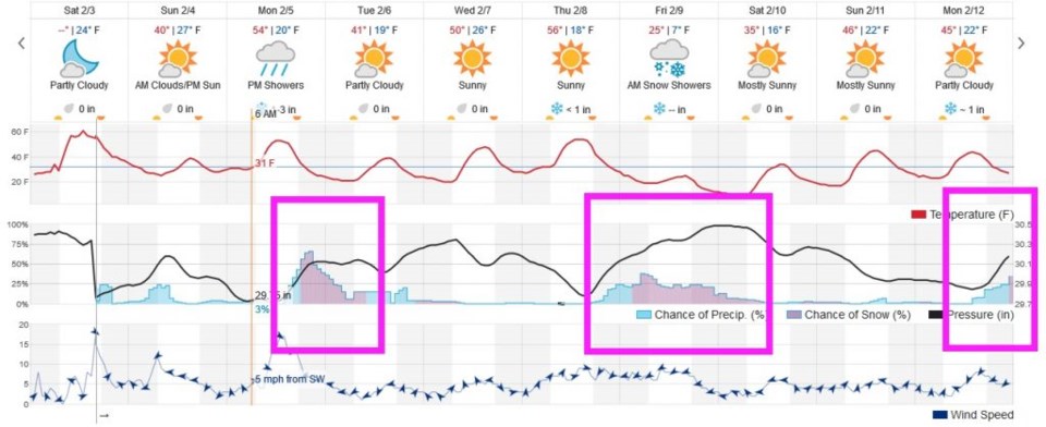
Down to the east of the Front Range, we need a period of moist up slope flow to give us snow chances. Ignoring the small chance this Sunday morning, I'm looking out at the Monday/Tuesday storm, the Friday/Saturday storm, and the hint of one early the following week (Figure 1). Note that, except for one day, Monday February 9th, no extreme cold is expected. Under each of the pink boxed 'storms' in Figure 1, you'll see those east and northeast winds establishing.
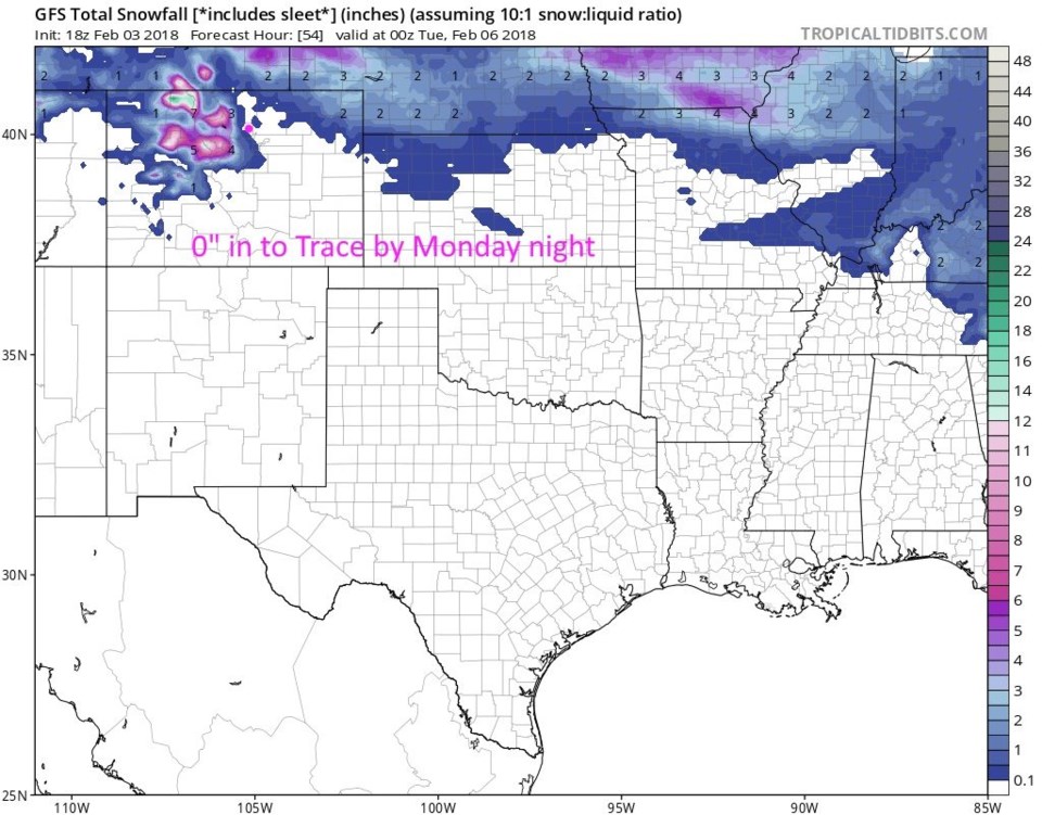
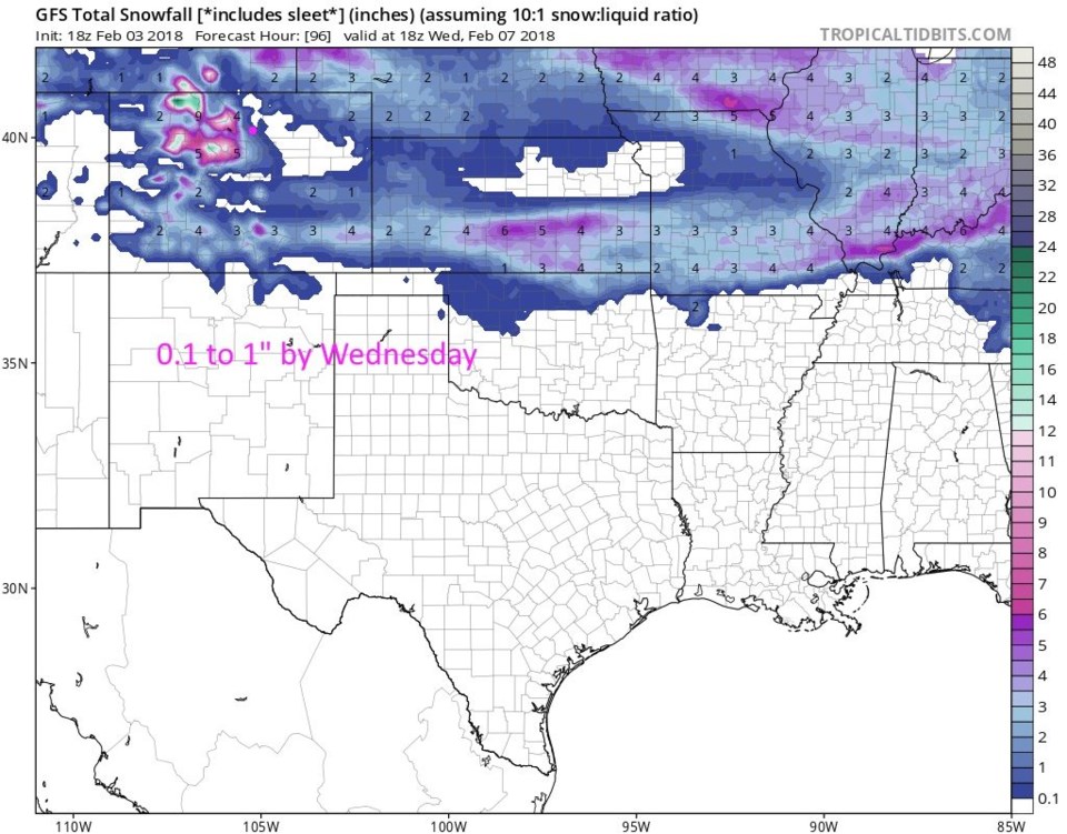
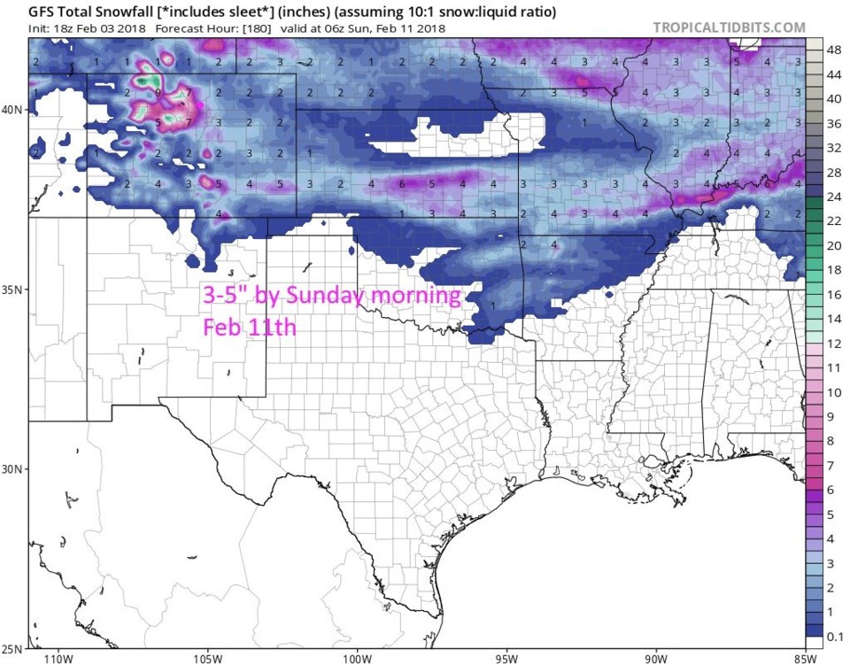
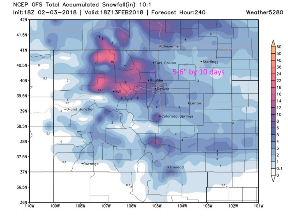
Just looking at the GFS model, Figure 2 shows no significant snow before Monday night. Figure 3 shows maybe a coating to an inch by Wednesday midday. Figure 4 shows maybe 2-4 inches (in addition to the first inch) by Sunday early morning. Finally Figure 5 is the (largely fictitious) 10 day map that gives us a total of 5-6", or that the storm 10 days out just adds another inch or two of snow.
All this IS still good news for the mountains!