Skip to content

The Next Storm/Next Snow Forecast Discussion from the Cherrywood Observatory – February 3, 2018

This content was originally published by the Longmont Observer and is licensed under a Creative Commons license.

Forecast Discussion:

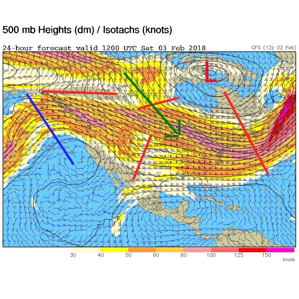
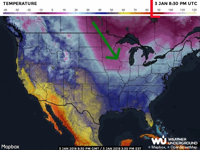
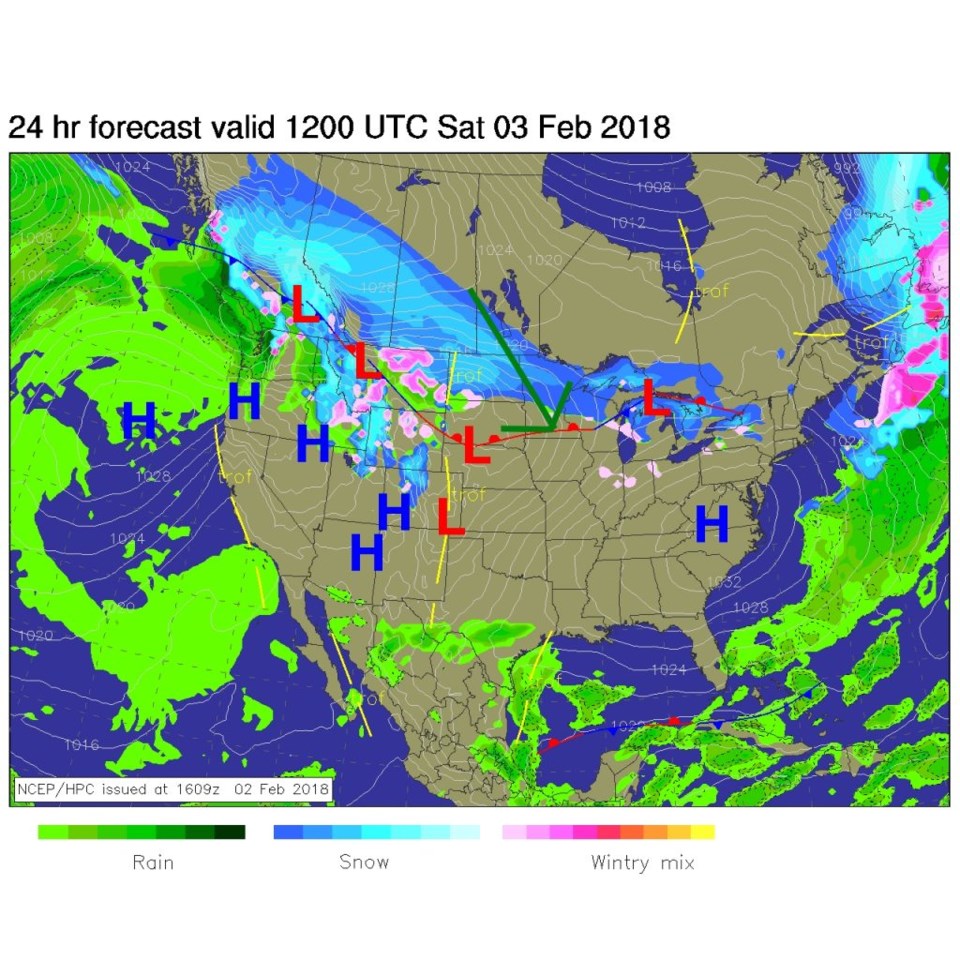
The big story for days and days to come is the northwest flow highlighted yesterday. Figure 1 shows the giant low Saturday morning in Hudson Bay and the flow around that over the top of a Pacific ocean ridge, down into the southeast US and up and out. The green line shows the dominate cold air flow (which is well east of Colorado). Figure 2 is the actual temperatures with the coldest air in purple.  Figure 3 is the location of the fronts currently.  Note the huge swath of up slope and frontal snow on the western extreme of this cold air flow (where the jet stream is located).

The longer range forecast:

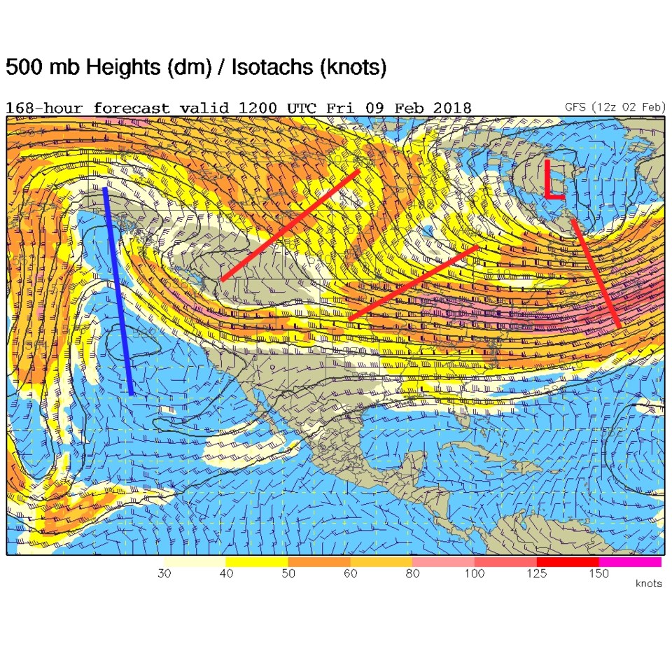
Figure 4 shows that this is the situation still in place Friday February 9th with the low moving just a bit east.

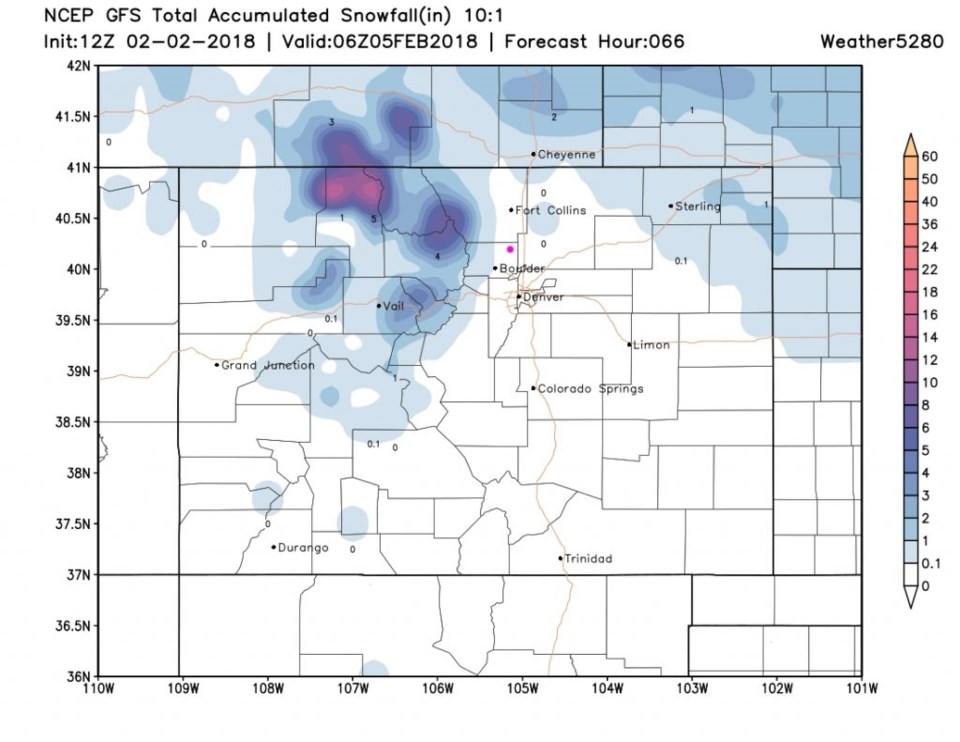
With the jet drifting in and out of Colorado from the north, and with little ripples in the flow (red lines) moving past, we can get snow in the mountains every day much of the week - and periods of banded snow down on the plains.  One push of cold air and banded snow will come in Sunday morning. We might see a dusting to an inch here.  Figure 5 is the snow through Monday early morning - it is barely measurable on this map. (Though it is present nearby on the Plains).

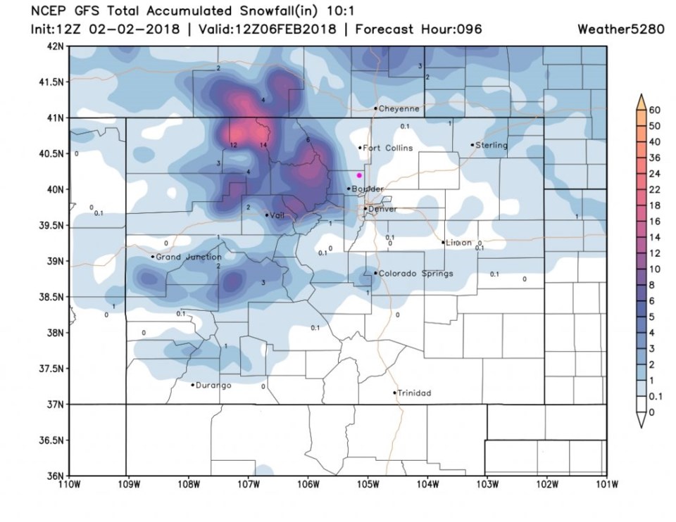
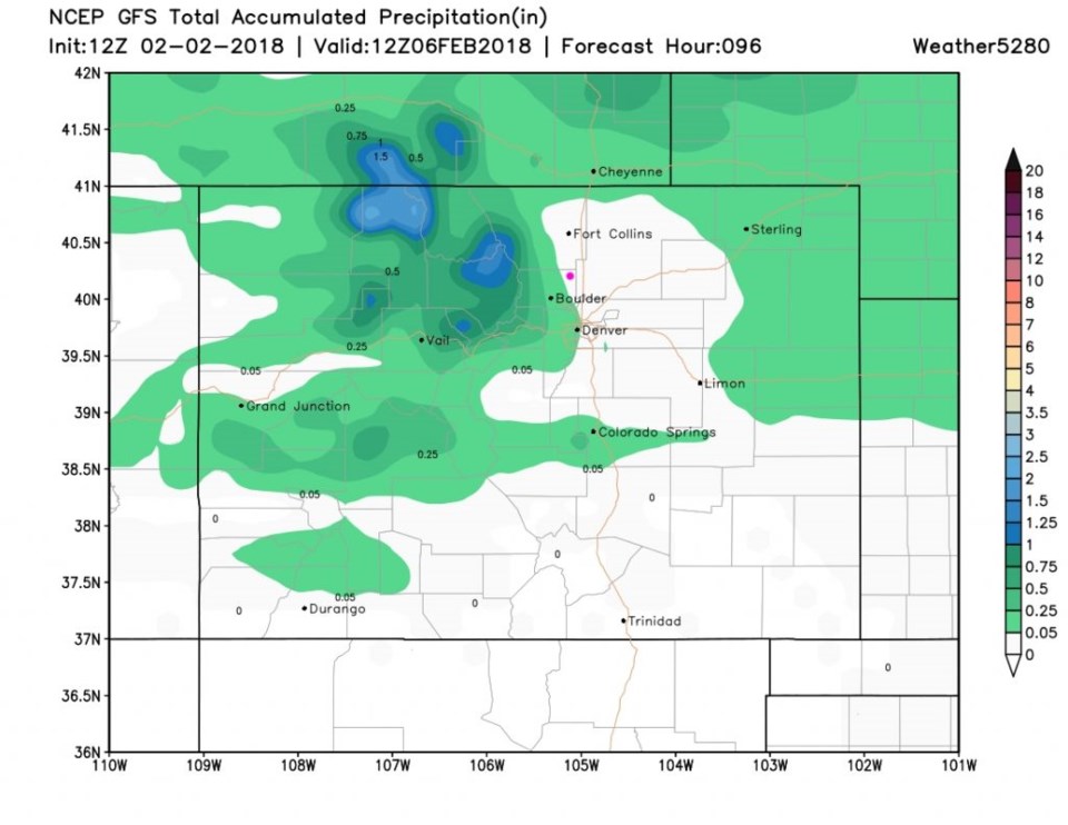
We should see some rain Monday afternoon when this push occurs again, but temperatures are warmer.  The GFS (Figure 6), shows up to an inch of snow by the next day. But the precipitation amount is less than 0.05 inches of liquid (Figure 7).

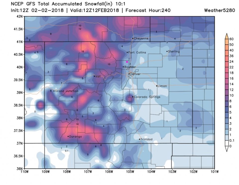
Since northwest flow will hold for most of the next 10 days, the models do put (fantasy) future snow down that adds up.  Figure 8 is the 10 day guess at snowfall totals around the state.  The mountains top 18 inches of snow and Longmont sees up to 3 inches. That total won't pan out, but it is an indication of the generally more unsettled pattern in place.

Figure 1: The forecast upper air 500mb map from the GFS for Saturday morning.. Troughs in red, ridge in blue, cold air flow in green.

Figure 2: Current surface temperatures for Friday PM. Cold air flow in green. From weatherunderground.com

Figure 3: The forecast surface map for Saturday morning from NCEP.

Figure 4: The forecast upper air 500mb map from the GFS for Friday morning. Troughs in red, ridge in blue, cold air flow in green.

Figure 5: The forecast snowfall total from Friday PM to Monday early morning from the GFS and weather5280.com

Figure 6: The forecast snowfall total from Friday PM to Tuesdayearly morning from the GFS and weather5280.com

Figure 7: The forecast precipitation total from Friday PM to Monday early morning from the GFS and weather5280.com

Figure 8: The forecast snowfall total from Friday PM to next Monday early morning from the GFS and weather5280.com

Current Weather

Mostly sunny

Mostly sunny

65°F

UV Index
6 High
Pressure
29.84 Falling
Visibility
7 miles
Dewpoint
46 °F
Humidity
50%
Wind
NNE 1.1 mph
Gust
3.7 mph
Wind Chill
65 °F

Hourly Forecast

Today
10 AM
65°F
Partly sunny
Today
11 AM
70°F
Partly sunny
Today
12 PM
74°F
Intermittent clouds
Today
1 PM
77°F
Intermittent clouds
Today
2 PM
76°F
Cloudy
Today
3 PM
75°F
Cloudy
Today
4 PM
73°F
Cloudy
Today
5 PM
70°F
Cloudy
Today
6 PM
68°F
Cloudy
Today
7 PM
65°F
Cloudy
Today
8 PM
62°F
Thunderstorms
Today
9 PM
59°F
Cloudy

7 Day Forecast

Mostly cloudy

Thursday

77 °F

Turning cloudy; warm


Thunderstorms

Thursday Night

47 °F

A thunderstorm in spots this evening; otherwise, considerable cloudiness


Thunderstorms

Friday

70 °F

Mostly cloudy and not as warm with a couple of thundershowers


Thunderstorms

Friday Night

43 °F

Cloudy with a couple of thundershowers


Rain

Saturday

46 °F

Chilly with periods of rain and a thunderstorm


Rain and snow

Saturday Night

39 °F

Cloudy with rain, mixed with a little snow late


Mostly cloudy

Sunday

59 °F

Mostly cloudy and warmer; a stray afternoon thundershower


Partly cloudy

Sunday Night

36 °F

Partly cloudy


Partly sunny

Monday

71 °F

Partly sunny and warmer


Partly cloudy

Monday Night

39 °F

Partly cloudy


Sunrise and Sunset

Sunrise
6:07 AM
Sunset
7:50 PM

Based on AccuWeather data