This content was originally published by the Longmont Observer and is licensed under a Creative Commons license.
Forecast Discussion:
Everything is on track with the ongoing storm... very cold air is in place today and light flurries are possible into this evening. Your meteorologist is hoping to catch an (on time) flight out to DCA in the morning, so I'm packing and scrambling.
I'll update this post with some early snow reports later in the day (when more have come in and I've checked into my hotel).
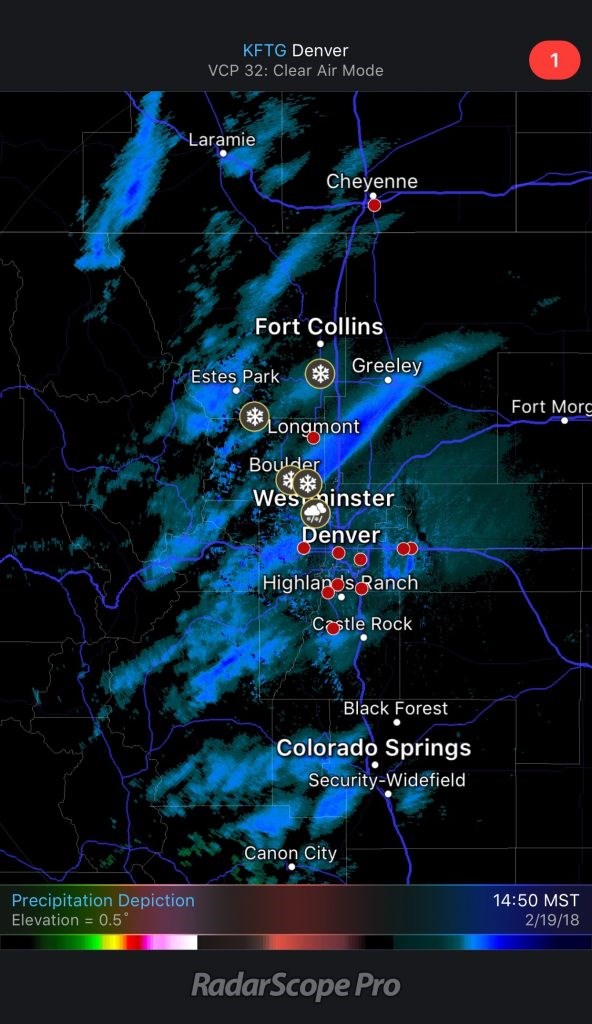
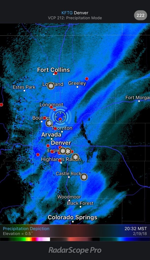
In the meantime, take a look at the great banding that formed - and go back a day and two and compare to what the models were predicting. I'm impressed actually!
UPDATE later Tuesday PM:
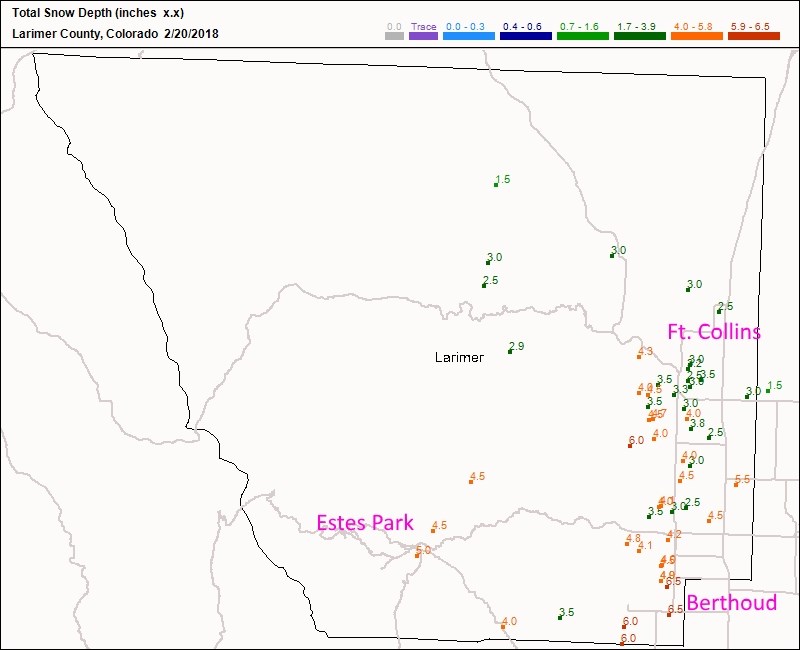
There was a lot of variability with the snow totals due to the banding (see lower two images). Figure 3 shows Ft. Collins with 6 inches on the southwest foothills down to 1.5 inches east of town. Berthoud got a solid 5-6 inches.
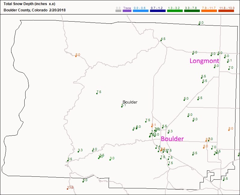
Figure 4: Longmont received 4-7 inches of snow (5 inches at my house). Boulder received 5-8 inches.
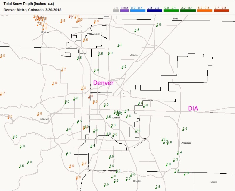
Figure 5: Denver received 7 inches in the west and 2 inches in the east. Overall, this was much needed moisture.