This content was originally published by the Longmont Observer and is licensed under a Creative Commons license.
Forecast Discussion:
We finally had a storm overproduce! (The second time this winter?) I predicted some rain, freezing rain and a coating to an inch of snow if we were lucky. We didn't get rain or ice, and all the precipitation that fell was in the form of snow - which added to a full inch at my house.
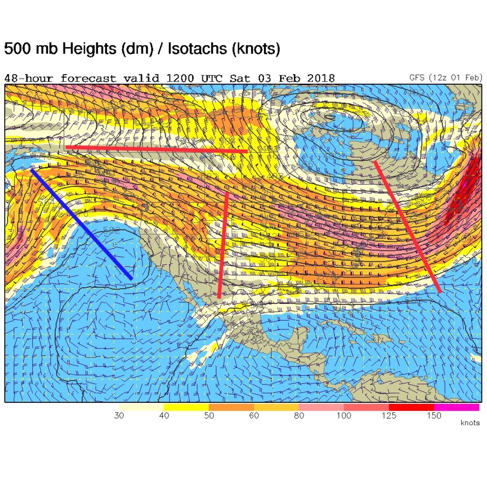
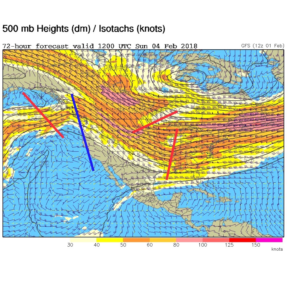
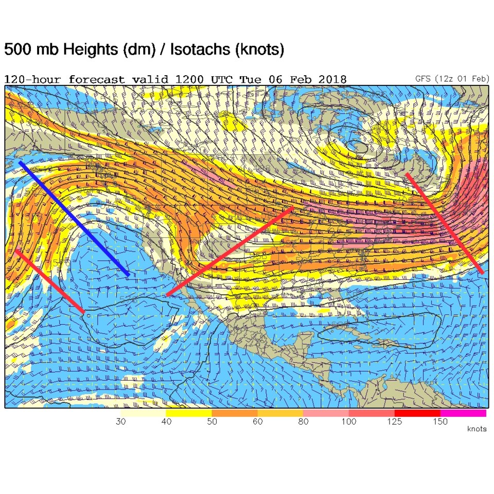
The ridge is now off in the Pacific Ocean and we have a healthy northwest flow regime (the jet stream is moving from the northwest to the southeast past Colorado/over Colorado). I've drawn red lines for smaller troughs in the giant trough pattern that dominates most of the US in the maps below.
The longer range forecast:
You can watch the smaller troughs pass on Saturday (Figure 1), Sunday (Figure 2), and off into Tuesday (Figure 3). Each trough will kick off snow in the mountains and bring a slight cooling and maybe a bit snow down here in Longmont.
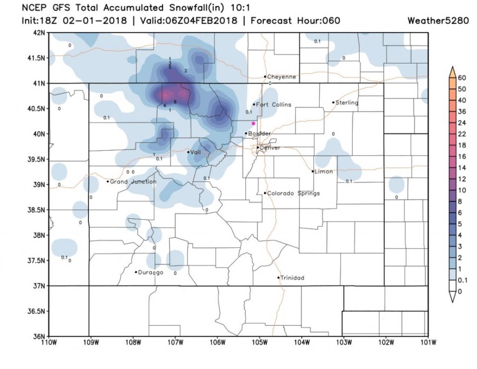
Figure 4 is the total snowfall through Sunday by the GFS - and we might see up to an inch fall by then. Details tomorrow!