Skip to content

The Next Storm/Next Snow Forecast Discussion from the Cherrywood Observatory – February 12 , 2018

This content was originally published by the Longmont Observer and is licensed under a Creative Commons license.

Forecast Discussion:

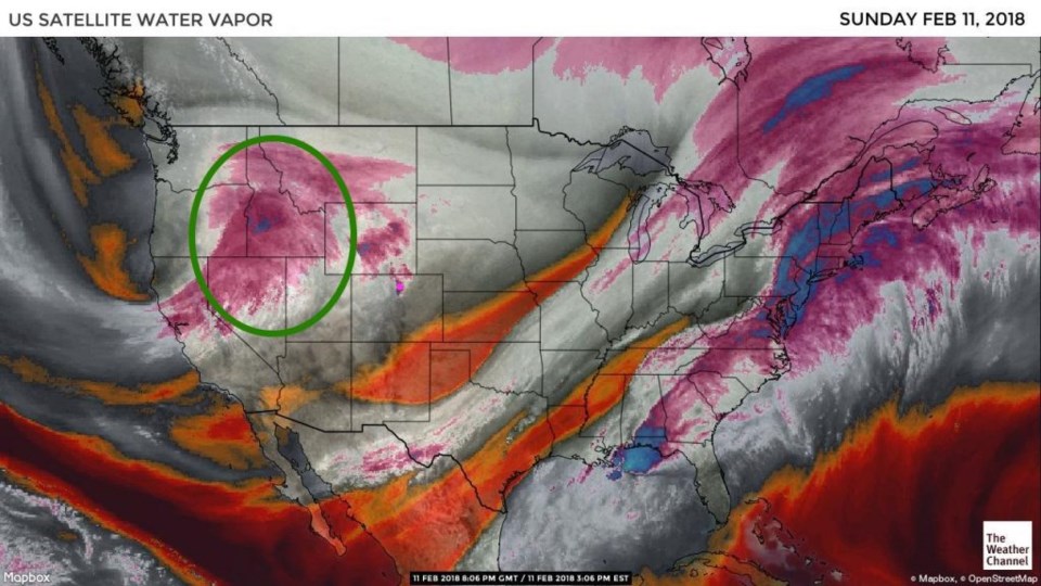
What?! I just put snowfall totals up in Sunday's forecast discussion from our last storm and ANOTHER front and storm is moving in for Monday (today).  Figure 1 is the (long ignored here) water vapor satellite image showing our next storm, circled in green, rolling towards us.

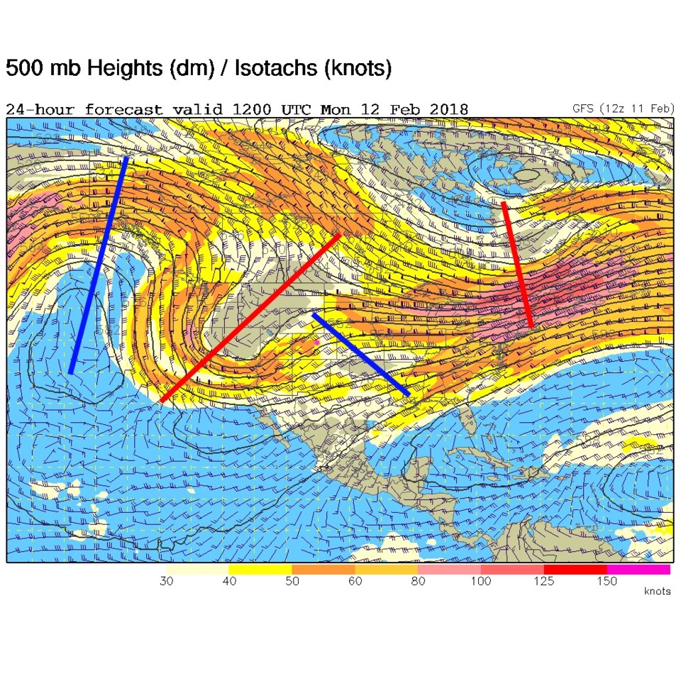
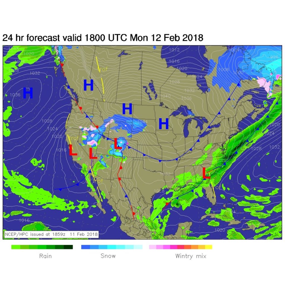
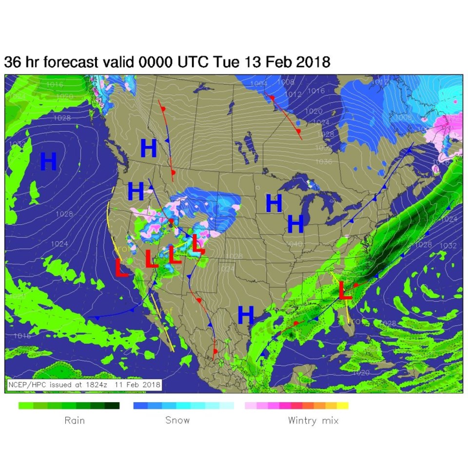
The trough driving that will be over the Great Basin by this morning (the big red line -Monday AM - Figure 2). The front will be through late Sunday night and temperatures drop into the 20'sF for a high today.  Very similar to our last storm, we'll see up slope flow and periods of freezing fog and freezing drizzle again.  Figure 3 shows the front past Longmont Monday morning and a good amount of snow on the Western Slopes. Figure 4, Monday evening, shows ice and snow snow spreading out onto the Plains of NE Colorado.

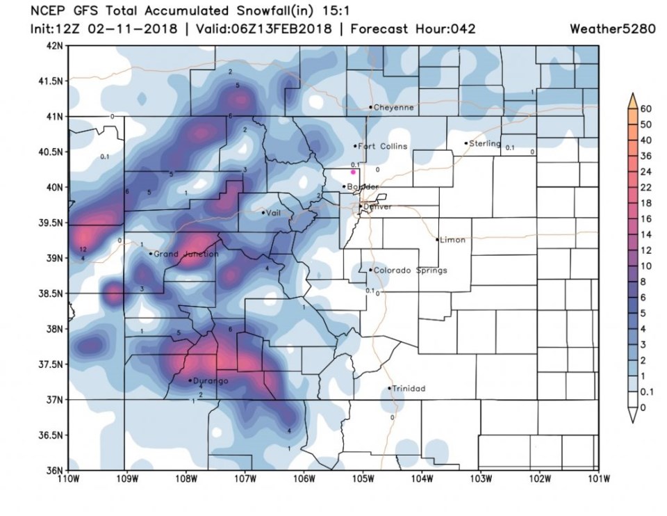
Figure 5 is the GFS's take on snowfall. Some choice spots in the West and high mountains will get a foot. Ft. Collins might see 1/2-1 inch, but Longmont is in the dusting to coating area.  Denver might see a coating to an inch of snow while Estes Park might get a couple of inches. This is also not a big storm.

Figure 1: The water vapor satellite image from the weather channel. Browns/reds are dry air. White and grey are moist. PInk/Blue are cold high clouds.

Figure 2: Forecast 500mb upper air map for Monday morning (today). Troughs are red lines, ridges are blue.

Figure 3: Forecast surface map for Monday midday from NCEP.

Figure 4: Forecast surface map for Monday night from NCEP.

Figure 5: The GFS total snowfall prediction between Sunday PM and late Monday night from weather5280.com

The longer range forecast:

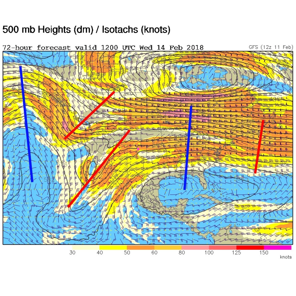
Our next storm comes in with a trough pushing in Wednesday giving what "looks" like a 1-3" storm on Thursday.

Figure 6: Forecast 500mb upper air map for Wednesday morning. Troughs are red lines, ridges are blue.

Current Weather

Light snow

Light snow

34°F

UV Index
0 Low
Pressure
30.21 Steady
Visibility
2 miles
Dewpoint
31 °F
Humidity
92%
Wind
NE 1.7 mph
Gust
2.8 mph
Wind Chill
34 °F

Hourly Forecast

Today
5 AM
34°F
Cloudy
Today
6 AM
34°F
Cloudy
Today
7 AM
35°F
Cloudy
Today
8 AM
34°F
Intermittent clouds
Today
9 AM
35°F
Intermittent clouds
Today
10 AM
36°F
Intermittent clouds
Today
11 AM
38°F
Intermittent clouds
Today
12 PM
40°F
Intermittent clouds
Today
1 PM
41°F
Intermittent clouds
Today
2 PM
42°F
Cloudy
Today
3 PM
43°F
Cloudy
Today
4 PM
41°F
Cloudy

7 Day Forecast

Rain and snow

Friday

43 °F

Chilly with some sun, then turning cloudy; a morning rain or snow shower in spots followed by a little rain this afternoon


Rain and snow

Friday Night

32 °F

Periods of snow; rain mixed in early, accumulating 1-3 inches


Flurries

Saturday

40 °F

A bit of morning snow with little or no accumulation; otherwise, cloudy and chilly; storm total snowfall 1-3 inches


Intermittent clouds

Saturday Night

31 °F

Partly cloudy


Partly sunny

Sunday

64 °F

Partly sunny, pleasant and warmer


Partly cloudy

Sunday Night

41 °F

Partly cloudy


Intermittent clouds

Monday

79 °F

Warmer with a blend of sun and clouds


Partly cloudy

Monday Night

36 °F

Partly cloudy


Intermittent clouds

Tuesday

64 °F

Cooler with periods of clouds and sunshine


Mostly cloudy

Tuesday Night

40 °F

Mostly cloudy


Sunrise and Sunset

Sunrise
6:15 AM
Sunset
7:44 PM

Based on AccuWeather data