This content was originally published by the Longmont Observer and is licensed under a Creative Commons license.
Forecast Discussion:
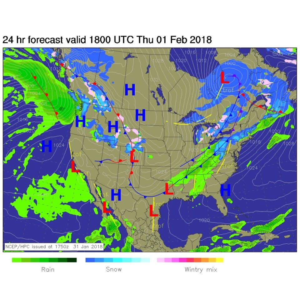
Our next two storms, while cooling things down to just a bit above normal temperatures, are going to be dominated by drying down slope flow. Figure 1 shows the frontal system in place down the Front Range on Wednesday. This is very shallow and not very moist air.
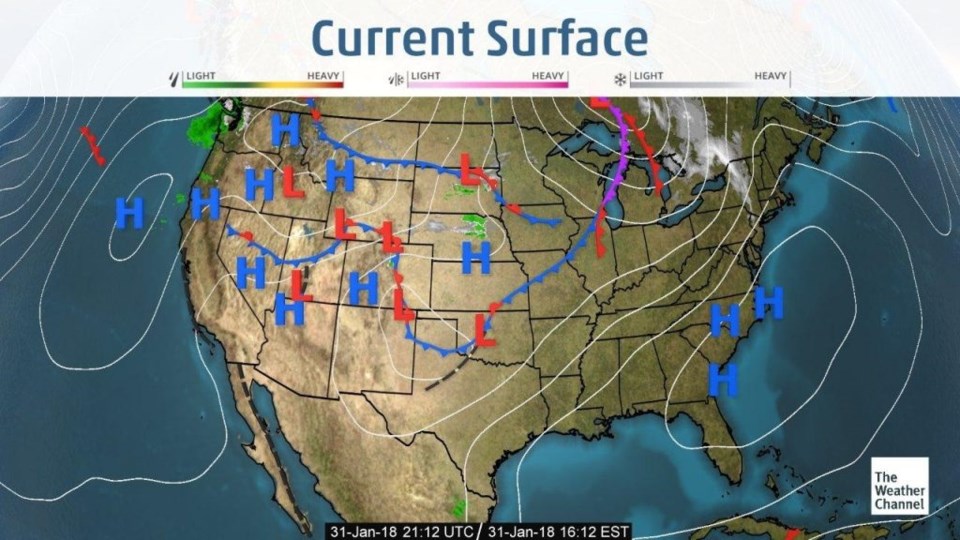
By midday today, the surface map hasn't changed much (Figure 2) but upper level dynamics (an approaching jet stream) will create some snow and freezing drizzle over northern Colorado.
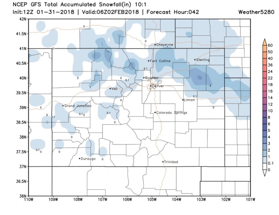
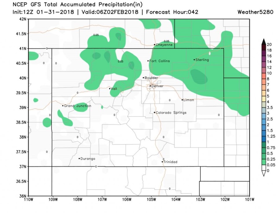
Figure 3 is the total snowfall through late Thursday night/early Friday AM and we 'may' see a dusting to an inch if we are very lucky. More likely, some freezing drizzle will glaze things and make bridges tricky to drive on. Figure 4 is the total precipitation which it is below the threshold of the lightest color.
The longer range forecast:
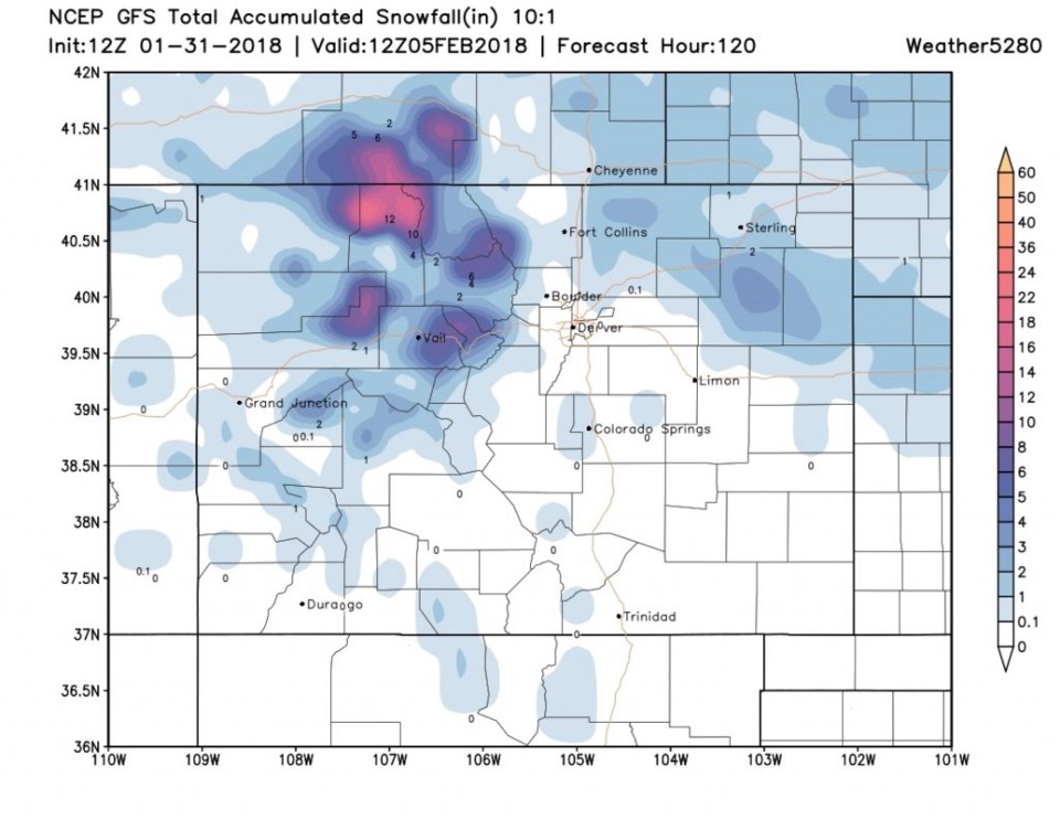
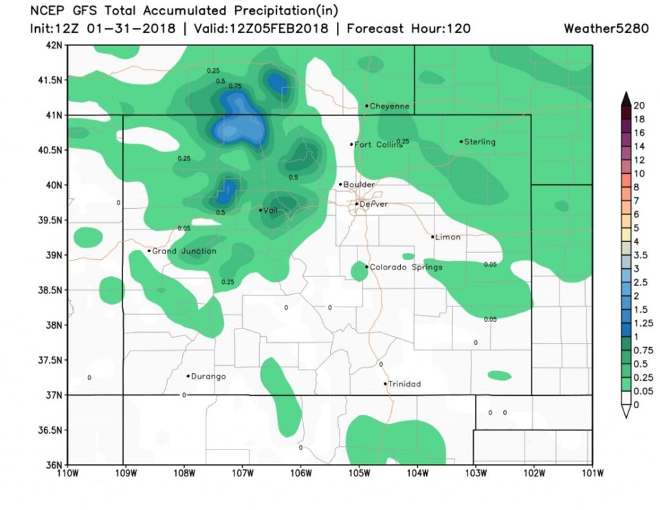
Our next storm, for the weekend leaves the same notch of low to no measurable snow up I-25 to almost Berthoud (down slope- Figure 5). Note, the mountains pick up a foot of snow in the higher elevations near the Wyoming border. In the precipitation department (Figure 6), the 'very little precipitation' strip runs right up from Denver into Wyoming.