This content was originally published by the Longmont Observer and is licensed under a Creative Commons license.
Forecast Discussion:
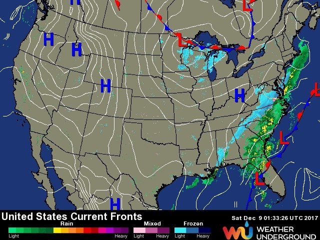
3-2-1 ...let the unusually beautiful weather begin again. Figure 1 says it all. There is a big ridge of high pressure in the western states and no precipitation anywhere except up in the Great Lakes and the extreme southeastern states.
The longer range forecast:
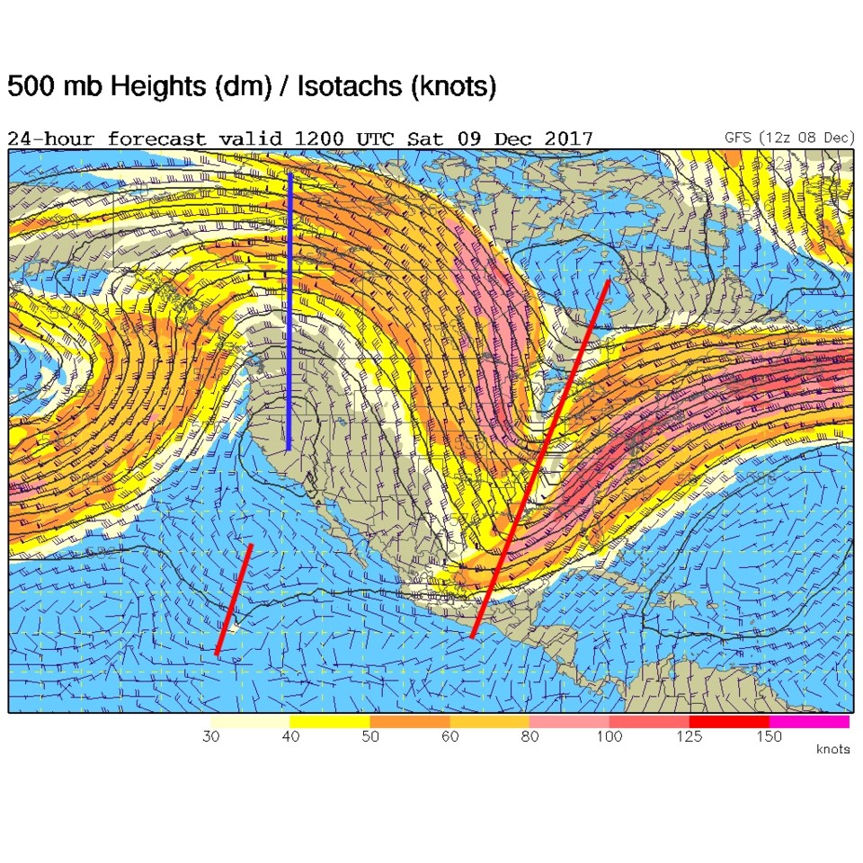
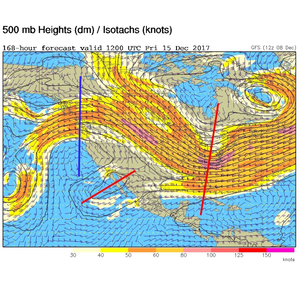
Figure 2 and 3 are the upper air patterns for this morning (Saturday) and then the forecast for Friday morning at the end of the week. The ridge (with a small trough deep down south) dominates the West all week and a deep trough dominates the East all week. It is really impressive how little things change.
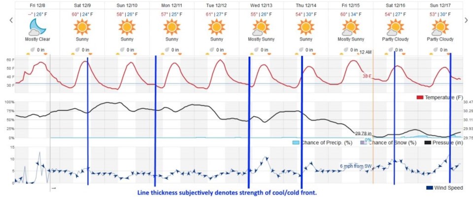
With the jet stream flowing from the northwest to the southeast, we are back to the regime where fronts of various strengths will drift into the state all week. In figure 4, I've drawn the weaker fronts (with little wind and little cooling) in thin blue lines. The thickest blue lines denote the stronger wind shifts and temperature drops. There is roughly one-a-day except for Tuesday and Friday. The dryness continues, temperatures hover around 15-20 degrees above normal, and my forecast discussions may remain sort of short this week.