This content was originally published by the Longmont Observer and is licensed under a Creative Commons license.
Forecast Discussion:
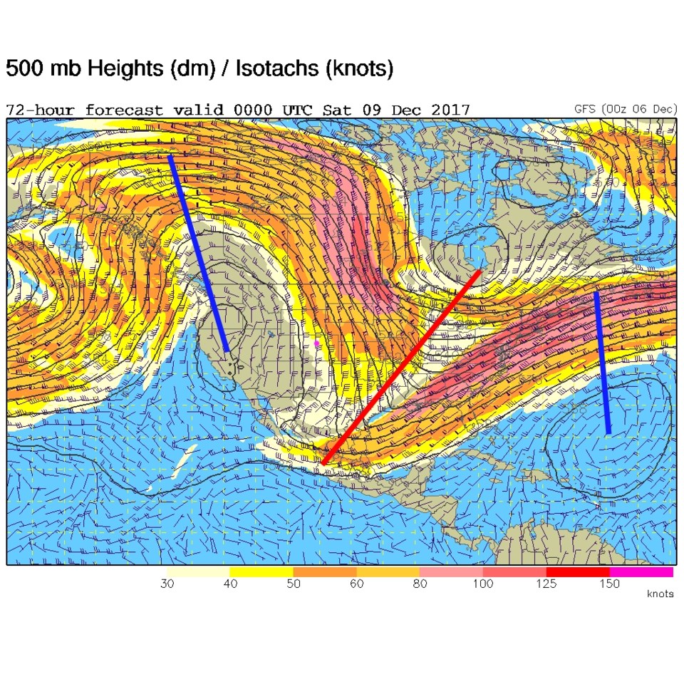
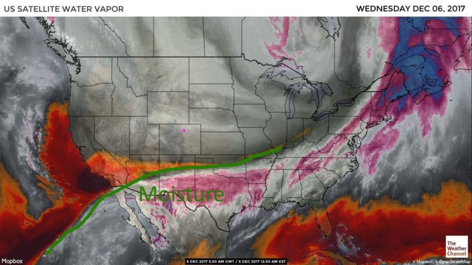
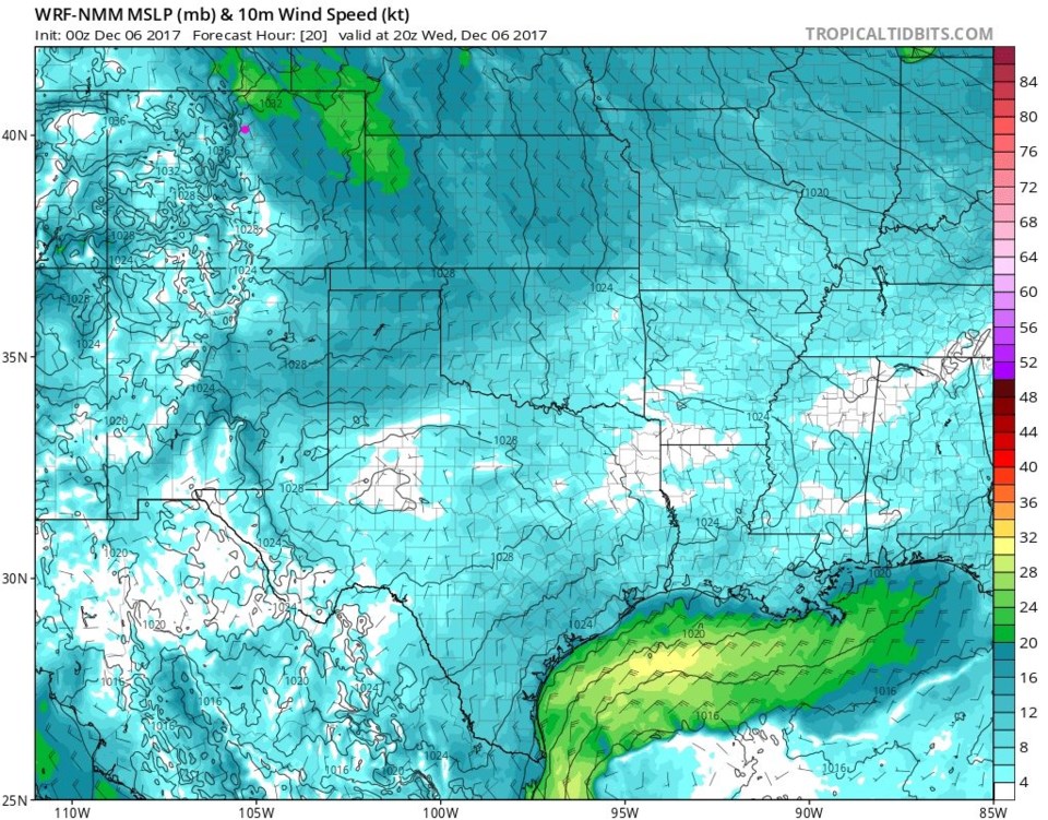
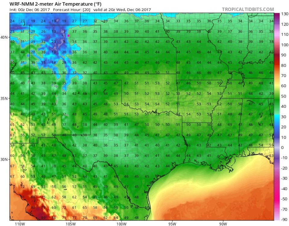
The Wednesday front comes racing in today, but things remain dry. Figure 1, the water vapor satellite image, shows that the tropical moisture is far to the south. But this front will bring in strong winds today (Figure 2). This figure has winds sustained around 20mph from the NNW around Longmont (and stronger up north). Real cold air comes in as well with a high staying in the 30's today (Figure 3). Bundle up!
The longer range forecast:
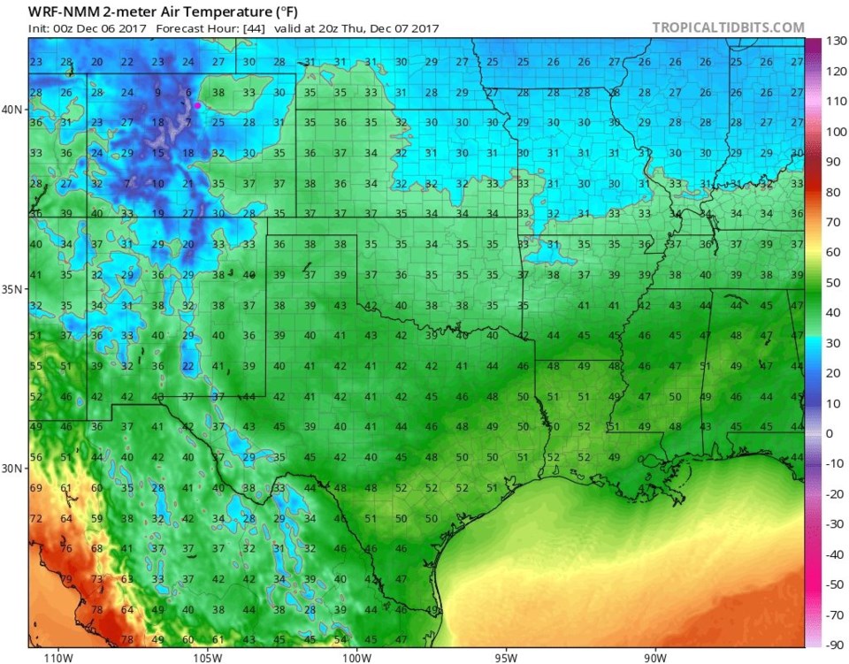
Another front keeps temperatures cold for Thursday (Figure 4). We stay in the 30's tomorrow as well (with more wind). There IS a chance of snow flurries around for this storm (but not much). Figure 5 is the total snowfall accumulation through the end of this week, and there is a dusting in the mountains and on spots on the Plains. Longmont probably remains dry.
By Friday (Figure 6) the western ridge finally moves in and we rapidly shoot up to highs in the 50's and then 60's on Saturday. Go get a tan!
(The pure fantasy Christmas forecast, from accuweather.com, has cooled to highs in the upper 40's, but only partly cloudy skies.)