This content was originally published by the Longmont Observer and is licensed under a Creative Commons license.
Forecast Discussion:
Please don't shoot the messenger... the snow storm is fading out of our future as the upper air pattern changes. But first... the warmth!
It won't be 80's like our last heat wave, but it will be close to 70F in many places today (Sunday). The record for DIA for this date is 69F and the forecast is for 67F. That isn't too far! For Longmont, the record is 70F and our forecast is for 68F.
Mild temperatures will continue through the night Sunday into Monday morning when the front should sweep down over our town between 7 and 8am. The warmest temperature of the day on Monday will happen around dawn or after midnight.
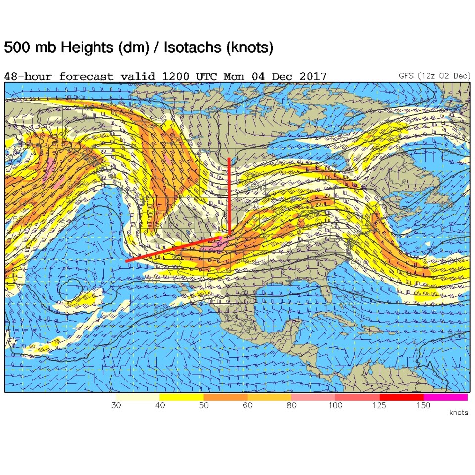
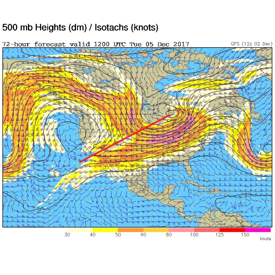
OK, back to our wimping-out snow storm... There is energy (a trough) that is heading further south of our state now, and a piece that is headed ahead of the storm through Wyoming (two red lines in Figure 1). After the storm is passed, it is very positively tilted again (Figure 2). There won't be optimal lift over NE Colorado and and the moisture won't hit us either.
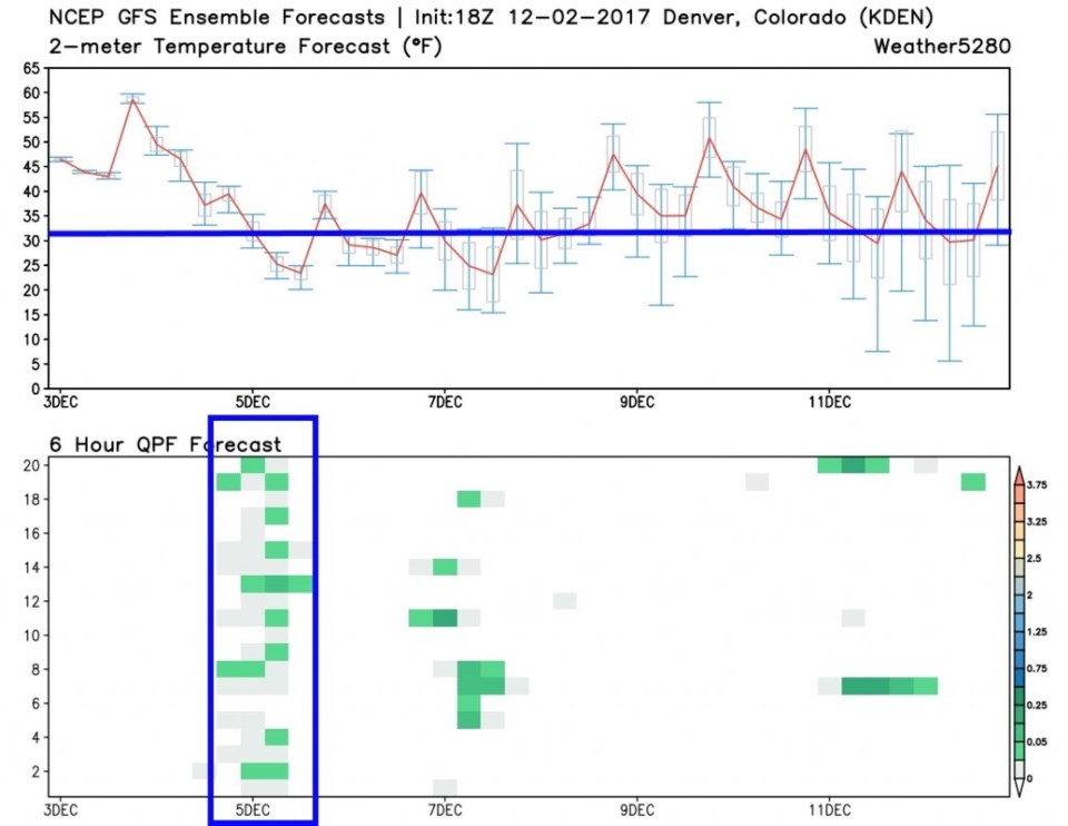
The 'fairly optimistic' graphical forecast of recent now has much less precipitation hitting the I-25 plains on Monday into Tuesday (boxed in blue in Figure 3). This same figure does show that cold air will slide down... so at least THAT will happen!
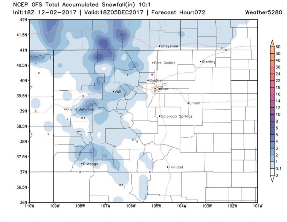
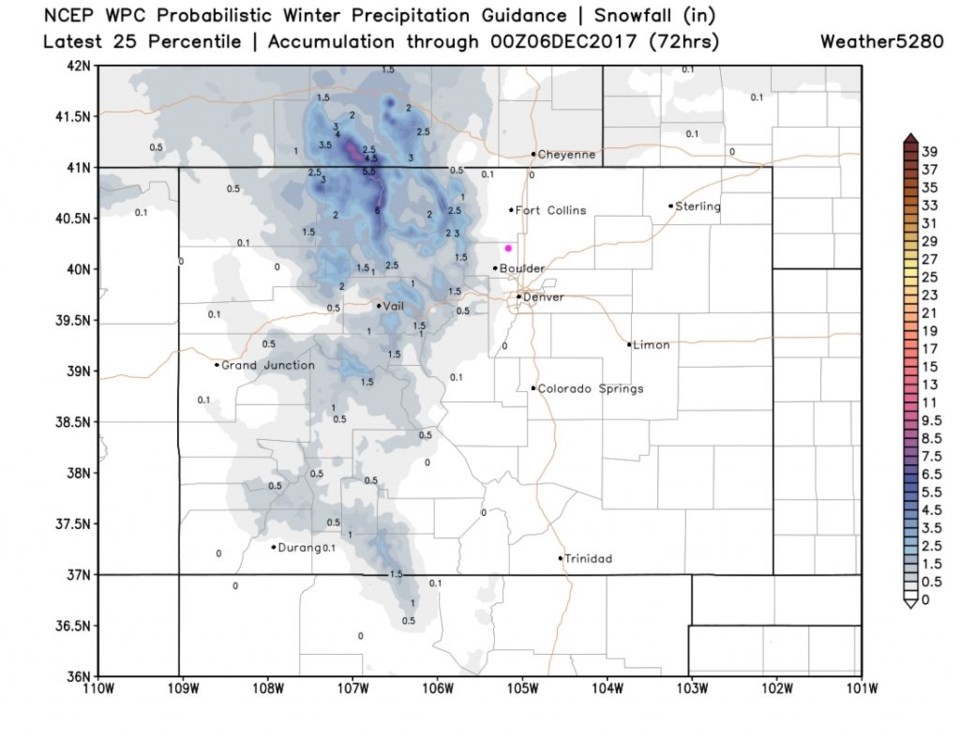
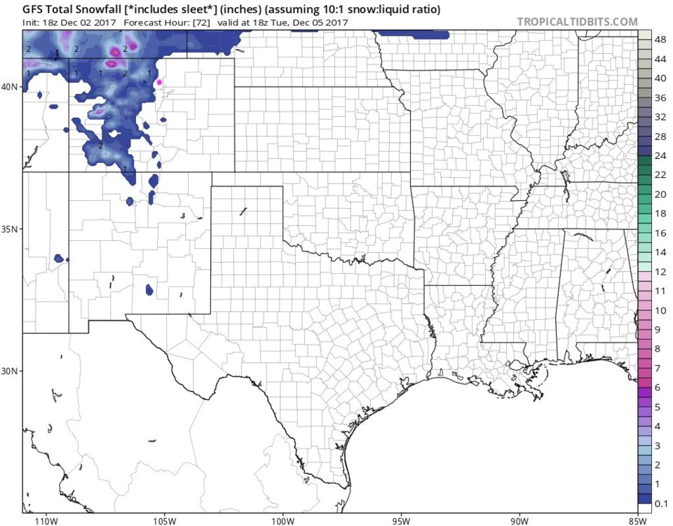
Figure 4, 5, and 6 are different model runs and they show nothing significant happening in Longmont (the pink dot). We may get some small amount of water, maybe even see snow in the air, but it won't be great. It will be very much like our past few storms.
The longer range forecast:
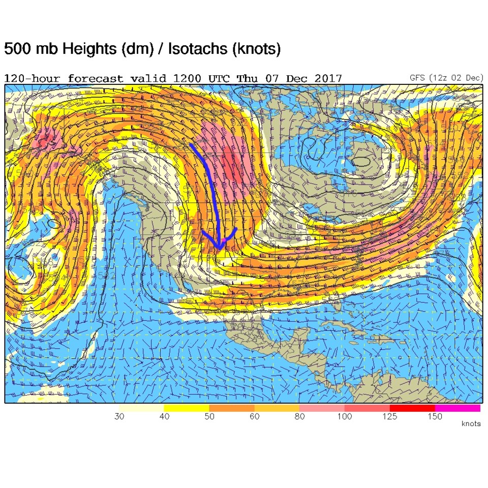
Through Thursday, we will have northerly flow that will keep us quite sharply cold (also can be seen in Figure 3). Figure 7 shows that northerly flow on Thursday before the ridge progresses towards and begins to warm us up again.
Bonus: Fantasy Christmas Eve and Day forecast from the 1 month forecast created by Accuweather.com: Highs around 50F, Lows around 15F partly cloudy skies. But they do have snow chances on New Years Eve. I would NOT put money on this so-distant-a forecast...but it is fun to watch.