This content was originally published by the Longmont Observer and is licensed under a Creative Commons license.
Forecast Discussion:
Because the bulk of the current snow storm will occur pre-dawn today (Thursday), and this article is being written later Wednesday night - I'll update this post midday today. It is usually better to look at the next storm after the current storm has played out as well.
A quick look at the last-minute model forecasts for this current snow...
Figure 1: The GFS 0.1-1 inch snow.
Figure 2: The HRRR 1.5-2 inches snow.
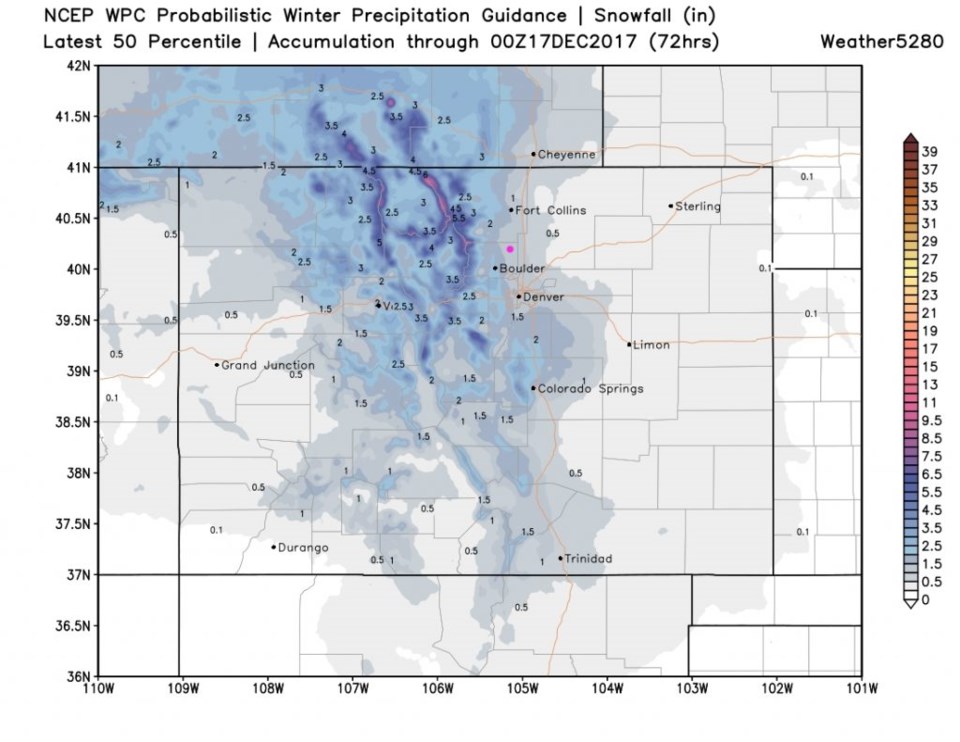
Figure 3: The WPC 1 to 1.5 inches snow.
Afternoon UPDATE:
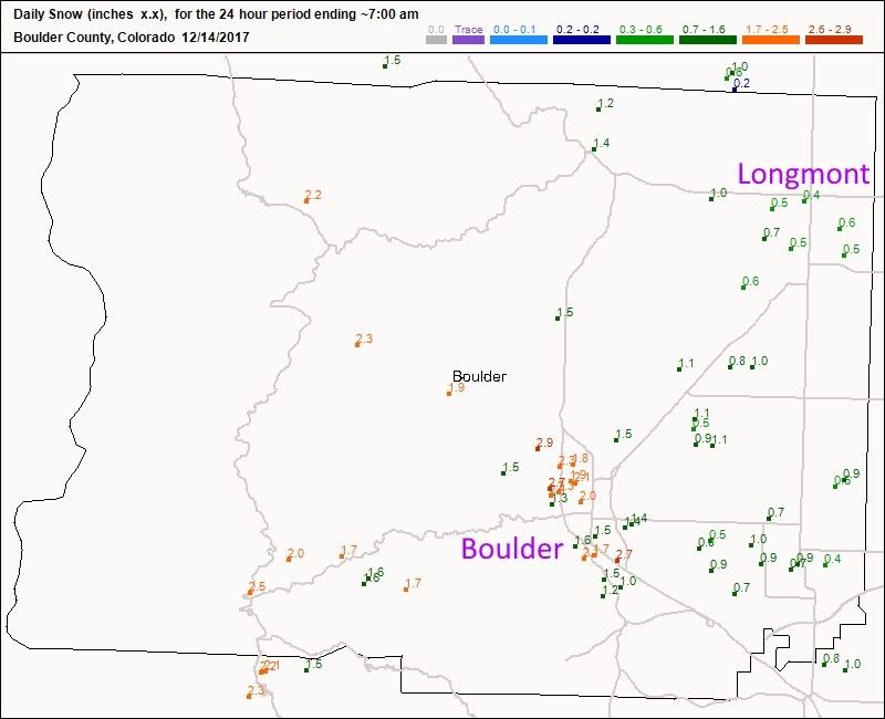
Figure 4 shows the actual snow reports as of Thursday afternoon for Boulder county.
Longmont received about 1/2 to 3/4th inch of snow. Boulder picked up 1 to 3 inches.
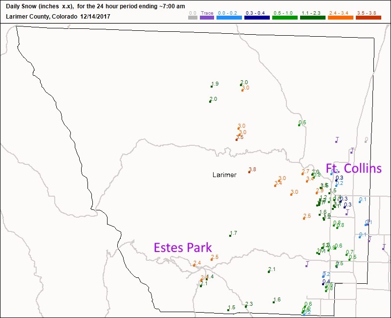
Figure 5 is Larimer county - Estes Park received about 2 to 2.5 inches of snow. Ft. Collins received 0.1 to 3" going east to west.
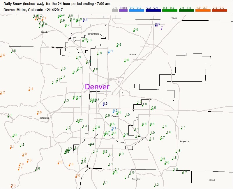
Figure 6 is the Denver Metro - which received a coating in places to an inch out east up to 2 inches up in the lower foothills to the west.
The ends a (not quite the record) 65 days of snow drought.


Afternoon UPDATE:
The longer range forecast:
We are still looking at snow from 8pm Saturday to 11am Sunday. Details later...
Fantasy Christmas Forecast: According to accuweather.com, someone's letter to Santa worked. We now see Christmas Eve and Christmas Day with highs in the lower 30's and snow flurries possible Christmas morning. That is quite a turn around in the super-long-range model. And that is exciting!


