This content was originally published by the Longmont Observer and is licensed under a Creative Commons license.
Forecast Discussion:
Stop the presses! (Oh, this is a Website.) There is CHANGE in the air. Literally.
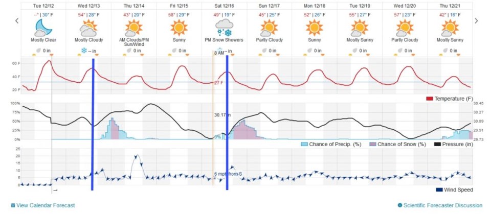
We'll start with the 10 day at-a-glance forecast in Figure 1. We have a pretty strong cold front that will slip down the Front Range this morning (Wednesday). The front will cross the Wyoming/Colorado border around 6am. It will blow through Longmont around 7-8am (about when my trash pick-up begins in NE Longmont). That will cut off the warmth of the day and keep it in the 50's (still way above the normal of 42F). Cooling will continue through the night and into Thursday giving us a near-normal high for tomorrow.
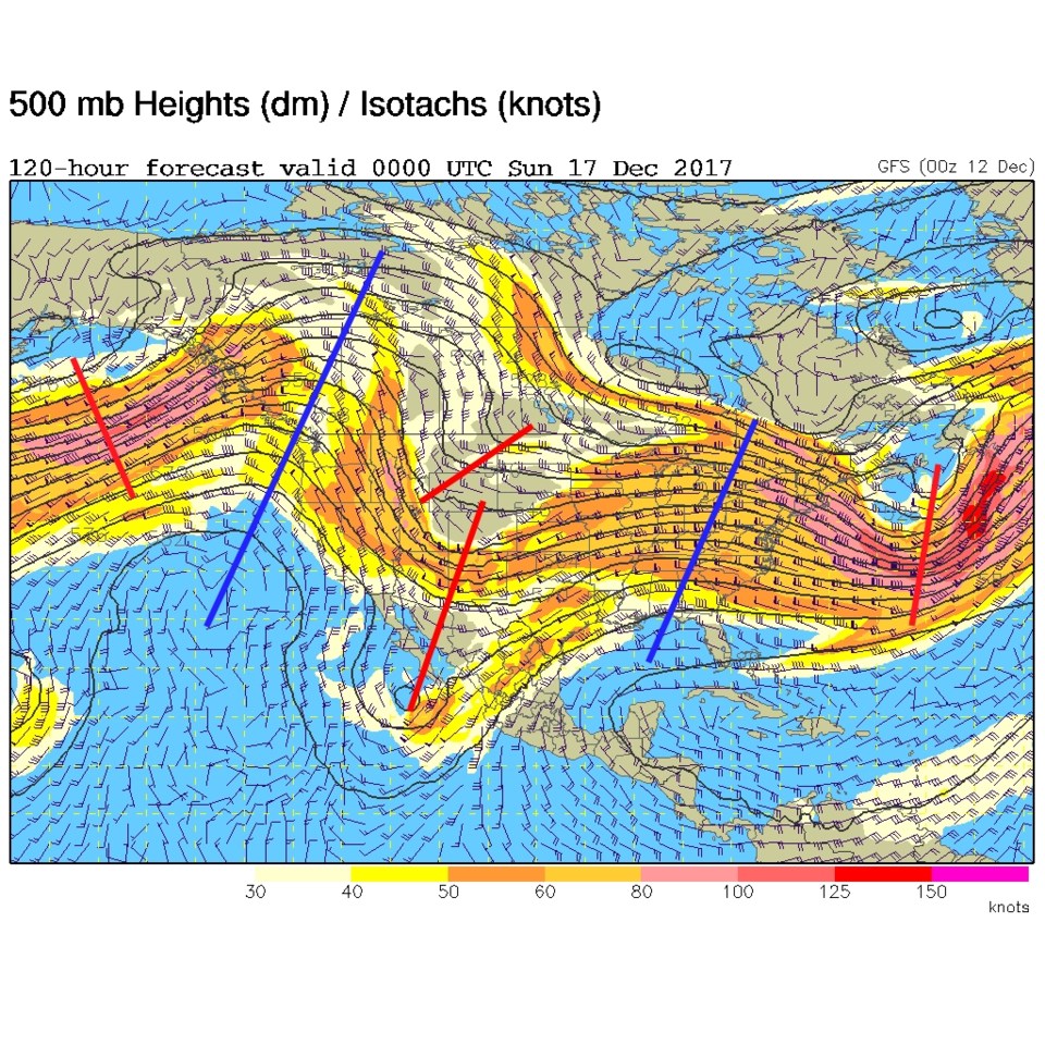
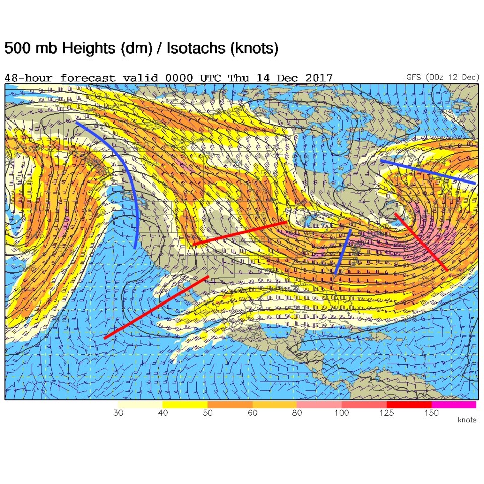
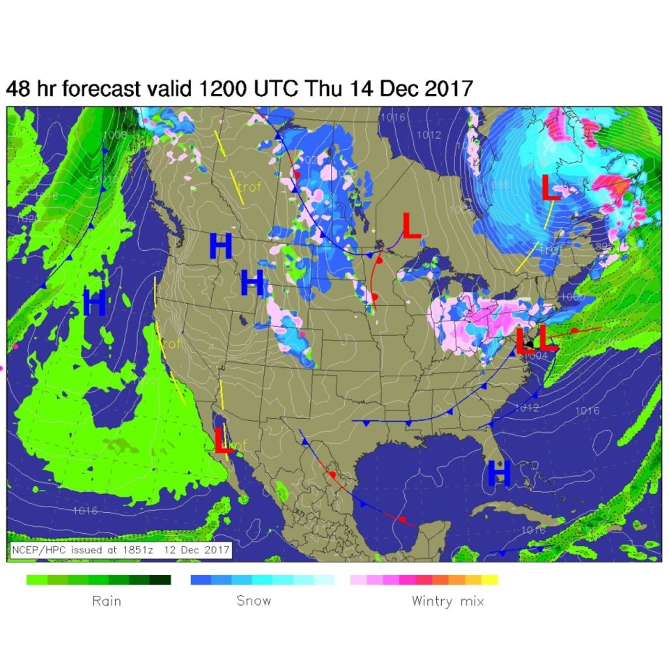
The big news comes from a short-wave trough coming down the upper air flow (Figure 2) that will pull easterly flow uphill and provide some lift to the atmospher. This up-slope flow should mean snow for the pre-dawn hours! Figure 3 is the surface map for midday Thursday. The front is in the distant southern U.S. already with a band of up-slope mountain and near-to-the-mountains plains snow falling.
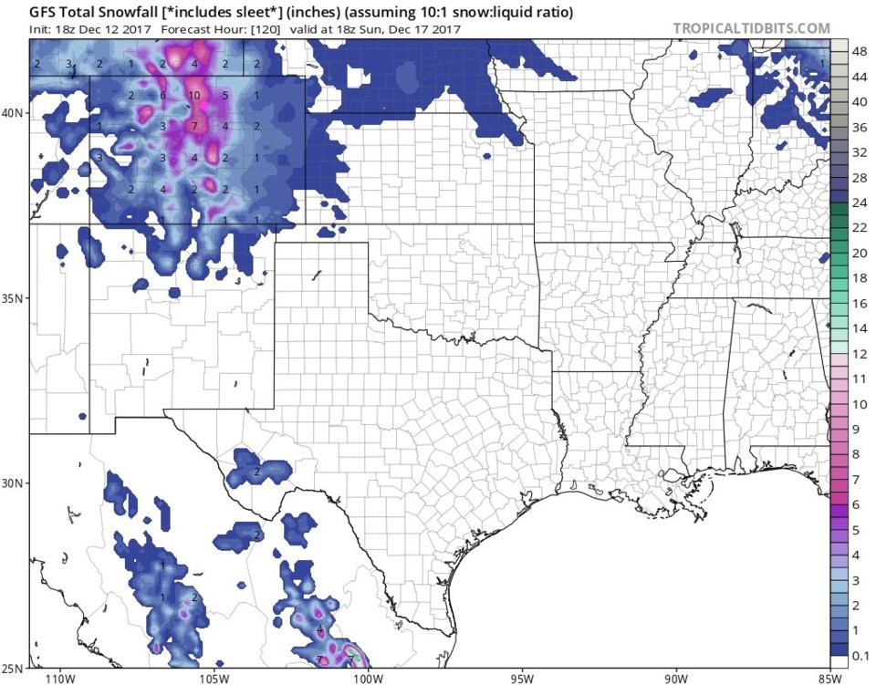
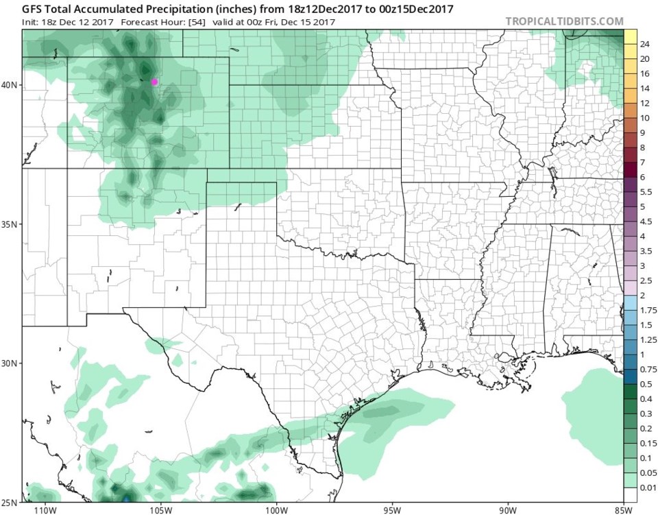
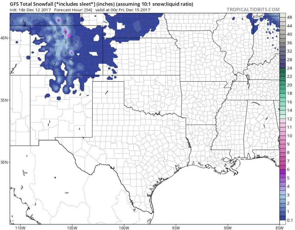
The GFS paints a total of about 0.10" to 0.15" of water equivalent for Longmont through Thursday PM (Figure 4). Figure 5 is the same model showing snow. We are in the, roughly, 1/2" area! WE should expect a coating to 1" in places.
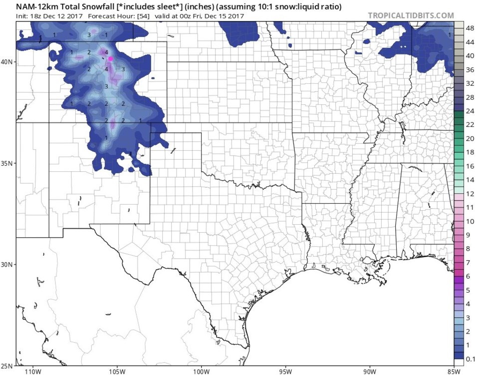
The NAM (Figure 5) drops more like 1-3". Local spots might pick that much snow up.
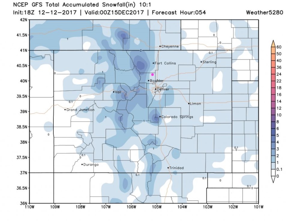
Zooming in on the GFS (Figure 6) still only gives us the minimal 0.1 to 1" of snow.
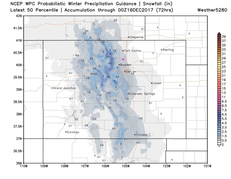
The WPC 50th percentile run for accumulation through Friday has us in the 0.5" area (Figure 7).
The longer range forecast:
You probably also noticed (in Figure 1) the weekend storm! Very similar to the scenario we're seeing tonight into Thursday, we have that same southern low hanging around to the southwest and another short wave traveling in from the northwest to lineup with it over Colorado (Figure 9).
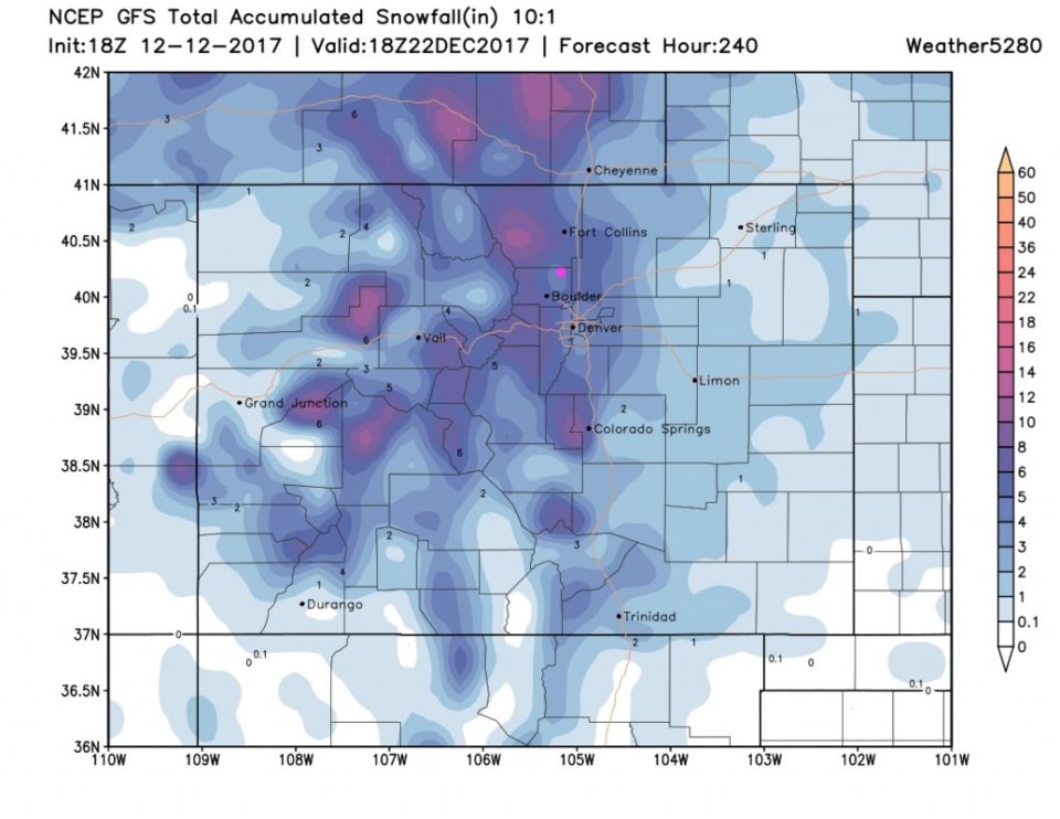
The GFS total snowfall through Sunday AM (Figure 10) shows this to be a more potent storm. We need to subtract this first inch of forecated snow - this has us in the 5-7" area!
Figure 11 (our record largest number of graphics in one of these discussions) has the GFS close-up looking like 5" of snow for Longmont. Finally we get some hope. (Christmas still looks warm and dry, but that is SO far away, this bit-of-a pattern change might give us hope there too.)