This content was originally published by the Longmont Observer and is licensed under a Creative Commons license.
Forecast Discussion:
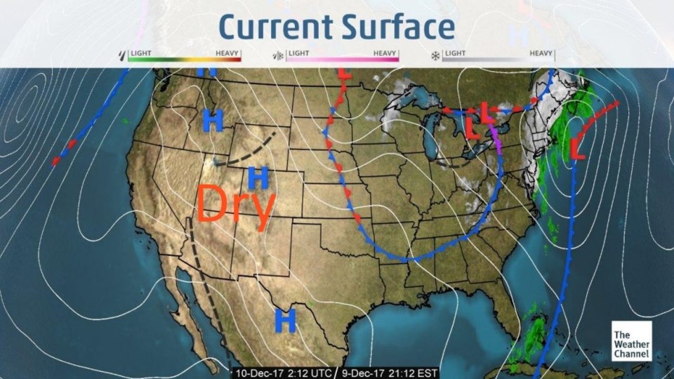
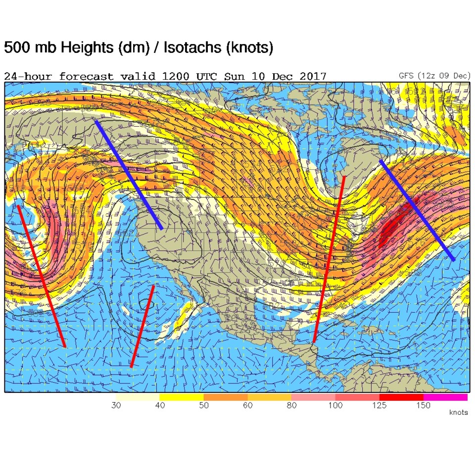
We enter an extended period of very temperate weather - with temperatures about 10-20 degrees above normal day and night. Like yesterday (Figure 1) high pressure dominates the entire western 1/2 of the nation. The upper air pattern (Figure 2) shows that giant ridge in the west that is keeping us dry and warm for the week.
The longer range forecast:
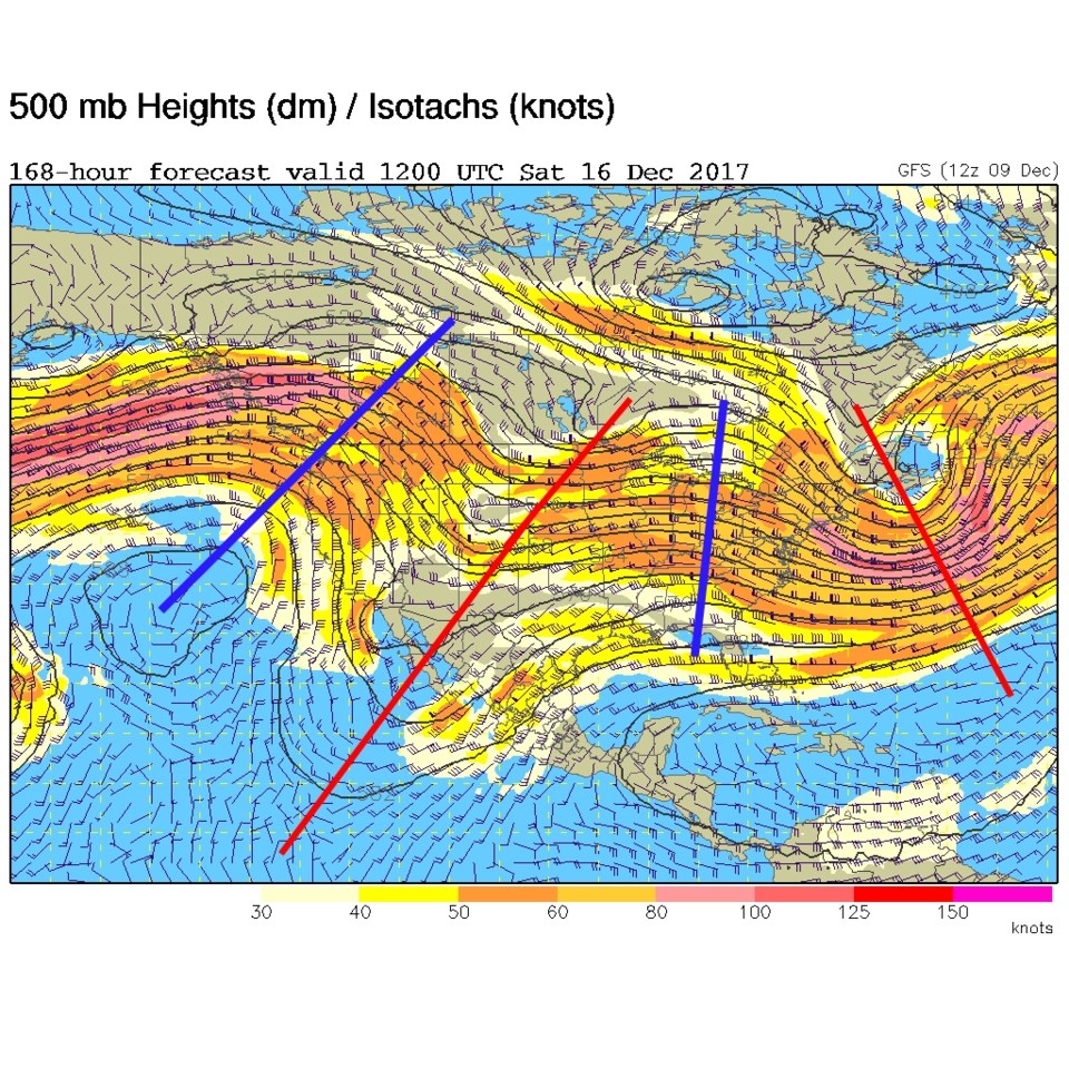
The next hint of something changing comes as a deeper trough links up with the deep south trough in Figure 2 (see Figure 3) for Saturday AM. Hopefully this will begin a pattern change that will make it feel more like winter around here.
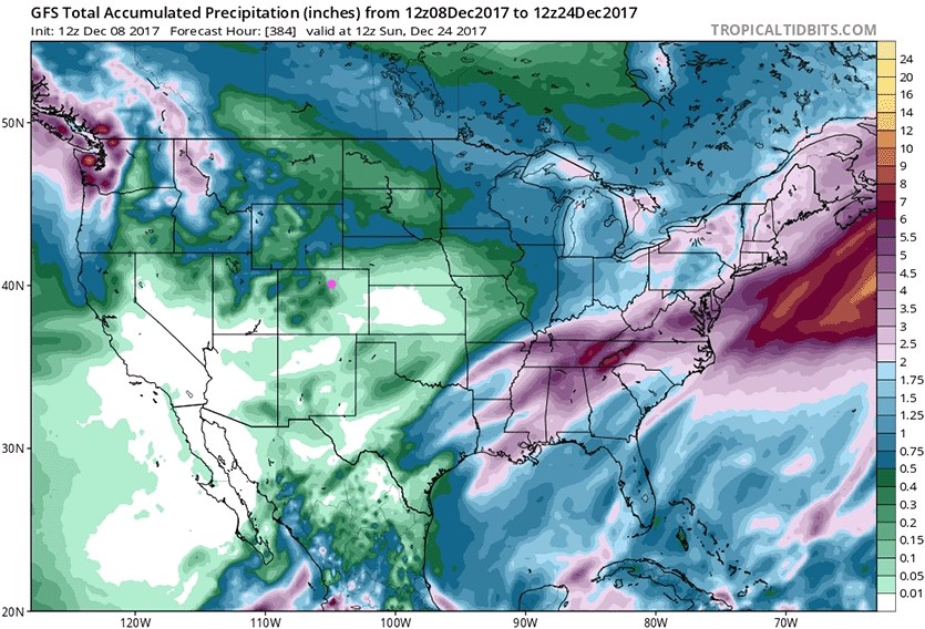
Figure 4, though, is the total precipitation between now and Christmas Eve for the U.S. (Longmont is the pink dot). There is very little precipitation expected for California (bad new) up into western Kansas (except for the western slopes of Colorado).