
This content was originally published by the Longmont Observer and is licensed under a Creative Commons license.
By John Ensworth
Discussion:
Today (Monday) will be very much like Sunday, but the severe risk shifts east out on to the Plains and away from the cities and Longmont. Figure 1 shows plenty of moisture around the state, but the source of it is mixed with some southwest monsoon like flow and some easterly Plains flow. We are ‘gear changing’ as the ridge passes overhead today. (Note the special cloud cover forecast tool for the eclipse, only 1 week away, below…)
Figure 1: Water vapor satellite image from Sunday PM.
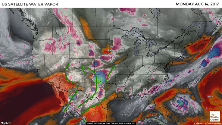
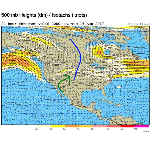
Figure 2 shows the ridge past us by tonight with west and southwest flow bringing in that monsoon flow more than it has in quite a while.
Figure 2: The 500mb map forecast for Monday night from the GFS model.
In a look at the longer range:
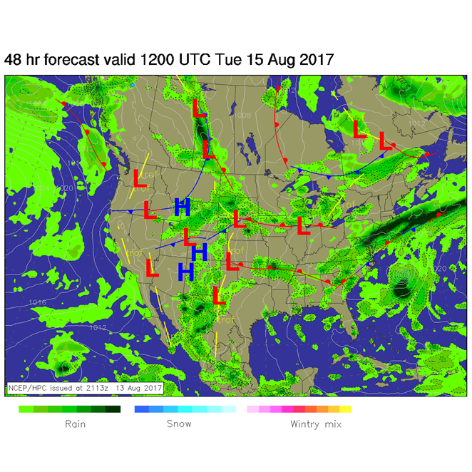
More than an inch of precipitatable water remains overhead into mid-week. Weak cool fronts will invade now and then from the north and new moisture will keep coming up from the south. Afternoon showers and thunderstorms continue to be the story. Figure 3 shows the Tuesday morning surface map with a suggested front in northern Colorado and a healthy flow of southerly moisture across New Mexico and up.
Figure 3: The Tuesday morning surfaced analysis forecast.
Eclipse forecast special:
As a bonus, I’m going to build a trend chart here for a sampling of eclipse viewing locations. Each forecast will be the expected % cloud cover (0% is clear, 100% is overcast) at 12pm Mountain Time for Teton Village, WY, Casper, WY, Glendo, WY, Lusk, WY, Alliance, NE, and Longmont, CO (Longmont is included for reference… it will NOT be in the totality path).
I’ll add each day’s model forecast for that time from Sunday night to Sunday night. The important thing to watch is the trend. Does your city look clearer as the week goes on, or more cloudy, or pretty constant? My expectation is that you will not be able to move far from where you are Monday morning due to traffic. You’ll need to pick your destination a day out and plan for that.
| Percent Cloud Cover Forecasted for | Sun 8/13 | Mon 8/14 | Tue 8/15 | Wed 8/16 | Thur 8/17 | Fri 8/18 | Sat 8/19 | Sun 8/20 |
| Teton Village | 26% |
| Casper | 9% |
| Glendo | 13% |
| Lusk | 9% |
| Alliance | 7% |
| Longmont | 23% |
*** This feature will run as close to daily as possible in this location on the Longmont Observer. ***
This article will provide a brief discussion concerning the ‘why’ behind the weather with a focus on severe weather, unusual weather, and snow (especially trying to predict snow depth and its human impact in Longmont).
Bio:
John Ensworth works from Longmont as the Principle Investigator for the NASA Science Mission Directorate Earth and space science education product review through the IGES (The Institute for Global Environmental Strategies – www.strategies.org) . He is in his 14th year running this review. He is an astronomer (from the 2nd grade onward) and became a meteorologist (in the 5th grade) when a thunderstorm in Arizona rained on his telescope when the weather service had only forecasted a 10% chance of rain. He has college degrees in physics and astronomy and climatology and a graduate degree in meteorology and earth science. He lectures at the Little Thompson Observatory in Berthoud, the Estes Park Memorial Observatory in Estes Park, and for a number of online universities. He built and runs a backyard observatory near Pace and 17th in northeast Longmont where he has lived for 8 years with his wife, daughter, son, and two cats. Invitations to open house nights at this observatory, LTO, and EPMO will be posted with future discussions when they are scheduled.
Forecasting severe weather and snow amounts via text lead to this column. He began texting friends about the weather right after the September 2013 flood. The readers of this column will, hopefully, keep him honest in what he ‘thought’ he had forecasted for ‘the most recent’ storm.


