This content was originally published by the Longmont Observer and is licensed under a Creative Commons license.
In Brief:
Our warmest day of the week happens today (Friday) before a cool front later today, a cold front on Saturday, and a cool front on Sunday knock us down to temperatures in the 60'sF Sunday. We have a chance of severe thunderstorms later today (Friday) with large hail and damaging winds.
There is another good chance of rain Saturday night into Sunday morning then showers possible the rest of of that chilly Sunday. We return to normal temperatures for next week.
11am Update:
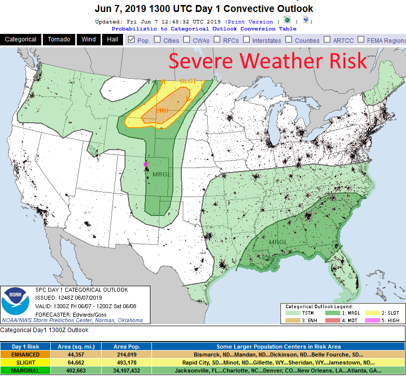
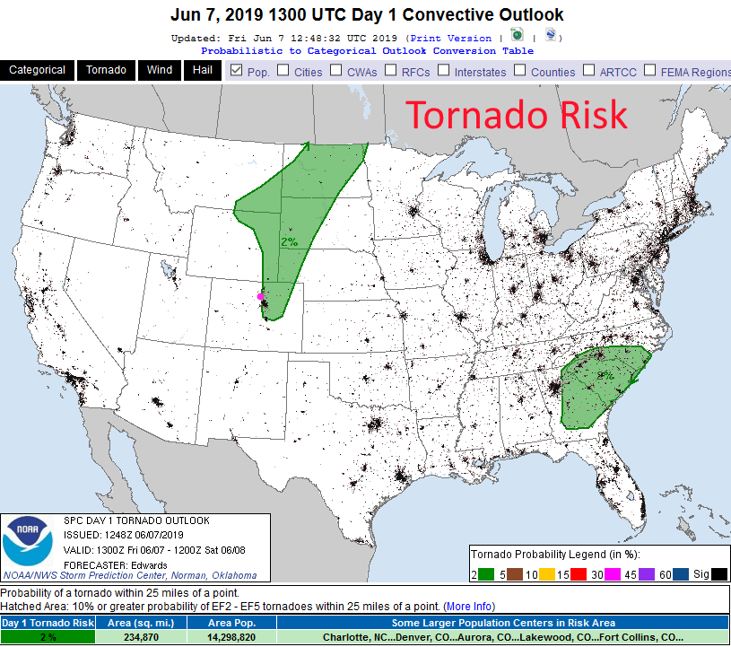
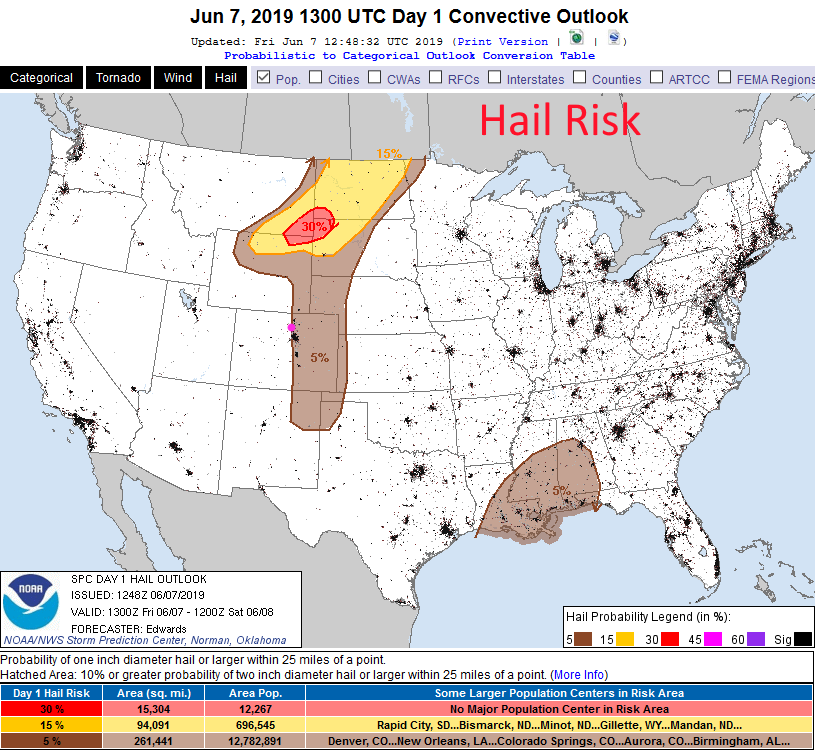
The SPC has removed the chance of tornadoes in Colorado today. Hail and damaging winds (and local flooding) - along with lightning are all still a threat where the stronger cells form and move.
End 11am Update.
9:30am Update:
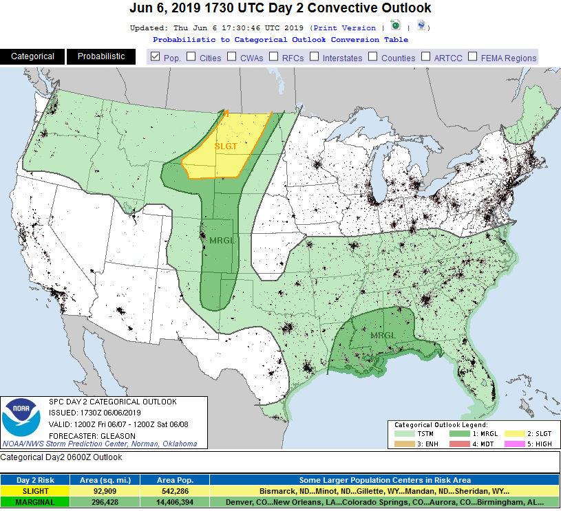
With a lee trough (a downwind dip in atmospheric pressure caused by air flow over the Rockies - similar to water going over a rock in a stream and dipping below stream level on the downstream side), some easterly air flow at the surface bringing in moisture, and the hottest temperatures of the year (upper 80'sF in most places) will create some severe weather just west of I-25 and eastward (Marginal Risk (1 on a scale of 1-5) in Figure 1 update).
Figure 2 udpate states that there is a 2% chance of a tornado within 25 miles of any given point in the green shaded area. Figure 3 update states there is a 5% chance of large hail (1 inch in diameter or greater) within 25 miles of any given point in the brown shaded area.
Precipitable water will rise to almost 0.9" so locally heavy rain and local flooding is possible. Storms should start to fire (non-severe) up in the mountains around 12pm then move into the I-25 corridor around 2-3pm. The upside is that storms should be fairly widely separated. Not everyone will get hit - many will see nothing.
End 9:30am Update.
Forecast Discussion:
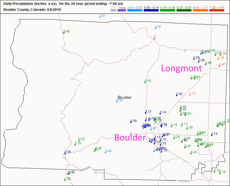
Let's start looking back to yesterday and see what those isolated storms could do - and what they did, they did over Longmont (to bad HRRR). Figure 1 shows 3/4th of an inch up to 1.5 inches of rain in town with the electrically active thunderstorms that formed on a boundary along I-25 Wednesday evening. I lost an Ethernet switch to the zapping (it had been plugged into the wall next to the power strip with surge protection. Doh!)
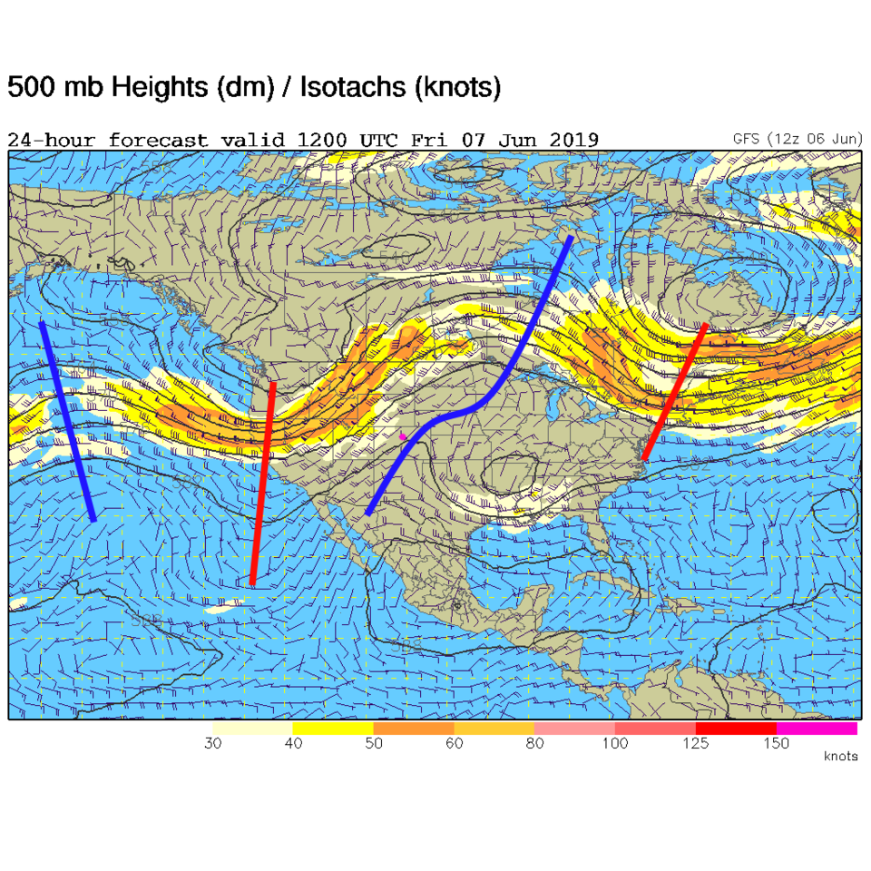
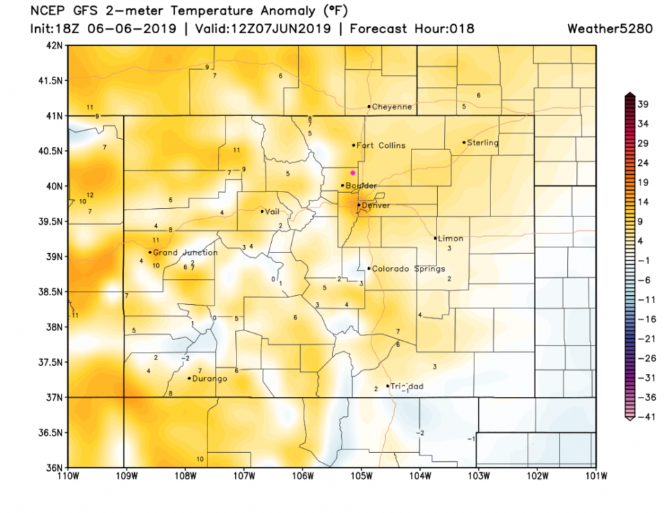
Today we get some good heat with a ridge right overhead as the deep trough in the West approaches (Figure 2). Friday AM we will be about 5-8 degrees above normal (Figure 3). Mid to upper 80'sF will feel toasty out in the sun.
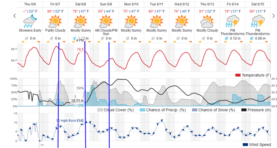
Our first wind shift and the start of the cooling arrives early afternoon today (Friday - first blue line in Figure 4). There is a fairly good chance of showers in the afternoon AND some of the storms that form along I-25 and eastward will become severe (Figure 6). The primary risk will be for large hail and damaging winds.
The Longer Range Forecast:
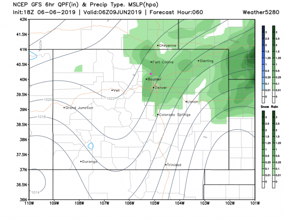
The main cold front arrives around 3pm Saturday (2nd blue line in Figure 4) and kick off more showers and storms into the night. Chances of rain remain somewhat high through Sunday with very cool temperatures that get another reinforcing shot of cool air in the afternoon (third blue line in Figure 4). The main rain will fall on the northeast plain early morning Sunday and late night Saturday (Figure 5).
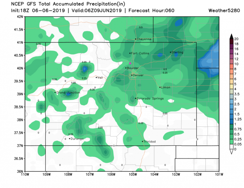
The GFS gives us between 1/4th inch and 1/2 inch of water (Figure 7). The weatherunderground model (Figure 4) gives us about 1/4th inch of water.
Next week looks very normal, as early June weather goes.