This content was originally published by the Longmont Observer and is licensed under a Creative Commons license.
Forecast Discussion:
The cold air and freezing drizzle and freezing fog did move in , now and then, on Friday. The second front is pushing down out of Wyoming this evening (Friday PM). A period of snow should give everything a dusting Friday PM (just prior to this post going live).
Light snow showers are possible all morning before another period of lift and up slope settles over Colorado later today (Saturday) giving us light snow this afternoon and evening.
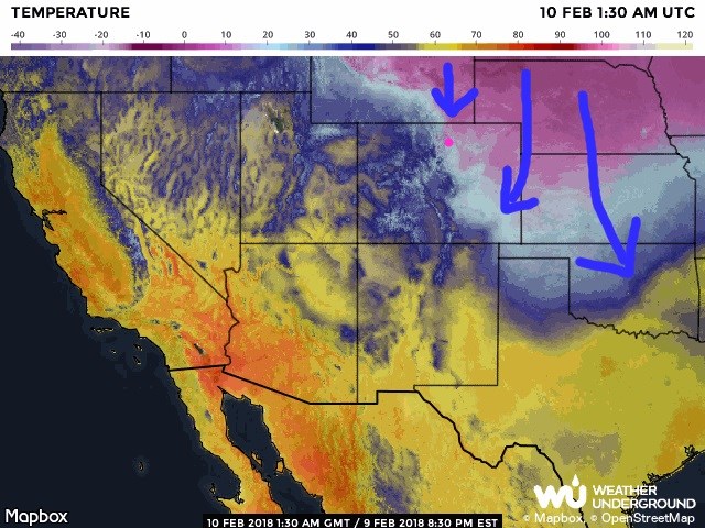
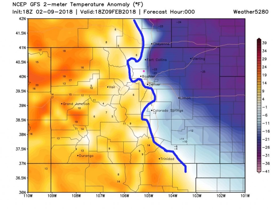
Figure 1 shows this cold air pouring down. The question over the last couple of days was 'would' that cold air move west over Longmont or further west. Figure 2 confirms (my blue line again) that it did a good job pushing up against the lower foothills. We spent the day below freezing. The models incorrectly warm us up again in the next forecast maps as they don't do well with such shallow, dense, cold air.
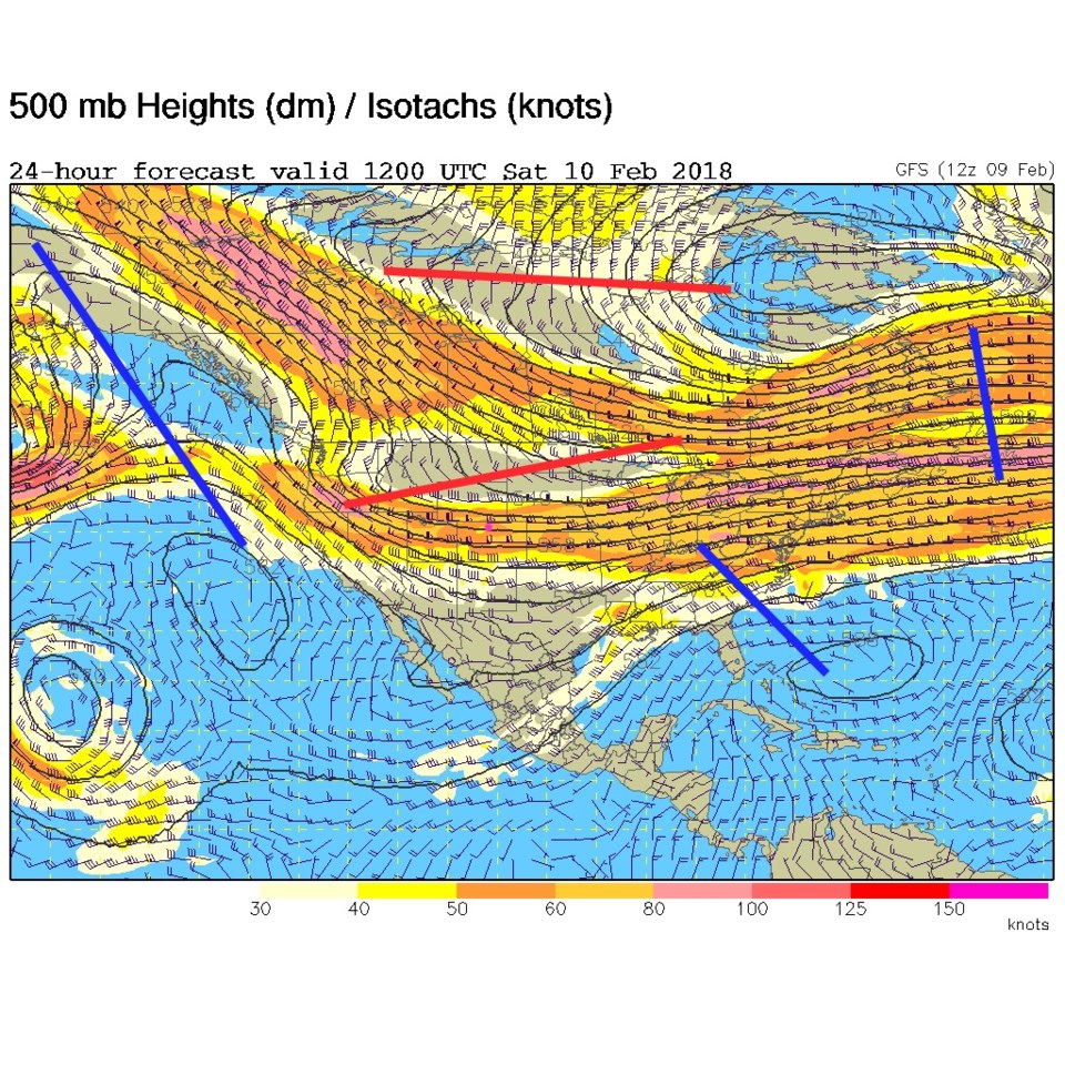
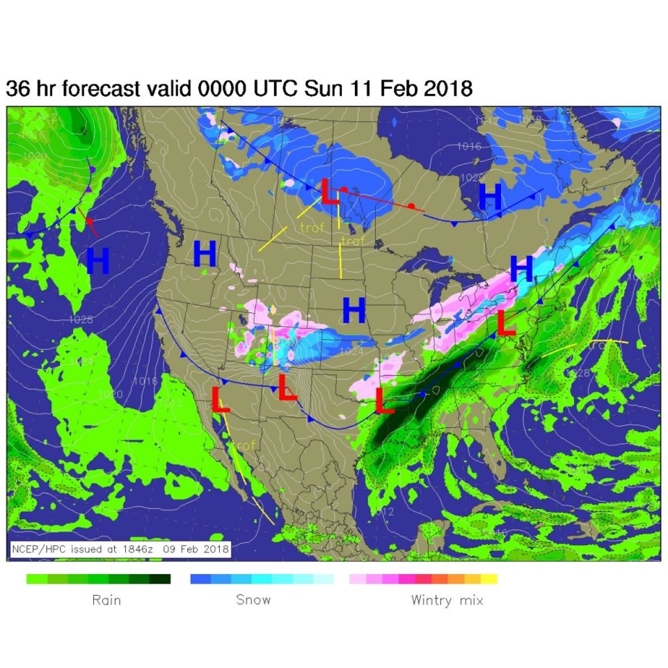
Pulling out to the big picture, Figure 3 is the 500mb upper air map and you can see the trough, that is pushing this storm, is very positively tilted stretching from the Great Lakes to Oregon.
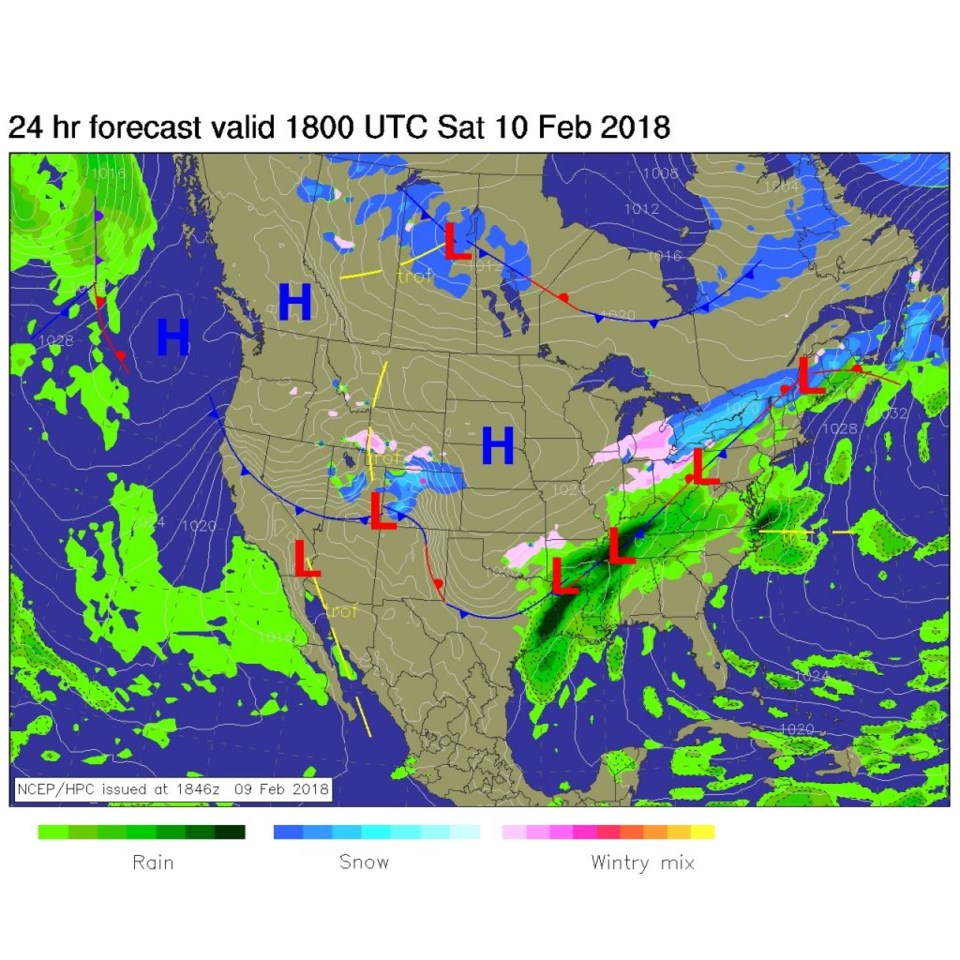
Figure 4 is the Saturday midday surface map and the main push of snow is just forming in the northern counties and moving south. Figure 5 is Saturday evening and snow covers most of the state.
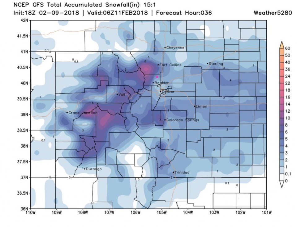
My forecast is for 1-3" of snow in Longmont, but what do the models say now?
Figure 6 is the GFS idea - Longmont gets 2-3 inches.
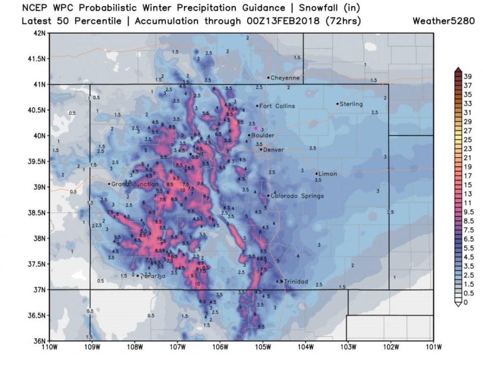
Figure 7 is the WPC 50th percentile probabilistic idea with 3 to 3.5 inches.
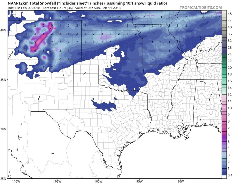
Figure 8 is the NAM and it has us in the 2-3 inch area as well. This storm will feature a number of hours of light snow at low temperatures. The snow will fluff up more than snow near freezing does.
After the storm clears late Saturday evening or just after midnight Saturday into Sunday - temperatures should drop to just above 0F.
The longer range forecast:
The Monday/Tuesday storm has faded to near nothing. Quite normal, dry, weather will be the norm for most of the next 10 days.


